
Oregon, Wisconsin facts for kids
Quick facts for kids
Oregon, Wisconsin
|
|
|---|---|

Village hall
|
|

Location of Oregon in Dane County, Wisconsin.
|
|
| Country | United States |
| State | Wisconsin |
| County | Dane |
| Area | |
| • Total | 4.49 sq mi (11.63 km2) |
| • Land | 4.49 sq mi (11.63 km2) |
| • Water | 0.00 sq mi (0.00 km2) |
| Elevation | 1,053 ft (321 m) |
| Population
(2020)
|
|
| • Total | 11,179 |
| • Density | 2,490.3/sq mi (961.5/km2) |
| Time zone | UTC-6 (Central (CST)) |
| • Summer (DST) | UTC-5 (CDT) |
| ZIP code |
53575
|
| Area code(s) | 608 |
| FIPS code | 55-60200 |
| GNIS feature ID | 1570854 |
| Website | www.vil.oregon.wi.us |
Oregon is a village in Dane County, Wisconsin, United States. It is home to 11,179 people, based on the 2020 census. Oregon is a suburb located just south of Madison. It is part of the larger Madison metropolitan area. Most of the village is found within the Town of Oregon.
Contents
History of Oregon Village

Oregon was first settled in 1841 by a person named Bartlet Runey. The very first house was built there in 1843. At first, the settlement was called "Rome Corners." You can still find a road south of the village with that old name.
When the Chicago and North Western Railroad built tracks through the village in 1864, their maps showed the name "Oregon." So, the village officially adopted this new name. Oregon became an incorporated village in 1881.
The main railroad line connecting Chicago to Minneapolis once passed right through Oregon. This line was even double-tracked from 1880 to 1950. While much of the line was closed in 1996, the part from Madison to Oregon was reopened in 2014. This was done to serve the Lycon Concrete Plant.
Historic Buildings in Oregon
Many of Oregon's old buildings are still standing today in the downtown area. These include the Netherwood Block and the Badger Cycle Company building. You can also see the original water tower on Janesville Street. Many businesses line the west side of North and South Main Street.
The Red Brick School is one of the most recognizable buildings in the village. It was built in 1922 and used to be the high school. Today, it has been restored and is used for business offices.
Geography and Location

Oregon is located at coordinates 42.923899 degrees North and -89.382304 degrees West.
The village covers a total area of about 4.49 square miles (11.63 square kilometers). All of this area is land, with no large bodies of water.
Roads and Transportation
Oregon is mainly served by U.S. Highway 14 (US 14) and Wisconsin Highway 138 (WIS 138). These two highways meet at the southeast corner of the village.
US 14 used to run directly through the village. However, a bypass road was built around the northern and eastern sides of Oregon between 1976 and 1978. The old route of US 14 is now known as County Trunk MM.
Population of Oregon
| Historical population | |||
|---|---|---|---|
| Census | Pop. | %± | |
| 1880 | 527 | — | |
| 1890 | 595 | 12.9% | |
| 1900 | 697 | 17.1% | |
| 1910 | 712 | 2.2% | |
| 1920 | 871 | 22.3% | |
| 1930 | 857 | −1.6% | |
| 1940 | 1,005 | 17.3% | |
| 1950 | 1,341 | 33.4% | |
| 1960 | 1,701 | 26.8% | |
| 1970 | 2,553 | 50.1% | |
| 1980 | 3,876 | 51.8% | |
| 1990 | 4,519 | 16.6% | |
| 2000 | 7,514 | 66.3% | |
| 2010 | 9,231 | 22.9% | |
| 2020 | 11,179 | 21.1% | |
| U.S. Decennial Census | |||
Oregon's Population in 2020
In 2020, the village of Oregon had a population of 11,179 people. The population density was about 2,490 people per square mile. There were 4,446 homes in the village.
Most of the people in Oregon, about 90.1%, identified as White. Other groups included 1.5% Black or African American, 1.2% Asian, and 0.2% Native American. About 1.4% were from other races, and 5.7% were from two or more races. About 4.0% of the population identified as Hispanic or Latino.
Oregon's Population in 2010
In 2010, Oregon had 9,232 people living in the village. There were 3,589 households, which are groups of people living together in one home. About 40.8% of these households had children under 18 living with them.
The average age of people in Oregon was 37 years old. About 28.6% of residents were under 18. The village had slightly more females (52.2%) than males (47.8%).
Education in Oregon
The Oregon School District serves the students in the area. This district includes several schools for different age groups:
- Brooklyn Elementary
- Netherwood Knoll Elementary
- Prairie View Elementary
- Forest Edge Elementary
- Rome Corners Intermediate
- Oregon Middle School
- Oregon High School
There is also one private school in Oregon called Sursum Corda Classical School. This is a Christian school run by Faith Lutheran Church.
Notable People from Oregon
- Micah Alberti, an actor and model
- Kevin J. Anderson, an author
- Lyman F. Anderson, a Wisconsin State Representative
- Wallace W. Andrew, a Wisconsin State Representative
- Jerry Frei, a former football coach for the Oregon Ducks and an NFL assistant coach
- Christopher J. Rollis, a newspaper editor and Wisconsin State Representative
- Jeff Richgels, a former professional bowler
- Jeffrey B. Skiles, the co-pilot of the "Miracle on the Hudson" flight
- Emily E. Sloan, the first woman elected as a county attorney in Montana
- Shaka Smart, the head coach of Marquette University's men's basketball team
- Lisa Stone, a former basketball coach at UW–Madison
Images for kids
-
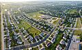
A view of Oregon, Wisconsin
See also
 In Spanish: Oregon (Wisconsin) para niños
