Oregon Inlet facts for kids
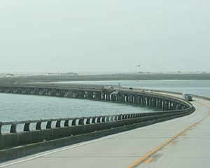
Oregon Inlet is a narrow waterway found along the Outer Banks in North Carolina. It connects the Pamlico Sound to the Atlantic Ocean. This inlet also separates two islands, Bodie Island and Pea Island. These islands are linked by the Marc Basnight Bridge, which is about 2.8 miles (4.5 km) long.
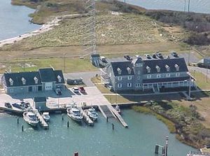
Oregon Inlet is very important for people who love to fish. Many charter fishing boats leave from here. They travel far out into the ocean towards the Gulf Stream to catch fish. The inlet is also home to a U.S. Coast Guard station. This station helps keep people safe on the water.
Contents
History of Oregon Inlet
Oregon Inlet was formed during a big hurricane in 1846. The storm hit the Outer Banks and created this new waterway. It separated Bodie Island from Pea Island. A ship named the Oregon was in Pamlico Sound during that storm. After the storm, its crew was the first to tell people on the mainland about the new inlet. That's why it has been called Oregon Inlet ever since.
Like many other inlets on the Outer Banks, Oregon Inlet slowly moves south. This happens because of sand drifting during tides and storms. Since 1846, the inlet has moved more than 2 miles (3.2 km) south. It moves about 66 feet (20 meters) each year.
The moving sand has caused problems for boats. The channel through Oregon Inlet often becomes too shallow. This makes it hard for fishing boats and other ships to pass. Since 1950, the channel has often been shallower than planned. Sometimes, it was even closed completely. This caused problems for the fishing industry and other boaters. Sadly, some ships and lives have been lost because of the shallow water. In 2022, Dare County got a special dredge boat called Miss Katie. Its job is to keep Oregon Inlet deep enough for boats to use safely.
Coast Guard Station History
The U.S. Coast Guard station at Oregon Inlet has moved four times. It started as a lifesaving station in 1883. Congress approved money for 29 such stations ten years earlier. By 1888, the Oregon Inlet Station had to move. This was likely because the channel shifted south and the ocean moved closer. The station was closed and moved about 400 feet (120 meters) west, closer to the sound.
Less than ten years later, a storm completely destroyed the station. By 1897, a new station was being built. It was finished in 1898 and cost less than $7,000. In 1933–34, the station was updated. It was changed to look much like it does today. A new part was added in 1979. By 1988, the station was left empty. The shifting Oregon Inlet threatened to cover it.
In July 1990, a ceremony was held to start building a new station. This new building cost $3.5 million. It is located behind the Oregon Inlet Fishing Center, on the north side of the inlet. The new station was designed to look like older stations on the Outer Banks.
Herbert C. Bonner Bridge
Quick facts for kids Herbert C. Bonner Bridge |
|
|---|---|

Oregon Inlet/Bonner Bridge
|
|
| Coordinates | 35°46′00.3″N 75°31′39.8″W / 35.766750°N 75.527722°W |
| Locale | Dare County |
| Other name(s) | Oregon Inlet Bridge Bonner Bridge |
| Named for | Herbert C. Bonner |
| Owner | NCDOT |
| Maintained by | NCDOT |
| Characteristics | |
| Design | Steel stringer |
| Total length | Before demolition 12,865.8 ft (3,921.5 m) After demolition 1,000 ft (300 m) |
| Width | 33.5 ft (10.2 m) |
| Clearance below | 6.6 ft (2.0 m) |
| History | |
| Opened | 1963 |
| Closed | 2019 |
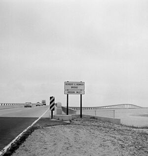
The Herbert C. Bonner Bridge was a two-lane bridge. It crossed Oregon Inlet, connecting Bodie Island and Pea Island in Dare County, North Carolina. The bridge carried NC 12. It was used by local people and many tourists. The bridge was about 2.7 miles (4.3 km) long. It was built in 1963 and named after Herbert C. Bonner.
Before the Bonner Bridge was built, Hatteras Island could only be reached by plane or ferry. Ferries could carry only 2,000 people a day. They cost the state $500,000 each year to run. There were also very long lines for the ferries during busy times. The shifting sandbars in the inlet often caused ferries to get stuck.
The Bonner Bridge cost $4 million to build. It could handle up to 14,000 cars a day. North Carolina paid $1.5 million, and the U.S. government paid $2.5 million. Representative Herbert C. Bonner helped arrange for the government to pay part of the cost. The bridge also allowed electricity to reach the islands through power lines, instead of using generators.
At first, people didn't fully understand how the bridge would affect the environment. Now, constant beach erosion, bad weather, and heavy traffic make it hard to keep the road safe. Between 1987 and 1999, about $50 million was spent to fix and protect the Bonner Bridge and NC 12 from the ocean. The bridge was expected to last 30 years. It handled about 2 million cars each year. The state transportation department rated its safety as a 4 out of 100, with 100 being the safest.
In October 1990, a dredge boat hit the bridge during a storm. This caused serious damage to several parts of the bridge. Hatteras Island was cut off for many weeks. People could only reach it by boat or plane. Emergency crews worked to fix the bridge quickly.
The plan to replace the bridge was approved. The new bridge would be longer and curve more inland. It was expected to cost about $1.3 billion. Construction was delayed many times by environmental lawsuits. On July 26, 2011, a contract for $215.8 million was given to replace the bridge. In September 2013, the last legal problems were solved. A judge ruled that the new bridge could be built. Construction was set to begin in early 2013 but was stopped again by another appeal. The new bridge was then expected to open in spring 2015. Most of the old bridge was to be taken down, but a part would stay as a fishing pier.
On December 3, 2013, the bridge was closed because of safety worries. Scans showed that too much sand had washed away from the bridge's support structures. The state transportation secretary said closing the bridge was needed to keep people safe. He also knew it would greatly affect people living on and visiting the Outer Banks. While the bridge was closed, ferries helped move cars and trucks across the Pamlico Sound. After sand was added back to support some of its pilings, the bridge reopened on December 15, 2013.
On December 16, 2015, crews started moving underground electric cables. These cables connected Hatteras Island to its power supplier. They were moved so that construction of the new bridge could begin. This marked the start of the new bridge project.
Marc Basnight Bridge
| Marc Basnight Bridge | |
|---|---|
| Coordinates | 35°46′21″N 75°32′14″W / 35.77250°N 75.53722°W |
| Carries | |
| Crosses | Oregon Inlet |
| Locale | Dare County |
| Named for | Marc Basnight |
| Owner | NCDOT |
| Maintained by | NCDOT |
| Characteristics | |
| Total length | 2.8 mi |
| History | |
| Designer | HDR, Inc. |
| Engineering design by | HDR, Inc. |
| Construction begin | March 8, 2016 |
| Construction end | 2019 |
| Opened | February 25, 2019 |
The official start of construction for the new bridge was on March 8, 2016. The project cost $252 million. The new bridge was expected to open in February 2019.
On July 27, 2017, a crew working on the bridge accidentally cut a power cable. This caused a large power outage on the Outer Banks islands. About 50,000 tourists had to leave until power was back on, which happened on August 3, 2017.
The 2.8-mile (4.5 km) long bridge opened on February 25, 2019. On March 7, 2019, the state transportation board voted to name the new bridge after Marc Basnight. This was a bit controversial. Many people on Hatteras Island wanted it to be named after Bonner, as it was often called the "New Bonner Bridge" during its construction.
The bridge won an award in 2019 from the Deep Foundation Institute. It was honored for its special foundation. This foundation was designed to stand strong against extreme bridge scour, which is when sand washes away from the bridge's supports.
 | George Robert Carruthers |
 | Patricia Bath |
 | Jan Ernst Matzeliger |
 | Alexander Miles |


