
Osceola, Indiana facts for kids
Quick facts for kids
Osceola, Indiana
|
|
|---|---|

Osceola, with St. Joe River flowing west to Mishawaka (bottom). Baugo Bay is in the upper right. Elkhart is in the distance.
|
|

Location of Osceola in St. Joseph County, Indiana.
|
|
| Country | United States |
| State | Indiana |
| County | St. Joseph |
| Township | Penn |
| Area | |
| • Total | 1.36 sq mi (3.53 km2) |
| • Land | 1.36 sq mi (3.52 km2) |
| • Water | 0.00 sq mi (0.01 km2) |
| Elevation | 735 ft (224 m) |
| Population
(2020)
|
|
| • Total | 2,590 |
| • Density | 1,905.81/sq mi (735.87/km2) |
| Time zone | UTC-5 (Eastern (EST)) |
| • Summer (DST) | UTC-4 (EDT) |
| ZIP code |
46561
|
| Area code(s) | 574 |
| FIPS code | 18-57114 |
| GNIS feature ID | 2396838 |
Osceola is a small town located in St. Joseph County, Indiana, in the United States. It's part of the larger South Bend–Mishawaka area. In 2020, about 2,590 people called Osceola home.
Contents
A Look Back: Osceola's History
Osceola was officially planned and marked out in 1837. The town was named after a famous Native American leader called Osceola, who was a Seminole chief. A post office, where people send and receive mail, has been open in Osceola since 1854.
Where is Osceola?
Osceola covers an area of about 1.37 square miles (3.53 square kilometers). Most of this area is land, with a very small part being water.
A special place in Osceola is the Ferrettie/Baugo Creek County Park. This park is quite large, covering 214 acres. It has many trails that follow along Baugo Creek, making it a great spot for outdoor activities.
Who Lives in Osceola?
| Historical population | |||
|---|---|---|---|
| Census | Pop. | %± | |
| 1880 | 129 | — | |
| 1930 | 432 | — | |
| 1940 | 498 | 15.3% | |
| 1950 | 1,091 | 119.1% | |
| 1960 | 1,350 | 23.7% | |
| 1970 | 1,572 | 16.4% | |
| 1980 | 1,990 | 26.6% | |
| 1990 | 1,999 | 0.5% | |
| 2000 | 1,859 | −7.0% | |
| 2010 | 2,463 | 32.5% | |
| 2020 | 2,590 | 5.2% | |
| U.S. Decennial Census | |||
Osceola is part of the Penn-Harris-Madison School Corporation. The town is split by the St. Joseph River, with most of it on the south side. A railroad also runs through the town, dividing it further.
A Closer Look at the People
According to the census from 2010, there were 2,463 people living in Osceola. A census is like a big count of everyone living in a place. There were 905 households, which are groups of people living together in one home.
Most of the people in Osceola were White (95.5%). Smaller groups included African American (1.4%), Native American (0.2%), and Asian (0.7%). About 2.1% of the population identified as Hispanic or Latino.
In these households, about 39.4% had children under 18 years old. Many homes (54.9%) were married couples living together. The average age of people in Osceola was about 35.7 years old. About 27.4% of residents were under 18, and 10.9% were 65 or older.
Getting Around Osceola
Since 2009, the Interurban Trolley has helped people travel in and out of Osceola. The Bittersweet/Mishawaka route connects Osceola to nearby cities like Elkhart and Mishawaka.
If you need to go further, you can switch to other bus systems. In Mishawaka, you can connect to the TRANSPO bus system. In Elkhart, you can transfer to other Interurban Trolley routes.
Learning in Osceola
Students in Osceola attend schools within the Penn-Harris-Madison School Corporation. The local elementary school is Moran Elementary School, located right in Osceola. After elementary school, students typically go to Grissom Middle School and then to Penn High School.
Images for kids
-
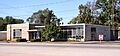
Osceola town hall.

See also
 In Spanish: Osceola (Indiana) para niños
