Otay Mesa, San Diego facts for kids
Quick facts for kids
Otay Mesa, San Diego
|
|
|---|---|
| Otay Mesa | |
| Country | |
| State | |
| County | |
| City | |
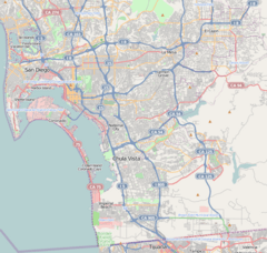
Otay Mesa (pronounced OH-ty MAY-sə) is a community in the southern part of the city of San Diego, California. It is located very close to the border between the United States and Mexico.
It shares borders with the Otay River Valley and Chula Vista to the north. To the west are Ocean View Hills and San Ysidro. East Otay Mesa and the San Ysidro Mountains are to the north and east. To the south, it borders Tijuana, Mexico. Important roads like Otay Mesa Road and California State Route 125 run through the area.
Contents
History of Otay Mesa
The name Otay comes from the Kumeyaay language, spoken by Native American people. Its exact meaning is debated. It might mean "brushy," "big mountain," or "big." Mesa is a Spanish word for a flat-topped hill or plateau.
In 1883 and 1884, a brave aviation pioneer named John J. Montgomery made the first controlled flights in the Western Hemisphere. He used gliders from the western edge of Otay Mesa.
The area that is now Otay Mesa became part of the city of San Diego in 1957. More land was added in 1985. Since 2010, several hidden tunnels have been discovered. These tunnels linked warehouses in Otay Mesa to entry points in Mexico.
Climate in Otay Mesa
Otay Mesa has a semi-arid climate. This means it has mild winters and warm summers with very little rain.
| Climate data for Brown Field Municipal Airport (normals 1998–2020, extremes 1945–1946, 1954–1961, 1998–present) | |||||||||||||
|---|---|---|---|---|---|---|---|---|---|---|---|---|---|
| Month | Jan | Feb | Mar | Apr | May | Jun | Jul | Aug | Sep | Oct | Nov | Dec | Year |
| Record high °F (°C) | 90 (32) |
93 (34) |
97 (36) |
99 (37) |
102 (39) |
103 (39) |
110 (43) |
102 (39) |
108 (42) |
103 (39) |
99 (37) |
87 (31) |
110 (43) |
| Mean maximum °F (°C) | 82.4 (28.0) |
81.8 (27.7) |
83.7 (28.7) |
85.8 (29.9) |
85.5 (29.7) |
88.8 (31.6) |
91.4 (33.0) |
92.9 (33.8) |
98.2 (36.8) |
93.7 (34.3) |
88.5 (31.4) |
80.3 (26.8) |
100.6 (38.1) |
| Mean daily maximum °F (°C) | 67.0 (19.4) |
66.4 (19.1) |
67.5 (19.7) |
69.8 (21.0) |
71.2 (21.8) |
74.3 (23.5) |
78.3 (25.7) |
80.6 (27.0) |
79.8 (26.6) |
76.7 (24.8) |
71.8 (22.1) |
66.7 (19.3) |
72.5 (22.5) |
| Daily mean °F (°C) | 55.7 (13.2) |
55.8 (13.2) |
57.4 (14.1) |
59.9 (15.5) |
62.8 (17.1) |
66.1 (18.9) |
69.9 (21.1) |
71.8 (22.1) |
70.3 (21.3) |
66.0 (18.9) |
60.2 (15.7) |
55.3 (12.9) |
62.6 (17.0) |
| Mean daily minimum °F (°C) | 44.4 (6.9) |
45.2 (7.3) |
47.3 (8.5) |
50.0 (10.0) |
54.4 (12.4) |
57.9 (14.4) |
61.5 (16.4) |
63.0 (17.2) |
60.8 (16.0) |
55.3 (12.9) |
48.6 (9.2) |
43.8 (6.6) |
52.7 (11.5) |
| Mean minimum °F (°C) | 35.2 (1.8) |
36.2 (2.3) |
39.4 (4.1) |
41.8 (5.4) |
47.2 (8.4) |
51.6 (10.9) |
56.9 (13.8) |
57.1 (13.9) |
53.0 (11.7) |
47.3 (8.5) |
40.2 (4.6) |
34.6 (1.4) |
32.9 (0.5) |
| Record low °F (°C) | 27 (−3) |
30 (−1) |
34 (1) |
34 (1) |
41 (5) |
44 (7) |
50 (10) |
52 (11) |
48 (9) |
38 (3) |
32 (0) |
29 (−2) |
27 (−3) |
| Average precipitation inches (mm) | 1.83 (46) |
2.39 (61) |
1.52 (39) |
0.80 (20) |
0.27 (6.9) |
0.10 (2.5) |
0.04 (1.0) |
0.01 (0.25) |
0.18 (4.6) |
0.44 (11) |
0.83 (21) |
1.82 (46) |
10.23 (260) |
| Average precipitation days (≥ 0.01 in) | 6.6 | 7.4 | 7.5 | 6.0 | 3.2 | 1.5 | 1.3 | 0.9 | 2.1 | 3.5 | 5.1 | 6.9 | 52 |
| Source: NOAA | |||||||||||||
Border Crossings and Connections
Otay Mesa is home to the Otay Mesa Port of Entry. This is one of two main border crossings in San Diego. The other is the San Ysidro Port of Entry. Large trucks usually use the Otay Mesa crossing. There is also a center here for people waiting for immigration decisions.
A new border crossing, the Otay Mesa East Port of Entry, is being built two miles east. It is expected to open around 2023.
Cross Border Xpress (CBX)
The Cross Border Xpress (CBX) is a special terminal and pedestrian bridge. It connects directly to the main terminal of Tijuana International Airport in Mexico. This 45,000 square foot facility in Otay Mesa opened in 2015. It cost $78 million to build.
CBX makes Tijuana Airport the world's first airport that is truly "binational." This means it has parts in two countries. The CBX terminal is in the United States, but it serves an airport whose main buildings and runways are in Mexico.
Highways in Otay Mesa
Otay Mesa is connected by several important highways:
 I-5
I-5 I-805
I-805 SR 11
SR 11
 SR 125
 SR 905 (which will become I-905 in the future)
Other Important Places
About 1.5 miles north of the Mexico-United States Border is the Otay Mesa Energy Center. This large power plant started working in 2009. It can produce 603 megawatts of electricity. Another power plant, the Pio Pico Energy Center, will add 300 more megawatts.
Pacific Gateway Park is a green space located between Otay Mesa Road and the international border.
There are also several important law enforcement facilities in the Otay Mesa area:
- The state's Richard J. Donovan Correctional Facility
- The Otay Mesa Detention Center
- The George Bailey County Detention facility
- The East Mesa Detention facility
- A training complex used by the FBI, Customs Service, and local police for firearms practice.
Education in Otay Mesa
Students in Otay Mesa attend schools in the San Ysidro School District (SYSD) and the Sweetwater Union High School District (SUHSD).
Local public schools include:
- Finney Elementary School
- Juarez Lincoln Elementary School
- Los Altos Elementary School
- Howard Pence Elementary School
- Silverwing Elementary School
- San Ysidro Elementary School
The area's high school students attend Montgomery High School.
See also
 In Spanish: Otay Mesa (San Diego) para niños
 | Aurelia Browder |
 | Nannie Helen Burroughs |
 | Michelle Alexander |


