Overlea, Maryland facts for kids
Quick facts for kids
Overlea, Maryland
|
|
|---|---|

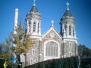
St. Michael's Church, in October 2010.
|
|
|
right
|
|
| Country | |
| State | |
| County | |
| Area | |
| • Total | 3.02 sq mi (7.81 km2) |
| • Land | 3.02 sq mi (7.81 km2) |
| • Water | 0.00 sq mi (0.00 km2) |
| Elevation | 226 ft (69 m) |
| Population
(2020)
|
|
| • Total | 12,832 |
| • Density | 4,254.64/sq mi (1,642.93/km2) |
| Time zone | UTC−5 (Eastern (EST)) |
| • Summer (DST) | UTC−4 (EDT) |
| FIPS code | 24-59325 |
| GNIS feature ID | 0590957 |
Overlea is a community in Baltimore County, Maryland, in the United States. It's known as a census-designated place, which means it's an area that the government counts for population statistics. In 2020, about 12,832 people lived here.
Students in Overlea often go to Overlea High School. Important roads in the area include Belair Road, which is part of U.S. Route 1, and Kenwood Avenue. The neighborhood of Fullerton is also part of Overlea.
Contents
Exploring Overlea's Location
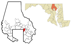
Overlea is located in the state of Maryland. It covers an area of about 3.02 square miles (7.81 square kilometers). All of this area is land, with no large bodies of water inside its borders.
Overlea's Past: A Look at Its History
Overlea started as a piece of land owned by a woman named Margaret Fuller in 1858. This was just a few years before the American Civil War began. Margaret Fuller was a widow from Ohio who moved to the area with her six children. Her land was called "Sophie's Garden Regulated."
This original land was located near where Belair Road and Taylor Avenue meet today. The first house built there is still standing.
Early Developments and Growth
In 1885, the community got its first Post Office and a general store. A year later, in 1886, Fullerton School was built. It started as a small log house and was later rebuilt as a frame house.
Overlea really began to grow in 1895. The Kennard Land Company bought a large farm and planned out many streets. They named these new streets after different trees, like Spruce, Ash, Cedar, Maple, and Walnut.
Community Hubs and Important Events
In 1910, a "town hall" was built at the corner of Overlea Avenue and Belair Road. This building is still there today and is now home to the Natural History Society of Maryland. The town hall also served as a grocery store.
On February 23, 1913, a group of women called "The Army of the Hudson" stopped at the town hall. These women were suffragists, meaning they were fighting for women's right to vote. They were on their way from New York City to a big march in Washington, D.C.. They held a meeting in the town hall, and some people in Overlea supported their cause.
In the same year, St. Michael's Roman Catholic Church held its first church service in the town hall. Later, in 1919, a part of Overlea became part of the city of Baltimore. This area is now known as Overlea, Baltimore.
People Living in Overlea: Population Facts
| Historical population | |||
|---|---|---|---|
| Census | Pop. | %± | |
| 1960 | 10,795 | — | |
| 1970 | 13,124 | 21.6% | |
| 1980 | 12,965 | −1.2% | |
| 1990 | 12,137 | −6.4% | |
| 2000 | 12,148 | 0.1% | |
| 2010 | 12,275 | 1.0% | |
| 2020 | 12,832 | 4.5% | |
| U.S. Decennial Census | |||
According to the 2020 census, Overlea had a population of 12,832 people. In 2000, there were 12,148 people living in the area. There were about 4,951 households, which are groups of people living together in one home.
The population was spread out in terms of age. About 22.9% of the people were under 18 years old. The median age, which is the middle age of all the people, was 38 years old.
Learning in Overlea: Schools
Overlea is home to Overlea High School. In the 2010 school year, about 1,073 students attended this high school.
See also
 In Spanish: Overlea (Maryland) para niños


