Pactola, South Dakota facts for kids
Quick facts for kids
Pactola, South Dakota
Camp Crook
|
|
|---|---|
| Country | United States |
| State | South Dakota |
| County | Pennington |
| Founded | 1876 |
| Founded by | General Crook |
| Named for | Pactolus |
| Elevation | 4,462 ft (1,360 m) |
| Time zone | UTC-7 (MST) |
| • Summer (DST) | UTC-6 (MDT) |
Pactola, also known as Camp Crook, was a small town in Pennington County, South Dakota. It was founded in 1875. This town was a busy place for gold miners. But it disappeared in the 1950s. Today, Pactola lies hidden beneath the waters of Pactola Lake. It is now known as a ghost town.
Contents
What's in a Name? Pactola's Story
The town first had the name Camp Crook. This name honored General George Crook. He set up his headquarters there. In 1878, miners wanted a new name. A journalist asked them to find a more interesting one. They chose Pactola.
Where Did the Name Pactola Come From?
The name Pactola comes from Ancient Greece. There was an ancient river called the Pactolus River in Lydia. People there also used to mine for gold. The miners of South Dakota chose this name to connect their town to that famous gold-rich river.
Pactola's Gold Rush History
The Rapid City Mining District started in July 1875. At this time, the Black Hills belonged to the Lakota people. Miners founded Camp Crook. They were trying to avoid General Crook. In August 1875, they were found and asked to leave the Black Hills.
General Crook's Role in Early Pactola
After the miners left, General Crook used the town as his base. He chased away other miners. These miners were breaking an agreement called the Treaty of Fort Laramie. This treaty protected the Lakota's land.
The Gold Rush Returns
The Black Hills were opened for mining in February 1876. Miners quickly returned to Pactola. They claimed land along the river. Some of these claims were worth a lot of money, up to $50,000.
In March, a group of 80 men got stuck in town. A big blizzard trapped them. Their leader, James C. Sherman, decided to stay. He hoped to find gold and get rich.
Building for Gold Mining
To help with gold mining, a long flume was built. A flume is like a channel that carries water. This water was used to wash the gold from the ground. By late 1876, the town was booming. About 300 miners lived in the area.
A store opened in 1876. In 1877, one of the first post offices in the Black Hills was built here. The Black Hills & Western Railroad soon laid tracks to Pactola. This made it easier to get to the town.
The Sherman House Hotel
James C. Sherman also opened the Sherman House. This was the first hotel in the Black Hills. It became a stop for two different stage lines. People traveling by stagecoach could rest and stay there.
The Town's Decline and Disappearance
Many companies tried to build more flumes. But these projects were too expensive. Over time, the town became smaller. Most people moved away. Before it was completely gone, only one of the original buildings remained.
New buildings included a lodge, some cabins, and another store. In the early 1950s, the town was covered by Pactola Lake. Only one cabin survived the flooding. It still stands downstream from the lake today.
Where Was Pactola Located?
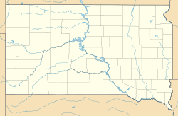
Pactola was located in the Black Hills of Pennington County. The town site is now under Pactola Lake. The lake is next to U.S. Route 385. It is about 11 miles north of Hill City. Before the flooding, the town was in a meadow near Rapid Creek.
 | Jewel Prestage |
 | Ella Baker |
 | Fannie Lou Hamer |


