Paddle Prairie Metis Settlement facts for kids
Quick facts for kids
Paddle Prairie
|
|
|---|---|
|
Metis settlement
|
|
| Paddle Prairie Metis Settlement Keg River Metis Colony No. 1 (formerly) |
|

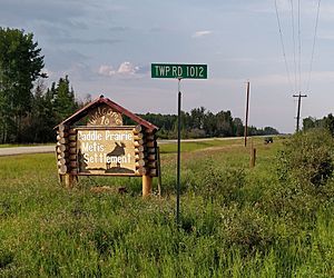
Southern boundary of Paddle Prairie
|
|

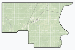
Boundaries of Paddle Prairie
|
|

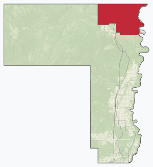
Location within County of Northern Lights
|
|
| Country | Canada |
| Province | Alberta |
| Region | Northern Alberta |
| Planning region | Lower Peace |
| Municipal district | Northern Lights |
| Established | May 9, 1939 |
| Area
(2021)
|
|
| • Land | 335.68 km2 (129.61 sq mi) |
| Population
(2021)
|
|
| • Total | 379 |
| • Density | 1.1/km2 (3/sq mi) |
| Time zone | UTC−7 (MST) |
| • Summer (DST) | UTC−6 (MDT) |
| Website | https://paddleprairiemetis.com/ |
Paddle Prairie Metis Settlement is a special community in northern Alberta, Canada. It is one of eight Metis settlements in Alberta. In fact, it is the largest one! This area is known for its beautiful forests, natural resources, and good farming land. The community also uses solar power for some of its buildings, which is pretty cool! It is located along the Mackenzie Highway (Highway 35), about 72 kilometers (45 miles) south of the Town of High Level.
Contents
History of Paddle Prairie
Life for the Métis in the 1930s
During the 1930s, a tough time called the Great Depression made life very hard for many people. This included the Métis people of Alberta. The Métis are a unique Indigenous group with mixed Indigenous and European ancestry. Many Métis families moved around a lot, living on public lands. They often did not have steady jobs or access to schools and doctors.
Creating the Métis Settlements
To help the Métis, the government formed a special group called the Ewing Commission. This group suggested that farming could help the Métis become more self-sufficient. They thought that creating farm communities would be a good way to help without costing too much money.
Because of these ideas, the Metis Population Betterment Act was passed in 1938. This law allowed land to be set aside for new Métis settlements. Eleven settlements were created between 1938 and 1939. Paddle Prairie was one of these original settlements. It was first known as Keg River.
The other first settlements were:
- Wolf Lake
- Utikuma Lake (now Gift Lake)
- Cold Lake
- Marlboro
- Big Prairie (now Peavine)
- Touchwood
- Goodfish Lake (now Kikino)
- Elizabeth
- Fishing Lake
- East Prairie
Later, Caslan (now Buffalo Lake) was added. It was first for Métis soldiers returning from World War II.
Early Days in Paddle Prairie
Paddle Prairie grew quickly. By 1941, a report showed that 72 people lived there in 19 families. The main village was built in the middle of the settlement. This area had open land and good soil. People started a lumber business there, cutting a lot of wood. They also cleared a 14-mile (23 km) road to the Peace River. This road helped them bring in supplies by boat.
Geography
Paddle Prairie is the largest and most northern of Alberta's Metis settlements. It covers about seventeen townships. The Peace River forms its eastern border. A ferry still operates on the Peace River near La Crete, connecting communities.
Population and People
How Many People Live Here?
In 2021, the population of Paddle Prairie was 551 people. These people lived in 212 homes. This was a small increase from its 2016 population of 544 people.
The land area of Paddle Prairie is about 1,726.45 square kilometers (666.58 square miles). This means there are about 1.1 people living in each square kilometer.
The local government also counted the population in 2018. At that time, 536 people lived in Paddle Prairie. This was a slight increase from 530 people in 2015.
 | Anna J. Cooper |
 | Mary McLeod Bethune |
 | Lillie Mae Bradford |


