Pajala Municipality facts for kids
Quick facts for kids
Pajala Municipality
Pajala kommun
|
||
|---|---|---|

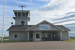
Pajala Airport
|
||
|
||
 |
||
| Country | Sweden | |
| County | Norrbotten County | |
| Seat | Pajala | |
| Area | ||
| • Total | 8,124.98 km2 (3,137.07 sq mi) | |
| • Land | 7,916.52 km2 (3,056.59 sq mi) | |
| • Water | 208.46 km2 (80.49 sq mi) | |
| Area as of January 1, 2010. | ||
| Population
(June 30, 2012)
|
||
| • Total | 6,318 | |
| • Density | 0.77760/km2 (2.01398/sq mi) | |
| Time zone | UTC+1 (CET) | |
| • Summer (DST) | UTC+2 (CEST) | |
| ISO 3166 code | SE | |
| Province | Norrbotten | |
| Municipal code | 2521 | |
| Website | www.pajala.se | |
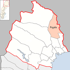
Pajala Municipality (in Swedish: Pajala kommun) is a local area in northern Sweden. It is part of Norrbotten County and shares a border with Finland. The main town, or 'seat,' where the local government is located, is called Pajala.
Over the years, the size of Pajala Municipality has changed. In 1884, Tärendö became its own municipality. Then, in 1914, Junosuando also separated. However, in 1971, these areas came back together, and Korpilombolo joined them too. In Pajala Municipality, Meänkieli and Finnish are recognized as official minority languages.
Contents
History of Pajala Municipality
Because of its location, Pajala Municipality has always been a natural place for trade. People from Sweden, Finland, and the native Sami people would meet here. The yearly Pajala market has been happening since the 1700s.
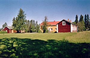
The home of Lars Levi Læstadius is in Pajala. He was a famous botanist, which means he studied plants. He also started a Christian movement called Laestadianism. His red house is now a museum. The yellow house next to it was used by the local Lutheran vicar from 1850 until today.
Geography and Landscape
Pajala Municipality is one of Sweden's largest areas by size. It covers about 8,000 square kilometers. This is roughly the same size as the historical province of Södermanland. However, Södermanland has over one million people, while Pajala Municipality has around 6,500 residents.
In Pajala, you can also find Jupukkamasten. This is a very tall structure, 335 meters high. It is a guyed mast used for sending out FM radio and TV signals. Along with three other masts of the same height, it is the tallest structure in all of Sweden.
Main Towns and Villages
There are four main towns or urban areas in Pajala Municipality. These are often called 'localities'.
| # | Locality | Population |
|---|---|---|
| 1 | Pajala | 1,985 |
| 2 | Korpilombolo | 548 |
| 3 | Junosuando | 345 |
| 4 | Kangos | 278 |
The main town, Pajala, is shown in bold.
Sister Cities Around the World
Pajala Municipality has three sister cities. These are cities in other countries that have special friendly relationships with Pajala.
 | Precious Adams |
 | Lauren Anderson |
 | Janet Collins |


