
Palmas Altas, Barceloneta, Puerto Rico facts for kids
Quick facts for kids
Palmas Altas
|
|
|---|---|
|
Barrio
|
|

Area near Isla Roque in Palmas Altas
|
|

Location of Palmas Altas within the municipality of Barceloneta shown in red
|
|

Palmas Altas, Barceloneta, Puerto Rico
Location in Caribbean
|
|
| Commonwealth | |
| Municipality | |
| Area | |
| • Total | 5.88 sq mi (15.2 km2) |
| • Land | 4.32 sq mi (11.2 km2) |
| • Water | 1.56 sq mi (4.0 km2) |
| Elevation | 0 ft (0 m) |
| Population
(2010)
|
|
| • Total | 3,778 |
| • Density | 388/sq mi (150/km2) |
| Source: 2010 Census | |
| Time zone | UTC−4 (AST) |
Palmas Altas is a neighborhood, also called a "barrio," located in the town of Barceloneta, Puerto Rico. In 2010, about 3,778 people lived in Palmas Altas.
A Look Back: History of Palmas Altas
After the Spanish–American War ended in 1898, Spain gave Puerto Rico to the United States. This happened under the rules of the Treaty of Paris of 1898. This meant Puerto Rico became a special area connected to the U.S., but not a state.
In 1899, the United States government counted the people living in Puerto Rico. This count is called a census. They found that 1,259 people lived in the Palmas Altas barrio at that time.
This chart shows how the population of Palmas Altas has changed over the years:
| Historical population | |||
|---|---|---|---|
| Census | Pop. | %± | |
| 1900 | 1,259 | — | |
| 1950 | 2,279 | — | |
| 1980 | 2,944 | — | |
| 1990 | 3,364 | 14.3% | |
| 2000 | 3,875 | 15.2% | |
| 2010 | 3,778 | −2.5% | |
| U.S. Decennial Census 1899 (shown as 1900) 1910-1930 1930-1950 1980-2000 2010 |
|||
Pictures of Palmas Altas
-
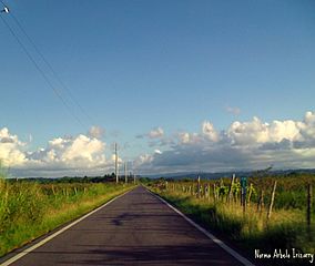
From Palmas Altas towards Barceloneta
-
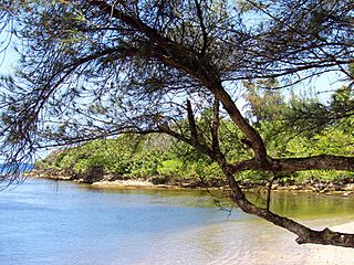
Beach at Palmas Altas
-
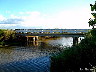
Small bridge in Palmas Altas


See also
 In Spanish: Palmas Altas (Barceloneta) para niños
- List of communities in Puerto Rico
