Panther Creek (Schoharie Creek tributary) facts for kids
Quick facts for kids Panther Creek |
|
|---|---|
|
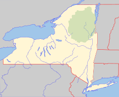
Location of mouth within New York
|
|
| Native name | Kehanagwara |
| Other name(s) | Panther Kil |
| Country | United States |
| State | New York |
| Region | Catskill Mountains |
| County | Schoharie |
| Physical characteristics | |
| Main source | Rossman Pond Schoharie County, New York 42°35′40″N 74°31′43″W / 42.5945202°N 74.5284772°W |
| River mouth | Schoharie Creek Breakabeen 682 ft (208 m) 42°32′56″N 74°24′24″W / 42.5489651°N 74.4065309°W |
| Basin features | |
| Basin size | 27.2 sq mi (70 km2) |
| Tributaries |
|
| Waterfalls | Boucks Falls |
Panther Creek is a cool stream in New York. It flows into the Schoharie Creek near a place called Breakabeen. This creek is known for its clean water and interesting history.
Contents
Panther Creek's History
Long ago, in the 1700s and even earlier, Panther Creek was part of an important trail. This trail was used by Native Americans. It started in Middleburgh and followed the Schoharie Creek.
The trail then went along Panther Creek all the way to its source. From there, it crossed over a ridge to Summit Lake. Finally, it followed Charlotte Creek and ended at the Susquehanna River. This trail was a key route for travel and trade.
Water Quality and Environment
Panther Creek is a very healthy stream. Experts check its water quality regularly.
How Clean is Panther Creek's Water?
In 2005, scientists did a "biological assessment" of the creek. This means they studied the living things in the water. They checked the creek near Breakabeen by State Route 30. The results showed the water was in "non-impacted conditions." This means it was very clean and healthy.
Similar tests in 2000 also showed great results. The New York State Department of Environmental Conservation (DEC) rates the water as Class C. This means it's good for fishing and for people to enjoy without touching the water. The DEC also adds "(TS)" to its rating. This special note means the creek's waters are perfect for trout to lay their eggs.
Dealing with Floods
Sometimes, heavy rains can cause the creek to flood. The bridge on West Fulton Road (County Route 4) can have problems. Debris like branches can get stuck under it. This can cause the water to overflow the road.
The bridge is a bit small for the creek. Also, there's a low spot on West Fulton Road. During big floods, water can flow over this low part of the road.
 | Jewel Prestage |
 | Ella Baker |
 | Fannie Lou Hamer |


