Paraburdoo, Western Australia facts for kids
Quick facts for kids ParaburdooWestern Australia |
|||||||||
|---|---|---|---|---|---|---|---|---|---|
 |
|||||||||
| Postcode(s) | 6754 | ||||||||
| Elevation | 424 m (1,391 ft) | ||||||||
| Area | [convert: needs a number] | ||||||||
| Location | |||||||||
| LGA(s) | Shire of Ashburton | ||||||||
| State electorate(s) | Pilbara | ||||||||
| Federal Division(s) | Durack | ||||||||
|
|||||||||
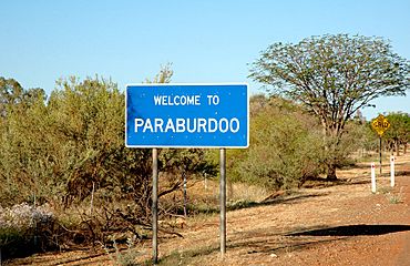
Paraburdoo (/ˌpærəbəˈduː/) is a town in the Pilbara region of Western Australia. It's mainly known for its mining industry. The town has its own airport, Paraburdoo Airport, which is about 9 kilometres (5.6 mi) away.
Contents
What's in a Name? The Meaning of Paraburdoo
The name "Paraburdoo" comes from an Aboriginal word. It might mean "feathered meat," possibly because of the many birds like little corellas or flock pigeons in the area. Another idea is that it means "Rock Cave," with "para" meaning rock and "buradoo" meaning hole or cave, referring to nearby caves.
Economy: The Mining Heart of Paraburdoo
Paraburdoo was built in the early 1970s. It was created to support the iron ore mining work of Hamersley Iron, which is now called Pilbara Iron. The town was officially recognized in 1972.
The town provides homes for people who work at three nearby mines. These mines are owned by Rio Tinto and are called the Channar, Eastern Range, and Paraburdoo mine.
Geography: Where is Paraburdoo Located?
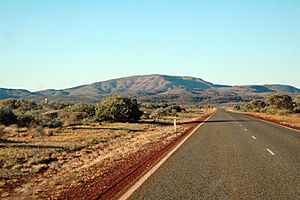
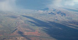
Paraburdoo is located far from major cities. It is about 1,528 kilometres (949 mi) north of Perth, the capital of Western Australia. The town is also about 24 kilometres (15 mi) north of the Tropic of Capricorn. It sits nearly 300 kilometres (190 mi) from the coast and is 424 metres (1,391 ft) above sea level.
Facilities: Life in Paraburdoo
Most people in Paraburdoo work for the Pilbara Iron mining company or for businesses that support the mines. The town has many facilities for families.
- For Kids: There is a daycare and a primary school.
- For Older Students: The nearest high school is Tom Price Senior High School in Tom Price, which is about 81 kilometres (50 mi) away. There is also a TAFE for further training.
- Sports and Fun: You can find skate parks, swimming pools, tennis courts, and fields for netball, cricket, and football.
- Daily Needs: Paraburdoo has its own shops and medical centers.
Climate: Hot and Dry Weather
Paraburdoo has a hot desert climate (called BWh in the Köppen climate classification system). This means it's very hot and dry.
- Summers: Days are extremely hot, and nights are warm. The average highest temperature in a year is 46.0 °C (114.8 °F). The hottest temperature ever recorded was 48.1 °C (118.6 °F) on January 21, 2024. On average, the temperature goes above 40.0 °C (104.0 °F) for over 72 days each year.
- Winters: Days are warm, and nights are cool.
- Rainfall: Rain can vary a lot. It often comes from storms and tropical cyclones, mostly between December and March. Some summer months might have no rain at all, while others can get over 200 millimetres (7.9 in) in just one month. From July to November, there is usually very little rain. The average yearly rainfall is 317.8 millimetres (12.5 in). Even though it gets some rain, its high evapotranspiration (water evaporating from the ground and plants) makes it a desert climate.
| Climate data for Paraburdoo | |||||||||||||
|---|---|---|---|---|---|---|---|---|---|---|---|---|---|
| Month | Jan | Feb | Mar | Apr | May | Jun | Jul | Aug | Sep | Oct | Nov | Dec | Year |
| Record high °C (°F) | 48.1 (118.6) |
47.4 (117.3) |
45.7 (114.3) |
41.6 (106.9) |
37.0 (98.6) |
32.5 (90.5) |
32.5 (90.5) |
36.7 (98.1) |
40.2 (104.4) |
44.7 (112.5) |
44.7 (112.5) |
47.8 (118.0) |
48.1 (118.6) |
| Mean daily maximum °C (°F) | 40.7 (105.3) |
38.9 (102.0) |
37.0 (98.6) |
33.9 (93.0) |
29.1 (84.4) |
25.2 (77.4) |
25.0 (77.0) |
27.7 (81.9) |
31.5 (88.7) |
36.0 (96.8) |
38.5 (101.3) |
40.6 (105.1) |
33.7 (92.7) |
| Mean daily minimum °C (°F) | 26.0 (78.8) |
25.1 (77.2) |
23.5 (74.3) |
19.9 (67.8) |
14.7 (58.5) |
11.3 (52.3) |
9.9 (49.8) |
10.9 (51.6) |
13.7 (56.7) |
18.3 (64.9) |
21.5 (70.7) |
24.7 (76.5) |
18.3 (64.9) |
| Record low °C (°F) | 16.2 (61.2) |
18.5 (65.3) |
11.7 (53.1) |
10.5 (50.9) |
5.3 (41.5) |
2.4 (36.3) |
1.3 (34.3) |
2.0 (35.6) |
4.4 (39.9) |
8.2 (46.8) |
13.1 (55.6) |
16.4 (61.5) |
1.3 (34.3) |
| Average rainfall mm (inches) | 58.3 (2.30) |
75.3 (2.96) |
48.5 (1.91) |
24.0 (0.94) |
18.1 (0.71) |
23.1 (0.91) |
13.6 (0.54) |
9.8 (0.39) |
3.3 (0.13) |
4.0 (0.16) |
8.4 (0.33) |
26.1 (1.03) |
317.8 (12.51) |
| Average precipitation days | 7.4 | 7.8 | 6.1 | 3.8 | 2.7 | 3.6 | 2.5 | 1.7 | 0.9 | 1.2 | 2.2 | 4.4 | 44.3 |
| Average afternoon relative humidity (%) (at 15:00) | 19 | 29 | 25 | 26 | 23 | 27 | 26 | 20 | 15 | 12 | 11 | 16 | 21 |
| Source: Bureau of Meteorology Temperatures: 1996–2020; Rain data: 1974–2020; Relative humidity: 1996–2010 |
|||||||||||||
See also
 In Spanish: Paraburdoo para niños
 | Aaron Henry |
 | T. R. M. Howard |
 | Jesse Jackson |


