Pat's Creek (Alberta) facts for kids
Quick facts for kids Pat's Creek |
|
|---|---|

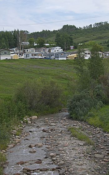
Pat's Creek in Peace River
|
|
| Country | Canada |
| Province | Alberta |
| Physical characteristics | |
| Main source | Northern Sunrise County 745 m (2,444 ft) 56°12′59″N 116°58′02″W / 56.216313°N 116.967244°W |
| River mouth | Peace River 320 m (1,050 ft) 56°14′00″N 117°17′50″W / 56.23339°N 117.297084°W |
| Basin features | |
| River system | Peace River |
Pat's Creek is a small stream that flows into the Peace River in northern Alberta, Canada. It ends right inside the town of Peace River.
This creek is named after Patrick Wesley. He was a Métis man who lived near the creek. He gave 5 acres of his land, including the creek, to the Anglican Church. He did this to thank them for helping him when he was very sick.
Where Pat's Creek Flows
Pat's Creek starts in Northern Sunrise County, Alberta. It begins high up, about 745 meters (2,444 feet) above sea level. The creek forms from two small, connected lakes located east of the community of St. Isidore.
As it flows west, Pat's Creek gets more water from another small stream near St. Isidore. It then passes just north of the community, creating deep valleys along its path. West of St. Isidore, it meets a slightly larger stream.
The creek then flows under Highway 688 and continues northwest. It moves west, then southwest, winding between Kaufmann and Grouard hills. For its last 1.5 kilometers (about 1 mile), the creek flows through a 3-meter (10-foot) wide tunnel. This tunnel goes under roads, sidewalks, and parks in the town of Peace River. Finally, Pat's Creek comes out of the tunnel and joins the Peace River. At this point, it is about 320 meters (1,050 feet) above sea level.
History of Pat's Creek
Flooding in Peace River
Pat's Creek can sometimes cause floods, especially when the snow melts in spring. A big flood happened on July 2, 1935. Heavy rains caused Pat's Creek to overflow its banks. Water and tree branches rushed down Main Street in Peace River.
The rain and floodwaters also made the Peace River rise a lot. It went up more than 6.1 meters (20 feet) higher than its usual level for July.
Old Highway Trail
Highway 2 used to follow Pat's Creek into the town of Peace River. However, this part of the highway had to be closed. There were huge landslides between Grouard Hill and Kauffman Hill.
Now, this 3-kilometer (1.9-mile) section is a wilderness trail. People can walk along it and enjoy nature above the creek.
 | John T. Biggers |
 | Thomas Blackshear |
 | Mark Bradford |
 | Beverly Buchanan |

