
Pawnee Rock, Kansas facts for kids
Quick facts for kids
Pawnee Rock, Kansas
|
|
|---|---|

Pawnee Rock Monument near Pawnee Rock (2013)
|
|

Location within Barton County and Kansas
|
|

|
|
| Country | United States |
| State | Kansas |
| County | Barton |
| Founded | 1874 |
| Incorporated | 1887 |
| Named for | Pawnee Rock |
| Area | |
| • Total | 0.28 sq mi (0.73 km2) |
| • Land | 0.28 sq mi (0.73 km2) |
| • Water | 0.00 sq mi (0.00 km2) |
| Elevation | 1,946 ft (593 m) |
| Population
(2020)
|
|
| • Total | 193 |
| • Density | 689/sq mi (264.4/km2) |
| Time zone | UTC-6 (CST) |
| • Summer (DST) | UTC-5 (CDT) |
| ZIP code |
67567
|
| Area code | 620 |
| FIPS code | 20-54875 |
| GNIS ID | 484937 |
Pawnee Rock is a small city in Barton County, Kansas, United States. In 2020, about 193 people lived there. The city gets its name from a famous nearby landmark, also called Pawnee Rock.
Contents
About Pawnee Rock
History of Pawnee Rock
Pawnee Rock was started in 1874. It was named after a famous rock formation nearby. The city officially became a town in 1887.
Pawnee Rock State Historic Site
Just north of the city, you can find the Pawnee Rock State Historic Site. This monument honors travelers who used the Santa Fe Trail long ago. It marks about the halfway point on that historic trail. The site has a stone building for picnics and a granite pillar on a small hill.
Geography of Pawnee Rock
Pawnee Rock covers a total area of about 0.28 square miles (0.73 square kilometers). All of this area is land. The city is located in Barton County, but its southern edge is right on the border with Pawnee County.
Population Changes in Pawnee Rock
The population of Pawnee Rock has changed over the years. Here's a look at how many people have lived in the city during different census years:
| Historical population | |||
|---|---|---|---|
| Census | Pop. | %± | |
| 1880 | 84 | — | |
| 1890 | 204 | 142.9% | |
| 1900 | 210 | 2.9% | |
| 1910 | 458 | 118.1% | |
| 1920 | 428 | −6.6% | |
| 1930 | 399 | −6.8% | |
| 1940 | 388 | −2.8% | |
| 1950 | 359 | −7.5% | |
| 1960 | 380 | 5.8% | |
| 1970 | 442 | 16.3% | |
| 1980 | 409 | −7.5% | |
| 1990 | 367 | −10.3% | |
| 2000 | 356 | −3.0% | |
| 2010 | 252 | −29.2% | |
| 2020 | 193 | −23.4% | |
| U.S. Decennial Census | |||
In 2020, there were 193 people living in Pawnee Rock. Most residents were white. About 25% of the population was under 18 years old. The average age in the city was 42.8 years.
Education in Pawnee Rock
The public schools in Pawnee Rock are part of the Fort Larned USD 495 school district. The local schools in Pawnee Rock were closed as part of a school unification plan. The high school's mascot used to be the Pawnee Rock Braves.
See also
 In Spanish: Pawnee Rock (Kansas) para niños
Images for kids
-
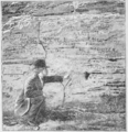
Pawnee Rock in 1880

