Paxville, South Carolina facts for kids
Quick facts for kids
Paxville, South Carolina
|
|
|---|---|
 |
|

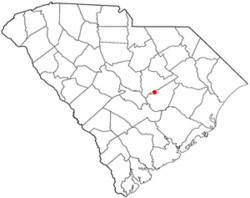
Location of Paxville, South Carolina
|
|
| Country | United States |
| State | South Carolina |
| County | Clarendon |
| Area | |
| • Total | 1.05 sq mi (2.72 km2) |
| • Land | 1.05 sq mi (2.72 km2) |
| • Water | 0.00 sq mi (0.00 km2) |
| Elevation | 184 ft (56 m) |
| Population
(2020)
|
|
| • Total | 232 |
| • Density | 220.74/sq mi (85.27/km2) |
| Time zone | UTC-5 (Eastern (EST)) |
| • Summer (DST) | UTC-4 (EDT) |
| ZIP code |
29102
|
| Area code(s) | 803, 839 |
| FIPS code | 45-55060 |
| GNIS feature ID | 1250042 |
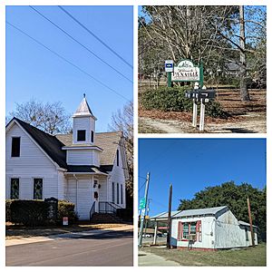
Paxville is a small town in Clarendon County, South Carolina, in the United States. In 2020, about 232 people lived there. The town was named after Joseph Pack, an important early settler.
Contents
A Look at Paxville's History
Joseph Pack and his wife, Louisa Alexandria Pack, came to America from England in 1770. Joseph became a very large landowner in the Carolina Low Country. He owned more than 10,000 acres of land.
Joseph helped start the town of Packsville, which was later renamed Paxville in 1902. Many people believe Paxville is the oldest town in Clarendon County. Some of Joseph Pack's land was given to him by King George III of the United Kingdom. Other land grants came from the state of South Carolina.
Joseph may have received some land for his service during the American Revolutionary War. There is a special marker that honors his time with the South Carolina Militia. Joseph and Louisa had a big family with six boys and six girls. Joseph Pack passed away in 1827, and Louisa died in 1832. Joseph Pack is buried in the Paxville Cemetery.
Where is Paxville Located?
Paxville is in the western part of Clarendon County. It covers an area of about 2.7 square kilometers (1.05 square miles). All of this area is land.
U.S. Route 15 goes through the town. This road leads north about 14 miles to Sumter. It also goes south about 9 miles to Summerton. South Carolina Highway 261 crosses US 15 in the middle of Paxville. This highway goes west about 6 miles to Pinewood. It also goes east about 9 miles to Manning, which is the main town for the county.
Paxville's Population
| Historical population | |||
|---|---|---|---|
| Census | Pop. | %± | |
| 1910 | 175 | — | |
| 1920 | 185 | 5.7% | |
| 1930 | 170 | −8.1% | |
| 1940 | 194 | 14.1% | |
| 1950 | 208 | 7.2% | |
| 1960 | 216 | 3.8% | |
| 1970 | 261 | 20.8% | |
| 1980 | 244 | −6.5% | |
| 1990 | 218 | −10.7% | |
| 2000 | 248 | 13.8% | |
| 2010 | 185 | −25.4% | |
| 2020 | 232 | 25.4% | |
| U.S. Decennial Census | |||
The population of Paxville has changed over the years. In 2000, there were 248 people living in the town. By 2010, the population had gone down to 185 people. However, in the most recent count in 2020, the population increased to 232 people.
Learning in Paxville
The schools in Paxville are part of the Clarendon School District 2.
See also
 In Spanish: Paxville para niños

