Pegnitz River facts for kids
The Pegnitz is a small river in Upper Franconia, Bavaria, Germany. It flows through a beautiful part of the country. The river is important for the cities it passes through, especially Nuremberg.
Quick facts for kids Pegnitz |
|
|---|---|

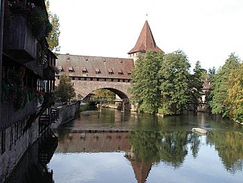
The Pegnitz in Nuremberg.
|
|
| Country | Germany |
| Physical characteristics | |
| Main source | Franconia 425 m (1,394 ft) |
| River mouth | Regnitz 49°29′11″N 10°59′12″E / 49.48639°N 10.98667°E |
| Length | 112.6 km (70.0 mi), with Fichtenohe 127.3 km (79.1 mi) |
| Basin features | |
| Progression | Regnitz→ Main→ Rhine→ North Sea |
| Basin size | 1,230 km2 (470 sq mi) |
Contents
Where Does the Pegnitz Start and End?
The Pegnitz river begins in the city also named Pegnitz. Its source is at a height of 425 meters (about 1,394 feet). The river flows for about 115 kilometers (71 miles). It meets another river called the Rednitz near Fürth. After they join, the river changes its name to Regnitz.
Animals Living in the Pegnitz
Many animals live in and around the Pegnitz river. You can often see ducks swimming peacefully. Swans also glide gracefully on the water. Sometimes, you might even spot gulls flying overhead or resting by the banks.
Rivers and Creeks Joining the Pegnitz
Several smaller rivers and creeks flow into the Pegnitz. These are called affluents. They add water to the Pegnitz as it travels.
- Högenbach (a creek that joins from the left side)
- Röthenbach (another creek)
Cities Along the River
The Pegnitz river flows through several interesting cities. Here are some of them, listed from where the river starts to where it ends:
- Pegnitz: This is the city where the river begins.
- Neuhaus on the Pegnitz
- Hersbruck
- Lauf an der Pegnitz
- Röthenbach an der Pegnitz
- Nuremberg: The river flows for about 14 kilometers (9 miles) through Nuremberg. In the city, the river sometimes splits into smaller channels. Many bridges and footbridges cross the river here. One famous bridge is the Kettensteg, an iron suspension bridge built in 1824. There is also a weir (a small dam) west of the Maxbrücke.
A Look at the River's History
In February 1909, there was a very big flood in Nuremberg. After this flood, people shortened the river's path within the city. They made it about four kilometers (2.5 miles) shorter.
However, since 1996, there have been plans to make the river longer again. People want to shape the river between Nuremberg and Fürth in a more natural way. This helps the environment and makes the river look more like it did before.
Images for kids
See also
 In Spanish: Río Pegnitz para niños
 | James Van Der Zee |
 | Alma Thomas |
 | Ellis Wilson |
 | Margaret Taylor-Burroughs |


