Pelham (village), New York facts for kids
Quick facts for kids
Village of Pelham, New York
|
|||
|---|---|---|---|

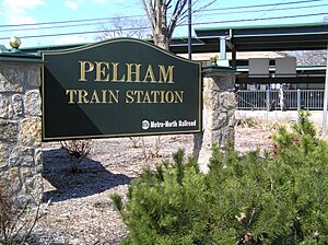
Pelham station is located within the village
|
|||
|
|||
| Nickname(s):
Pelham Village
|
|||

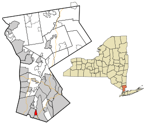
Location of Pelham (village), New York
|
|||
| Country | United States | ||
| State | New York | ||
| County | Westchester | ||
| Town | Pelham | ||
| Area | |||
| • Total | 0.82 sq mi (2.14 km2) | ||
| • Land | 0.82 sq mi (2.13 km2) | ||
| • Water | 0.00 sq mi (0.01 km2) | ||
| Elevation | 72 ft (22 m) | ||
| Population
(2020)
|
|||
| • Total | 7,326 | ||
| • Density | 8,912.41/sq mi (3,440.43/km2) | ||
| Time zone | UTC-5 (Eastern (EST)) | ||
| • Summer (DST) | UTC-4 (EDT) | ||
| ZIP code |
10803
|
||
| Area code(s) | 914 | ||
| FIPS code | 36-57001 | ||
| GNIS feature ID | 0960106 | ||
| Website | http://www.pelhamgov.com | ||
Pelham is a small village in Westchester County, New York, in the United States. It is part of the larger Town of Pelham. In 2020, about 7,326 people lived here.
Contents
History of Pelham Village
Early Land Purchase
On June 27, 1654, a man named Thomas Pell bought a large area of land. He purchased about 9,166 acres (37.09 km2) from the Siwanoy Native American tribe. This land included what we now know as Pelham, New Rochelle, and parts of Bronx County. Of course, the land that makes up today's Village of Pelham was part of this big purchase. When Thomas Pell passed away in 1669, his nephew, John Pell, inherited all the land.
How the Village Grew
The original Village of Pelham was officially created in 1896. Its borders were the New Haven Railroad to the north, Colonial Avenue to the south, New Rochelle to the east, and the Hutchinson River to the west.
Another village, North Pelham, was formed soon after, on August 29, 1896. Its borders were the New Haven Railroad to the south, New Rochelle to the east and northeast, and the Hutchinson River to the west and northwest.
By 1940, the Village of Pelham had 1,918 residents. North Pelham was much larger, with 5,046 people. In June 1975, the Village of North Pelham joined with the existing Village of Pelham. This created the single Village of Pelham we know today.
Geography of Pelham
Pelham is a small area, covering about 0.8 square miles (2.1 km2). According to the United States Census Bureau, all of this area is land.
Population and People
| Historical population | |||
|---|---|---|---|
| Census | Pop. | %± | |
| 1880 | 218 | — | |
| 1900 | 303 | — | |
| 1910 | 681 | 124.8% | |
| 1920 | 1,056 | 55.1% | |
| 1930 | 2,053 | 94.4% | |
| 1940 | 1,918 | −6.6% | |
| 1950 | 1,843 | −3.9% | |
| 1960 | 1,964 | 6.6% | |
| 1970 | 2,076 | 5.7% | |
| 1980 | 6,848 | 229.9% | |
| 1990 | 6,413 | −6.4% | |
| 2000 | 6,400 | −0.2% | |
| 2010 | 6,910 | 8.0% | |
| 2020 | 7,326 | 6.0% | |
| U.S. Decennial Census | |||
Population Details (2000 Census)
In 2000, there were 6,400 people living in Pelham. These people lived in 2,287 homes, and 1,687 of these were families. The village had about 7,785.5 inhabitants per square mile (3,006.0/km2) people per square mile. There were 2,337 housing units in total.
Most of the people in Pelham were White (83.22%). Other groups included Black (6.66%), Asian (4.95%), and Hispanic or Latino people (7.20%).
Households and Families
About 39.7% of homes had children under 18 living there. Most homes (58.9%) were married couples living together. About 11.6% of homes had a female head of household without a husband. About 26.2% of homes were not families.
The average home had 2.79 people. The average family had 3.30 people.
Age and Income
The population was spread out by age. About 27.7% of people were under 18. About 30.7% were between 25 and 44 years old. The average age in the village was 37 years.
In 2000, the average income for a household in Pelham was $82,430. For families, the average income was $95,929. The average income per person in the village was $43,397. Only a small number of families (1.3%) and people (3.3%) lived below the poverty line.
Climate and Weather
| Climate data for Pelham, New York | |||||||||||||
|---|---|---|---|---|---|---|---|---|---|---|---|---|---|
| Month | Jan | Feb | Mar | Apr | May | Jun | Jul | Aug | Sep | Oct | Nov | Dec | Year |
| Record high °F (°C) | 73 (23) |
75 (24) |
86 (30) |
96 (36) |
97 (36) |
99 (37) |
104 (40) |
102 (39) |
101 (38) |
89 (32) |
82 (28) |
77 (25) |
104 (40) |
| Mean daily maximum °F (°C) | 39.2 (4.0) |
42.9 (6.1) |
51.4 (10.8) |
62.6 (17.0) |
73.8 (23.2) |
81.6 (27.6) |
86.0 (30.0) |
83.9 (28.8) |
76.1 (24.5) |
65.4 (18.6) |
55.1 (12.8) |
43.8 (6.6) |
63.5 (17.5) |
| Mean daily minimum °F (°C) | 20.1 (−6.6) |
22.3 (−5.4) |
29.1 (−1.6) |
38.4 (3.6) |
47.2 (8.4) |
56.8 (13.8) |
62.3 (16.8) |
60.8 (16.0) |
53.0 (11.7) |
41.2 (5.1) |
34.6 (1.4) |
25.6 (−3.6) |
41.0 (5.0) |
| Record low °F (°C) | −10 (−23) |
−5 (−21) |
2 (−17) |
17 (−8) |
29 (−2) |
38 (3) |
49 (9) |
44 (7) |
34 (1) |
27 (−3) |
12 (−11) |
−4 (−20) |
−10 (−23) |
| Average precipitation inches (mm) | 3.56 (90) |
2.84 (72) |
4.07 (103) |
4.16 (106) |
4.33 (110) |
3.44 (87) |
4.20 (107) |
3.93 (100) |
4.37 (111) |
3.67 (93) |
4.09 (104) |
3.80 (97) |
46.46 (1,180) |
| Average snowfall inches (cm) | 9.8 (25) |
10.9 (28) |
6.8 (17) |
1.4 (3.6) |
.2 (0.51) |
0 (0) |
0 (0) |
0 (0) |
0 (0) |
.1 (0.25) |
.8 (2.0) |
8.6 (22) |
38.6 (98) |
| Average rainy days (≥ 0.01 in) | 8.5 | 8.1 | 9.3 | 9.8 | 10.9 | 9.3 | 9.0 | 8.7 | 7.6 | 6.7 | 9.2 | 9.4 | 113.4 |
| Source 1: Weatherbase | |||||||||||||
| Source 2: Homefacts (precipitation only) The Weather Channel (extremes) | |||||||||||||
Education in Pelham
The schools in Pelham Village are part of the Pelham Union Free School District.
- Colonial Elementary School
- Hutchinson Elementary School
- Pelham Middle School
- Pelham Memorial High School
These schools serve students from different parts of the village.
See also
 In Spanish: Pelham (villa) para niños
 | William Lucy |
 | Charles Hayes |
 | Cleveland Robinson |


