Pelion Range facts for kids
Quick facts for kids Pelion Range |
|
|---|---|
The Pelion Range from Mount Oakleigh
|
|
| Highest point | |
| Peak | Mount Ossa |
| Elevation | 1,617 m (5,305 ft) AHD |
| Geography | |
| Country | Australia |
| State | Tasmania |
| Region | Cradle Mountain-Lake St Clair National Park |
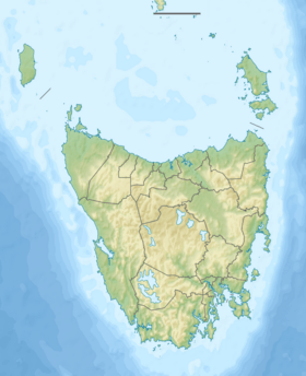
| Range coordinates | 41°50′S 146°02′E / 41.833°S 146.033°E |
| Geology | |
| Age of rock | Jurassic |
| Type of rock | Dolerite |
The Pelion Range is a group of mountains located in the beautiful Cradle Mountain-Lake St Clair National Park in Tasmania, Australia. This mountain range is famous for being home to some of Tasmania's tallest peaks. It includes Mount Ossa, which is the highest point in the entire state.
About the Pelion Range
The Pelion Range gets its name from Mount Pelion in Greece. It is a significant part of Tasmania's natural landscape. The range offers stunning views and challenging hikes for adventurers.
Location and Key Features
The Pelion Range is found within the Cradle Mountain-Lake St Clair National Park. This park is a popular destination for nature lovers. A well-known walking trail, called the Overland Track, goes right through the Pelion Range. Hikers often pass through a spot called the Pelion Gap. This makes several of the mountains in the range popular for climbing.
The highest point in the Pelion Range, and in all of Tasmania, is Mount Ossa. It stands tall at 1,617 metres (5,305 ft) above sea level. This makes it a major landmark for the region.
How the Mountains Formed
The Pelion Range is mostly made up of a type of rock called Dolerite. This rock formed during the Jurassic period, which was millions of years ago. Dolerite is a strong, dark-colored rock. It was created when molten rock cooled and hardened deep underground. Over time, erosion shaped these rocks into the mountains we see today.
See also
 In Spanish: Montañas Pelion para niños
 | Isaac Myers |
 | D. Hamilton Jackson |
 | A. Philip Randolph |


