Pelly Mountains facts for kids
Quick facts for kids Pelly Mountains |
|
|---|---|

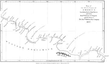
The Pelly Mountains in an 1837 map by Peter W. Dease and Thomas Simpson plotted during their Arctic expedition.
|
|
| Highest point | |
| Peak | Fox Mountain |
| Elevation | 2,404 m (7,887 ft) |
| Prominence | 1,404 m (4,606 ft) |
| Geography | |
| Country | Canada |
| Territory | Yukon |
| Range coordinates | 61°41′28″N 133°31′13″W / 61.69111°N 133.52028°W |
| Parent range | Yukon Ranges |
The Pelly Mountains are a large group of mountains in the Yukon territory of Canada. Imagine a huge area of land, about 44,014 square kilometers (which is about 17,000 square miles)! That's how big these mountains are.
They are part of an even bigger mountain system called the Yukon Ranges. These ranges then connect to the massive Pacific Coast Ranges, which stretch along the western side of North America. So, the Pelly Mountains are like a smaller piece of a much larger mountain puzzle!
Contents
Exploring the Pelly Mountains
The Pelly Mountains are a wild and beautiful place. They are known for their rugged peaks and vast landscapes. This mountain range is a significant part of the Yukon's geography.
Where are the Pelly Mountains?
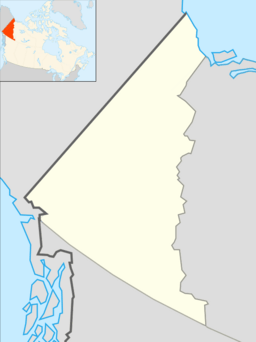
You can find the Pelly Mountains in the central part of the Yukon. The Yukon is a territory in northwestern Canada. It is famous for its wilderness and stunning natural beauty. The mountains are far from big cities.
What are Sub-ranges?
A mountain range can be so big that it has smaller groups of mountains inside it. These smaller groups are called "sub-ranges." The Pelly Mountains have a few important sub-ranges:
- Big Salmon Range
- Glenlyon Range
- Saint Cyr Range
Each of these sub-ranges has its own unique features and peaks.
The Highest Peak
The tallest mountain in the Pelly Mountains is called Fox Mountain. It stands at an impressive height of 2,404 meters (about 7,887 feet) above sea level. Imagine climbing to the very top of that!
A Look at History
People have known about the Pelly Mountains for a long time. Explorers and mapmakers have been charting this area for centuries. For example, an old map from 1837 shows the Pelly Mountains. This map was created by two explorers named Peter W. Dease and Thomas Simpson. They were on an Arctic expedition when they plotted these mountains. Their work helped us understand the geography of this remote region.
 | Stephanie Wilson |
 | Charles Bolden |
 | Ronald McNair |
 | Frederick D. Gregory |


