Pencarrow Head facts for kids
Quick facts for kids
Pencarrow Head
Pencarrow
|
|
|---|---|
|
Rural area
|
|

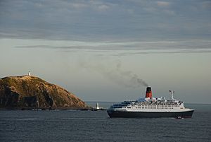
Ocean liner Queen Elizabeth 2 at Pencarrow Head
|
|
| Country | New Zealand |
| Region | Wellington Region |
| Territorial authority | Lower Hutt |
| Ward | Wainuiomata |
| Electorates |
|
| Area | |
| • Total | 268.40 km2 (103.63 sq mi) |
| Population
(June 2023)
|
|
| • Total | 700 |
| • Density | 2.61/km2 (6.8/sq mi) |
| Time zone | UTC+12 (NZST) |
| • Summer (DST) | UTC+13 (NZDT) |
| Postcode(s) |
5013
|
| Area code(s) | 04 |
Pencarrow Head, also known as Pencarrow, is a cool headland in the Wellington Region of New Zealand. A headland is a piece of land that sticks out into the sea. The name "Pencarrow" comes from a family home in Cornwall, England. This home belonged to Sir William Molesworth, who was a director of the New Zealand Company. The name itself is from the Cornish language. "Pen" means "head" and "Carrow" means "valley".
Pencarrow Head is the eastern point that marks the entrance to Wellington Harbour. It's located south of Eastbourne and is part of Lower Hutt. The area is quite hilly and you can't get there by car. Instead, there's a fun walking and mountain biking track that follows the coastline. This headland also marks the northern end of Fitzroy Bay.
Contents
The Famous Pencarrow Lighthouse
The most exciting part of Pencarrow Head is the Pencarrow Head Lighthouse. This lighthouse was the first permanent one built in New Zealand, finished in 1859. It's one of Wellington's most important historical spots.
New Zealand's First Female Lighthouse Keeper
Did you know that New Zealand's only female lighthouse keeper, Mary Bennett, worked right here? She was a very important part of the lighthouse's history. You can enjoy a four-hour return walk from Eastbourne to visit this amazing place.
Pencarrow's Special Lakes
Pencarrow is also home to two unique freshwater wetlands, Lake Kohangapiripiri and Lake Kohangatera. These lakes were once connected to the sea. But, strong earthquake activity blocked them off, turning them into freshwater areas.
For many years, farm animals grazed around these wetlands. This caused some damage to the area. However, farming stopped in 2004, and the wetlands are now recovering well. The Department of Conservation and the Greater Wellington Regional Council work together to look after this special environment.
Shipwrecks at Pencarrow Head
The waters around Pencarrow Head can be tricky for ships. Many vessels have been wrecked on the rocks between the Head and Point Hinds to the north. Some of these include:
- Henrietta in 1852
- Hunter in 1876
- Carlotta in 1878
- Magic in 1921
- Admiral in 1960
- Maria Luisa in 1996 (which crashed into another ship called Sydney Express)
These shipwrecks remind us how powerful the ocean can be.
People of Pencarrow
The Pencarrow area covers about 268 square kilometers. As of 2023, it had an estimated population of 700 people. This means there are about 2.6 people living in each square kilometer.
The population has grown over the years. In 2018, there were 651 people living here. This was an increase of 63 people since 2013, and 78 people since 2006. The people living in Pencarrow come from different backgrounds, adding to the area's unique community.
 | Georgia Louise Harris Brown |
 | Julian Abele |
 | Norma Merrick Sklarek |
 | William Sidney Pittman |

