Perdiguero facts for kids
Quick facts for kids Perdiguero |
|
|---|---|

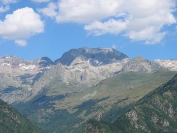
Peak of Perdiguère, Lac du Portillon and ascending route
|
|
| Highest point | |
| Elevation | 3,222 m (10,571 ft) |
| Listing | List of Pyrenean three-thousanders |
| Geography | |
| Location | France — Spain |
| Région Communauté |
Midi-Pyrénées Aragon |
| Département Province |
Haute-Garonne Huesca |
| Parent range | Pyrenees |
| Climbing | |
| First ascent | 1817 by Friedrich Parrot and Pierre Barrau |
| Easiest route | West ridge from the refuge of Portillon |
Perdiguero is a tall mountain peak located in the Pyrenees mountain range. It stands right on the border between two countries: France and Spain. This impressive summit reaches a height of 3,222 meters (about 10,571 feet) above sea level.
Where is Perdiguero?
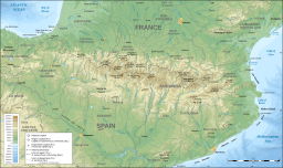
Perdiguero is found in a beautiful area of the Pyrenees. On the Spanish side, it's near the town of Benasque. On the French side, it's close to the village of Oô, which is not far from Bagnères-de-Luchon.
This mountain is special because it's the highest point in the Haute-Garonne region of France. It's just a bit taller than another nearby peak called Pointe de Literole.
Right at the base of Perdiguero, you'll find a beautiful body of water called Lake Portillon. This lake adds to the stunning scenery around the mountain.
Who first climbed Perdiguero?
The first recorded climb to the top of Perdiguero happened a long time ago, in 1817. Two brave explorers, Friedrich Parrot and Pierre Barrau, were the first to reach its summit. They showed the way for many other climbers who would follow.
The easiest way to climb Perdiguero today is usually from the west side. Climbers often start from a mountain hut, or "refuge," near Lake Portillon.
See also
 In Spanish: Pico Perdiguero para niños
 | Bessie Coleman |
 | Spann Watson |
 | Jill E. Brown |
 | Sherman W. White |


