Perinton, New York facts for kids
Quick facts for kids
Perinton, New York
|
|
|---|---|

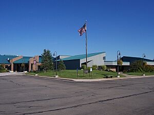
Perinton Town Hall
|
|

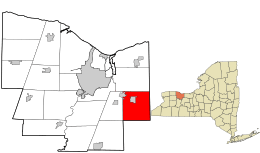
Location in Monroe County and the state of New York.
|
|

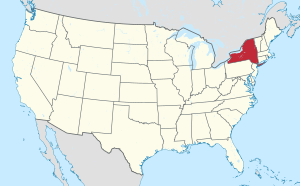
Location of New York in the United States
|
|
| Country | United States |
| State | New York |
| County | Monroe |
| Established | May 26, 1812 |
| Area | |
| • Total | 34.55 sq mi (89.47 km2) |
| • Land | 34.19 sq mi (88.55 km2) |
| • Water | 0.36 sq mi (0.93 km2) |
| Elevation | 546 ft (166 m) |
| Population
(2020)
|
|
| • Total | 47,479 |
| • Density | 1,388.68/sq mi (536.18/km2) |
| Time zone | UTC−5 (EST) |
| • Summer (DST) | UTC−4 (EDT) |
| ZIP Code |
14450
|
| Area code(s) | 585 |
| FIPS code | 36-055-57221 |
Perinton is a town in Monroe County, New York, United States. It was once known as Perrinton or Perrington. In 2020, about 47,479 people lived there.
The village of Fairport is located within Perinton, right on the Erie Canal. Perinton is next to East Rochester (to the west) and other towns like Victor (south), Macedon (east), Pittsford (west), and Penfield (north).
The small community of Egypt is in southeastern Perinton. Important places in Egypt include the Egypt Fire Department, Lollypop Farm, and Egypt Park. Another area, Bushnell's Basin, is in the southwest. It has the Bushnell's Basin Fire Department and Richardson's Canal House.
Contents
History of Perinton
Early Beginnings and First Settlers
In 1788, two men named Oliver Phelps and Nathaniel Gorham bought a huge piece of land in Western New York. It was about 2.6 million acres! Later, William Walker bought 36 square miles of this land. He hired his brother Caleb and his cousin Glover Perrin to measure and divide the land into 66 equal parts. This area was first called Township 12, Range 4.
In 1793, Glover Perrin and his large family became the first permanent white settlers here. They chose flat areas with plenty of water, like the community of Egypt and Perinton Center. Early businesses included mills, blacksmith shops, and places to eat and stay.
Fairport's Growth and the Erie Canal
By the late 1820s, the village of Fairport, which is part of Perinton, started to grow quickly. This was because of the Erie Canal, which made it easy to transport goods. Fairport officially became a village in 1867.
From the 1850s to the 1950s, Fairport was a busy canal port and a growing industrial town. Companies like DeLand Chemical Company and American Can Company became successful because of easy transportation by canal and later by railroad. The village also added services like a fire department, a public library, and parks.
Modern Perinton
Outside of Fairport, the town of Perinton was mostly farmland until the 1950s. Today, you can still find farms, but they are surrounded by neighborhoods, offices, and many parks. Fairport still feels like a canal town and uses the canal for fun activities.
Many people who live in Perinton attend the Fairport Central School District. They also get their mail through the Fairport postal service. Because of this, people often say they live in "Fairport" even if they are outside the village limits.
In 2008, Perinton was named one of the top 100 best places to live in the United States by RelocateAmerica.com. The historic Richardson's Canal House was added to the National Register of Historic Places in 1980.
Fun in Perinton: Parks and Recreation
Perinton is known as "Trail Town USA" by the American Hiking Society. This means it's a great place for hiking! The town has the Crescent Trail, which is a 35-mile system of walking paths.
Here are some of the parks and recreation areas in Perinton:
- Beechwoods Park: Great for hiking.
- Egypt Park: Has baseball fields, tennis courts, and a playground.
- Fellows Road Park: Offers tennis, volleyball, basketball, baseball, a playground, and an exercise trail.
- Garnsey Arboretum: A place for hiking and enjoying nature.
- Horizon Hill: Has indoor space and a small outdoor shelter.
- Indian Hill: Another spot for hiking.
- Kreag Road Park: Features baseball, basketball, tennis, a playground, and access to the canal.
- Perinton Park: Includes a boathouse for rowing, basketball, tennis, volleyball, a playground, and a hiking trail.
- Perinton Recreation Center: Has soccer fields, a bandshell for concerts, a playground, and a hiking trail.
- Potter Park: Offers soccer, baseball, tennis, a teen center, and a skating rink.
- Powder Mills Park: You can go downhill skiing, cross-country skiing, fishing, or enjoy the playground and hiking trails. It also has a fish hatchery.
- Spring Lake Park: Good for fishing and baseball.
- White Brook Nature Area: A natural space to explore.
Geography of Perinton
Perinton covers a total area of about 89.5 square kilometers (34.5 square miles). Most of this area, about 88.5 square kilometers (34.19 square miles), is land. The rest, about 0.9 square kilometers (0.36 square miles), is water.
Population and People
| Historical population | |||
|---|---|---|---|
| Census | Pop. | %± | |
| 1820 | 1,664 | — | |
| 1830 | 2,106 | 26.6% | |
| 1840 | 2,513 | 19.3% | |
| 1850 | 2,891 | 15.0% | |
| 1860 | 3,015 | 4.3% | |
| 1870 | 3,261 | 8.2% | |
| 1880 | 4,030 | 23.6% | |
| 1890 | 4,450 | 10.4% | |
| 1900 | 4,703 | 5.7% | |
| 1910 | 6,566 | 39.6% | |
| 1920 | 7,799 | 18.8% | |
| 1930 | 9,854 | 26.3% | |
| 1940 | 10,170 | 3.2% | |
| 1950 | 11,559 | 13.7% | |
| 1960 | 16,314 | 41.1% | |
| 1970 | 31,568 | 93.5% | |
| 1980 | 41,802 | 32.4% | |
| 1990 | 43,015 | 2.9% | |
| 2000 | 46,090 | 7.1% | |
| 2010 | 46,462 | 0.8% | |
| 2020 | 47,479 | 2.2% | |
| U.S. Decennial Census | |||
In 2000, there were 46,090 people living in Perinton. There were about 17,591 households, and 12,964 of these were families. The population density was about 1,350 people per square mile.
About 93.90% of the people were White, 1.72% were African American, and 2.84% were Asian. About 1.43% of the population was Hispanic or Latino.
In terms of age, 26.7% of the people were under 18 years old. The average age in Perinton was 39 years. For every 100 females, there were about 93 males.
The average income for a household in Perinton was $69,341. For families, the average income was $80,606.
Economy and Businesses
One of the main companies in Perinton is PAETEC.
Communities and Locations in Perinton
- Bushnell's Basin – A small community in the southwest part of town, located on NY 96.
- Egypt – A community in the eastern part of town, located on NY 31.
- Fairport – The main village in the northwest part of town, where NY 31F and NY 250 meet.
- Fullam's Corners – A community west of Fairport village, on O'Connor Road, Route 31F, and Jefferson Avenue.
- Hannans Corner – A community at the intersection of NY 250 and NY 31 (Palmyra Road).
- Perinton Square Mall – A shopping mall located west of Hannans Corner, on NY 31.
See also
 In Spanish: Perinton para niños

