Penfield, New York facts for kids
Quick facts for kids
Penfield
|
|
|---|---|
| Motto(s):
a town of planned progress
|
|

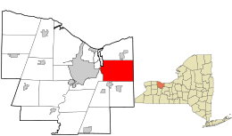
Location in Monroe County and the state of New York.
|
|

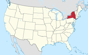
Location of New York in the United States
|
|
| Country | United States |
| State | New York |
| County | Monroe |
| Established | March 30, 1810 |
| Area | |
| • Total | 37.85 sq mi (98.04 km2) |
| • Land | 37.22 sq mi (96.40 km2) |
| • Water | 0.63 sq mi (1.64 km2) |
| Elevation | 512 ft (156 m) |
| Population
(2020)
|
|
| • Total | 39,438 |
| • Estimate
(2022)
|
38,872 |
| • Density | 1,002.93/sq mi (387.23/km2) |
| Time zone | UTC-5 (EST) |
| • Summer (DST) | UTC-4 (EDT) |
| ZIP codes |
14526, 14450, 14580, 14625
|
| Area code(s) | 585 |
| FIPS code | 36-055-57144 |
| Website | https://www.penfield.org/ |
Penfield is a town located in Monroe County, New York, in the United States. It's a suburb of the city of Rochester. In 2020, about 39,438 people lived there.
The town was officially started in 1810. It was named after Daniel Penfield, a soldier from the Revolutionary War. He bought the land for the town in 1795. Penfield's motto is "A Town of Planned Progress," which means they like to grow and develop in a thoughtful way.
Contents
Exploring Penfield's Geography
Penfield covers about 37.9 square miles (98.04 square kilometers). Most of this area is land, with a small part being water. The town is surrounded by other towns. To the north is Webster, and to the south are Perinton, Pittsford, and East Rochester. To the east is Walworth, and to the west are Irondequoit and Brighton.
Parks and Natural Features
Penfield has many parks with different types of land, water areas, and sports fields. These parks offer great places for outdoor activities. Some of the parks include:
- Abraham Lincoln Park
- Channing H Philbrick Park
- Ellison Park
- Greenwood Park
- Harris Whalen Park
- Heritage Park
- LaSalle's Landing Park
- Lucien Morin Park
- Rothfuss Park
- Schaufelberger Park
- Shadow Pines Municipal Land
- Sherwood Fields Park
- Veteran's Memorial Park
About two million years ago, huge glaciers helped shape Penfield's land. These melting glaciers created interesting hills and valleys, especially near Ellison Park. The land became very fertile, which was great for farming. Today, this rich soil is still used to grow fruits like apples, cherries, plums, peaches, and pears.
Penfield also shares a part of Irondequoit Bay with two other towns, Irondequoit and Webster. The southeastern end of this bay is located in Penfield.
Understanding Penfield's Population
| Historical population | |||
|---|---|---|---|
| Census | Pop. | %± | |
| 1820 | 3,244 | — | |
| 1830 | 4,477 | 38.0% | |
| 1840 | 2,842 | −36.5% | |
| 1850 | 3,185 | 12.1% | |
| 1860 | 3,210 | 0.8% | |
| 1870 | 2,928 | −8.8% | |
| 1880 | 2,955 | 0.9% | |
| 1890 | 2,845 | −3.7% | |
| 1900 | 2,857 | 0.4% | |
| 1910 | 2,977 | 4.2% | |
| 1920 | 2,087 | −29.9% | |
| 1930 | 3,306 | 58.4% | |
| 1940 | 3,774 | 14.2% | |
| 1950 | 4,847 | 28.4% | |
| 1960 | 12,601 | 160.0% | |
| 1970 | 23,782 | 88.7% | |
| 1980 | 27,201 | 14.4% | |
| 1990 | 30,219 | 11.1% | |
| 2000 | 34,645 | 14.6% | |
| 2010 | 36,242 | 4.6% | |
| 2020 | 39,438 | 8.8% | |
| U.S. Decennial Census | |||
In 2000, there were 34,645 people living in Penfield. These people lived in about 13,144 homes. Many of these homes (about 63.4%) were families with married couples. About 34.9% of homes had children under 18 living there.
The population is spread out in terms of age. About 25.8% of the people were under 18 years old. The average age in Penfield was 40 years. For every 100 females, there were about 92.3 males.
Communities and Neighborhoods in Penfield
Penfield has several smaller communities and areas within its borders:
- East Penfield - A small village area located near the eastern border of the town.
- East Rochester - A tiny part of the Village of East Rochester extends into Penfield near its southern edge.
- Lloyd's Corners - A community found where two main roads, Route 441 and Route 250, meet.
- Panorama - A community located where Route 441 and Route 153 connect, just east of the main Penfield village.
- Penfield - This is the main village area of Penfield, located near the western town line.
- Penfield Center - A community at the crossing of Penfield Center Road, Route 250, and Route 286.
- Roseland - A community in the northeastern part of the town.
Penfield's Economy and Jobs
Penfield is part of the larger Rochester, NY metropolitan area, which means many people work for big companies and organizations in the region. Some well-known companies that provide jobs and influence the area include Kodak, Xerox, and Bausch & Lomb.
Important health, insurance, and education organizations also contribute to the local job market. These include the University of Rochester, Rochester Institute of Technology, and Rochester Regional Health.
Some major companies with offices or facilities directly in Penfield are Paychex, Nalge Nunc International, Birds Eye Foods, and Wegmans.
Schools and Education in Penfield
Most students in Penfield attend schools in the Penfield Central School District or the Webster Central School District. Smaller parts of the town are served by the East Rochester Union Free School District, Pittsford Central School District, and Wayne Central School District.
There are also several private schools in Penfield:
- The Charles Finney School (for grades K–12)
- Bread Of Life Christian Academy (for grades K–8)
- Southeast Christian Academy (for grades 1–12)
- Rochester Christian School (for grades K–8)
- St. Joseph Elementary School (for grades K–6)
- Webster Montessori School (for grades pre-K–5)
A Look Back at Penfield's History
The land where Penfield now stands was once hunting grounds for the Seneca Nation, a Native American tribe. While there's no proof of Seneca villages in Penfield, there is a place called "Indian Landing" on Irondequoit Bay. From this spot, trails and water paths connected to many parts of the region, even leading to the Great Lakes and the Gulf of Mexico.
After the American Revolution, the land became part of a large land deal called the Phelps and Gorham Purchase. Daniel Penfield bought parts of this land in 1795.
The town of Penfield was officially created in 1810. The first town meeting happened on April 2, 1811. Over time, parts of Penfield were used to form other towns, like Brighton in 1814 and Webster in 1840. Today, Penfield is mostly the same area that was known as "township 13" in the original land purchase.
The first Penfield town hall was built in 1895. It was later recognized as an important landmark in 1981. This building, located at 2131 Five Mile Line Road, was once a library. The town hall moved to its current location at 3100 Atlantic Avenue in 1966. The original building is now a clothing store.
Several historic buildings in Penfield are listed on the National Register of Historic Places. This means they are important for their history and are protected. Some of these include the Horace and Grace Bush House, Daisy Flour Mill, and the Mud House.
Notable People from Penfield
Many interesting people have connections to Penfield, including:
- Josh Bolton - a former professional soccer player.
- Obadiah Bush - a person who fought against slavery and was an ancestor of the Bush family.
- Chyna - a famous former professional wrestler.
- Velvet D'Amour - a fashion model.
- Geoffrey Deuel - an actor.
- Pete Duel - an actor.
- Robert Forster - an actor.
- Lou Gramm - the lead singer of the band Foreigner.
- Bud Lewis - a former professional soccer player.
- Joe Mercik - a former professional soccer player.
- Edmund Mann Pope - a United States military officer and a state senator in Minnesota.
See also
 In Spanish: Penfield (Nueva York) para niños
 | William Lucy |
 | Charles Hayes |
 | Cleveland Robinson |

