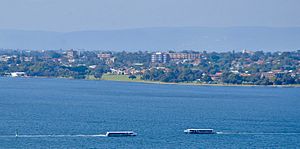
Perth Water facts for kids
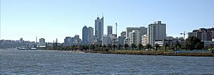
Perth Water is a beautiful part of the Swan River in Perth, Western Australia. It sits right next to the city center. This wide, shallow section of the river is a famous landmark. It stretches from the Causeway in the east to the Narrows Bridge in the west. It also borders the northern part of the suburb South Perth.
Contents
History of Perth Water
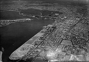
Perth Water used to be much larger than it is today. Over many years, people have changed its shorelines.
A lot of land has been added to both sides of the river. For example, in 1879, land was filled in to create The Esplanade. This shows how much the area has changed over time.
How the Narrows Bridge Changed the River
When the Narrows Bridge was built, a large part of Perth Water was filled in. This happened on the northwest side of the river.
This area was once called Mounts Bay. The road along the shore was known as Mounts Bay Road. Filling in the land for the bridge effectively removed Mounts Bay. Today, the Perth Convention and Exhibition Centre stands on land that was once part of the river.
Fun Events at Perth Water
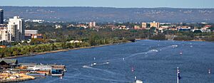
Perth Water is a popular spot for exciting events. In 2006, it hosted the final race of the Red Bull Air Race World Series. This was the first time Australia held this event.
Every year, Perth Water is the main location for the Australia Day City of Perth Skyworks. Huge crowds gather along the riverbanks to watch the fireworks. Kings Park offers a great view because it's high up and looks right over Perth Water. Many old postcards and photos show this amazing view of the city and river.
How People Use Perth Water
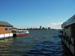
Since Perth was first settled, there have always been places for boats at Barrack Street Jetty. Today, the Transperth ferry service travels between Elizabeth Quay and Mends Street in South Perth.
Other companies also use these jetties. They offer trips to Rottnest Island and fun cruises along the Swan River. Ferry companies work hard to keep Perth Water clean. They use special methods to prevent oil pollution.
Indigenous Names for the Area
The Noongar people are the traditional owners of this land. They have their own names for different parts of Perth Water:
- Perth Water – Buneenboro
- Mends Street Jetty – Goorgoogoo
- Sir James Mitchell Park, South Perth foreshore – Gabudjulup
- Riverside Drive (once shallow waters east of Government House) – Gabbee darbul
- Point Belches (southeast side of Narrows Bridge area) – Gareenup
This body of water is also known as Derbarl Yerrigan. This name is now used for the entire Swan River. In the Noongar language, Derbarl means estuary water, and Yerrigan means "rising up."
For larger boats, there's a special path called a navigable channel. This channel goes from the Narrows Bridge to Barrack Street Jetty. It follows the north shore, next to Riverside Drive.
This channel has been dredged (made deeper) since 1908. This helps keep the ferry path clear between South Perth and Perth. Keeping it clear is an ongoing job.
See also
- Melville Water
- Elizabeth Quay
- Islands of Perth, Western Australia
 | Jackie Robinson |
 | Jack Johnson |
 | Althea Gibson |
 | Arthur Ashe |
 | Muhammad Ali |


