
Pewee Valley, Kentucky facts for kids
Quick facts for kids
Pewee Valley, Kentucky
|
|
|---|---|

Location of Pewee Valley in Oldham County, Kentucky.
|
|
| Country | United States |
| State | Kentucky |
| County | Oldham |
| Settled | 1852 |
| Incorporated | 1870 |
| Named for | a local bird |
| Area | |
| • Total | 1.94 sq mi (5.03 km2) |
| • Land | 1.93 sq mi (5.00 km2) |
| • Water | 0.01 sq mi (0.02 km2) |
| Elevation | 778 ft (237 m) |
| Population
(2020)
|
|
| • Total | 1,588 |
| • Estimate
(2022)
|
1,618 |
| • Density | 821.95/sq mi (317.34/km2) |
| Time zone | UTC-5 (Eastern (EST)) |
| • Summer (DST) | UTC-4 (EDT) |
| ZIP code |
40056
|
| Area code(s) | 502 |
| FIPS code | 21-60492 |
| GNIS feature ID | 2404509 |
Pewee Valley is a small, friendly city in Oldham County, Kentucky, United States. It's known for its quiet neighborhoods and green spaces. In 2020, about 1,588 people called Pewee Valley home. The city gets its unique name from a local bird, the eastern wood pewee.
Contents
History of Pewee Valley
Pewee Valley started as a simple stop along the Louisville and Frankfort Railroad in 1852. Back then, it was called Smith's Station. No one is quite sure which "Smith" it was named after. It might have been Henry S. Smith, whose family were early settlers, or Thomas Smith, who owned a local shop.
The name changed to Pewee Valley in 1856 when Henry's son, Charles Franklin Smith, opened a post office there. The "Pewee" part comes from the eastern wood pewee, a small bird found in the area. It's a bit of a mystery why it's called a "Valley," though, because the town actually sits on a ridge!
Geography and Location
Pewee Valley is located in Oldham County, Kentucky. According to the United States Census Bureau, the city covers a total area of about 1.9 square miles (5.0 square kilometers). Almost all of this area is land, with only a tiny bit of water.
Who Lives in Pewee Valley?
| Historical population | |||
|---|---|---|---|
| Census | Pop. | %± | |
| 1890 | 435 | — | |
| 1900 | 464 | 6.7% | |
| 1910 | 651 | 40.3% | |
| 1920 | 649 | −0.3% | |
| 1930 | 582 | −10.3% | |
| 1940 | 625 | 7.4% | |
| 1950 | 687 | 9.9% | |
| 1960 | 881 | 28.2% | |
| 1970 | 950 | 7.8% | |
| 1980 | 982 | 3.4% | |
| 1990 | 1,283 | 30.7% | |
| 2000 | 1,436 | 11.9% | |
| 2010 | 1,456 | 1.4% | |
| 2020 | 1,588 | 9.1% | |
| 2022 (est.) | 1,618 | 11.1% | |
| U.S. Decennial Census | |||
Every ten years, the United States counts its population in a process called a census. The last census in 2020 showed that 1,588 people lived in Pewee Valley.
In 2000, there were 1,436 people living in the city. Most residents were White (96.10%), with smaller percentages of African American (2.37%), Asian (0.28%), and other backgrounds. About 2.02% of the population identified as Hispanic or Latino.
There were 484 households in Pewee Valley in 2000. About 33.7% of these households had children under 18 living there. Most households (73.3%) were married couples living together. The average household had about 2.71 people.
The population of Pewee Valley includes people of all ages. In 2000, about 23.6% of residents were under 18 years old. About 20.2% were 65 years or older. The average age in the city was 46 years.
The median income for a household in Pewee Valley was $71,625 in 2000. This means that half of the households earned more than this amount, and half earned less. For families, the median income was $81,639. A small number of families (2.0%) and individuals (3.8%) lived below the poverty line.
Images for kids
-
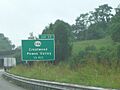
An exit sign for Pewee Valley on Interstate 71.

See also
 In Spanish: Pewee Valley (Kentucky) para niños
