Phanagoria Island facts for kids

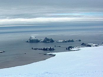
Zed Islands from Miziya Peak; Phanagoria Island is the second one on the left.
|
|

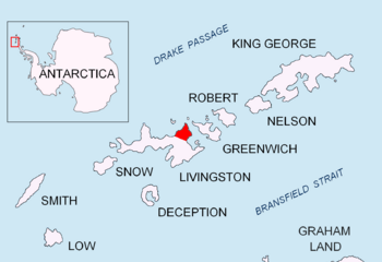
Location of Varna Peninsula in the South Shetland Islands
|
|
| Geography | |
|---|---|
| Location | Antarctica |
| Coordinates | 62°26′03″S 60°09′46″W / 62.43417°S 60.16278°W |
| Archipelago | Zed group |
| Area | 20 ha (49 acres) |
| Length | 700 m (2,300 ft) |
| Width | 500 m (1,600 ft) |
| Administration | |
| Administered under the Antarctic Treaty System | |
| Demographics | |
| Population | uninhabited |
Phanagoria Island is a cool place in Antarctica. It's part of a small group of islands called the Zed Islands. This island is the third largest in its group. You can find it just off the north coast of Livingston Island.
The island is special because it's mostly free of ice. It stretches about 700 meters (that's like seven football fields!) long and 500 meters wide. Its total surface area is about 20 hectares. Phanagoria Island is separated from its neighbors, Esperanto Island and Lesidren Island, by narrow water channels. These channels are about 70 to 130 meters wide. The island is located about 2.1 kilometers northwest of Williams Point.
Island Name and History
Phanagoria Island got its name from an old town called Phanagoria. This town was part of Old Great Bulgaria way back in the 7th century.
In the early 1800s, people who hunted seals visited this area. They were some of the first humans to explore these icy waters.
Where is Phanagoria Island?
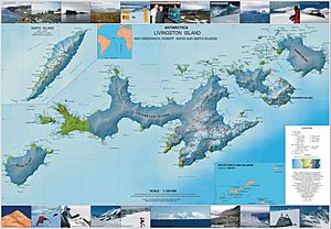
Phanagoria Island is located at coordinates 62°26′03″S 60°09′46″W. Many countries have created maps of this island over the years. British mappers created maps in 1968. Chilean maps came out in 1971, and Argentine maps in 1980. More recently, Bulgarian maps were made in 2005 and 2009.


