Esperanto Island facts for kids

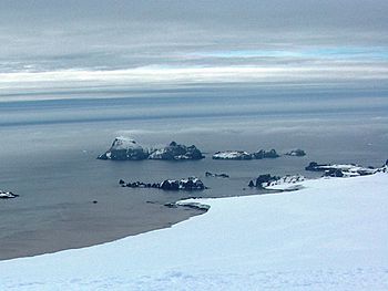
Zed Islands from Miziya Peak; Esperanto Island is the leftmost one in the background
|
|

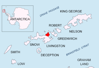
Location of Esperanto Island
|
|
| Geography | |
|---|---|
| Location | Antarctica |
| Coordinates | 62°25′43″S 60°10′23″W / 62.42861°S 60.17306°W |
| Archipelago | South Shetland Islands |
| Area | 56 ha (140 acres) |
| Length | 0.95 km (0.59 mi) |
| Width | 0.9 km (0.56 mi) |
| Highest elevation | 290 m (950 ft) |
| Administration | |
| Administered under the Antarctic Treaty System | |
| Demographics | |
| Population | Uninhabited |
Esperanto Island is a cool, rocky island located in Antarctica. It's the biggest island in a small group called the Zed Islands. You can find it off the north coast of Varna Peninsula on Livingston Island. This area is part of the South Shetland Islands.
The island has no ice and rises to about 290 meters (950 feet) high. It stretches for about 950 meters (1,040 yards) long and 900 meters (980 yards) wide. Its total surface area is about 56 hectares (138 acres). Esperanto Island is very close to Phanagoria Island, only 70 meters (77 yards) away. It's also about 2.7 kilometers (1.7 miles) northwest of Williams Point on Livingston Island.
People who hunted seals visited this area a long time ago in the early 1800s. The island gets its name from Esperanto, which is a special international language that was created to help people from different countries communicate easily.
Where is Esperanto Island located?
Esperanto Island is found at these coordinates: 62°25′43″S 60°10′23″W.
Many countries have mapped this island over the years. The British mapped it in 1968, followed by Chile in 1971, and Argentina in 1980. Bulgaria also created maps of the island in 2005 and 2009. These maps help us understand the island's shape and exact location.
See also
- In Spanish: Isla Esperanto para niños


