Pic de la Munia facts for kids
Quick facts for kids Pic de la Munia |
|
|---|---|

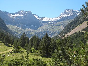
Le cirque de Barrosa : à gauche, la Robiñera, à droite la Munia.
|
|
| Highest point | |
| Elevation | 3,133 m (10,279 ft) |
| Geography | |
| Région Communauté |
Midi-Pyrénées Aragon |
| Département Province |
Hautes-Pyrénées Huesca |
| Parent range | Massif de la Munia Pyrénées |
| Climbing | |
| First ascent | Victor Paget and Charles Packe (1864) |
The Pic de la Munia is a tall mountain in the Pyrénées range, standing at 3,133 m (10,279 ft) (about 10,279 feet) high. It's the highest point around three large, bowl-shaped valleys called cirques: Troumouse, Barroude, and Barrosa.
This impressive peak sits right on the border between France (in the Hautes-Pyrénées area) and Spain (in the Huesca area). The first people known to climb it were Victor Paget and Charles Packe in 1864.
Contents
What's in a Name? The Meaning of Munia
The name Munia has a couple of possible meanings. One idea is that it comes from a Spanish word meaning "nun."
Another idea is that it comes from the Latin word moenia, which means "walls." This makes sense because the mountain has very steep, wall-like sides.
How to Reach the Summit
There are three main ways to climb to the top of Pic de la Munia. Each route offers a different adventure for climbers.
The North Face Route
This is the most direct and popular way to climb Pic de la Munia. It starts from the Troumouse car park, which is about 2,100 meters (6,890 feet) high. The path goes along the huge north side of the mountain, which is very impressive.
This climb is a bit challenging. You'll need to climb a small wall (rated III-) to reach the Col de la Munia. After that, there's a tricky section called the "cat's footstep" (rated II) just before the very top. The views of the high mountains along this route are amazing! Once you reach the Col de la Munia (at 2,853 meters or 9,360 feet), the path to the summit is clear and follows a sharp ridge to the east.
The Southern Route from Pineta Valley
The second way to climb starts from the south, in the Pineta valley. This route begins at about 1,900 meters (6,234 feet). A path leads you to the Col de la Munia from the other side of the mountain. This part of the climb is not too difficult.
Once you reach the Col de la Munia, the rest of the climb to the summit is the same as the first route. You'll follow the clear path along the ridge to the east.
The Eastern Ridge Route
The third way to reach the summit also starts from the Troumouse car park. However, this route goes through the easternmost part of the cirque. The climb follows the mountain's crest, moving from east to west. This offers a different perspective of the mountain and its surroundings.
See also
- List of Pyrenean three-thousanders
- In Spanish: La Munia para niños


