Pine Knot, Kentucky facts for kids
Quick facts for kids
Pine Knot, Kentucky
|
|
|---|---|

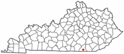
Location in Kentucky
|
|
| Country | United States |
| State | Kentucky |
| County | McCreary |
| Area | |
| • Total | 6.47 sq mi (16.75 km2) |
| • Land | 6.40 sq mi (16.59 km2) |
| • Water | 0.06 sq mi (0.16 km2) |
| Elevation | 1,411 ft (430 m) |
| Population
(2020)
|
|
| • Total | 1,380 |
| • Density | 215.49/sq mi (83.19/km2) |
| Time zone | UTC-5 (Eastern (EST)) |
| • Summer (DST) | UTC-4 (EDT) |
| ZIP code |
42635
|
| Area code(s) | 606 |
| FIPS code | 21-61122 |
| GNIS feature ID | 2403414 |
Pine Knot is a small community in McCreary County, Kentucky, in the United States. It is called a "census-designated place" (CDP) because the government counts its population for official records.
In 2020, about 1,380 people lived in Pine Knot. This number was a bit lower than in 2010, when 1,621 people lived there.
Where is Pine Knot?
Pine Knot is located in the southern part of McCreary County. To its north, you'll find the town of Stearns. To the south, it borders Strunk.
A major road, U.S. Route 27, goes through Pine Knot. This highway can take you about 5 miles (8 km) north to Whitley City, which is the main town of McCreary County. If you go south on US 27, you'll reach Oneida, Tennessee, about 12 miles (19 km) away.
Kentucky Route 92 also crosses US 27 in Pine Knot. If you follow KY 92 east, it leads to Williamsburg, about 19 miles (31 km) away.
The area of Pine Knot is about 6.47 square miles (16.75 square kilometers). Most of this area is land, with a small part being water. The community is on a ridge, which is like a long, raised area of land. Water from this ridge flows into different creeks that eventually lead to the Cumberland River.
How Many People Live Here?
| Historical population | |||
|---|---|---|---|
| Census | Pop. | %± | |
| 1980 | 1,389 | — | |
| 1990 | 1,549 | 11.5% | |
| 2000 | 1,680 | 8.5% | |
| 2010 | 1,621 | −3.5% | |
| 2020 | 1,380 | −14.9% | |
| U.S. Decennial Census | |||
The population of Pine Knot has changed over the years. In 2000, there were 1,680 people living in the community. These people lived in 584 households, and 390 of these were families.
Most people in Pine Knot are White. There are also smaller groups of African American, Native American, and Asian people. Some residents are of Hispanic or Latino background.
In 2000, about 27% of the people living in Pine Knot were under 18 years old. About 13% were 65 years or older. The average age of people in Pine Knot was 32 years.
The average income for a household in Pine Knot was about $13,777 in 2000. For families, the average income was around $20,313. Many families and individuals in Pine Knot lived below the poverty line at that time.
Getting Around
The McCreary County Airport is located about 3 miles (5 km) northeast of Pine Knot. This airport helps people travel to and from the county.
See also
 In Spanish: Pine Knot (Kentucky) para niños
 | Kyle Baker |
 | Joseph Yoakum |
 | Laura Wheeler Waring |
 | Henry Ossawa Tanner |

