Pine Pass facts for kids
Quick facts for kids
Pine Pass
|
|
|---|---|
| Country | Canada |
| Province | British Columbia |
| Elevation | 875 m (2,871 ft) |
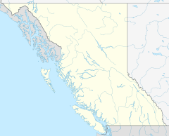
The Pine Pass is a mountain pass located in the Hart Ranges of the Canadian Rockies in British Columbia, Canada. It's like a natural pathway through the mountains! This pass connects the Peace Country in the northeastern part of the province.
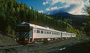
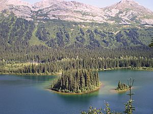
You can travel through Pine Pass on Highway 97 or by train on the Canadian National Railway (CNR) tracks. The pass is also home to some cool places like Bijoux Falls Provincial Park, Pine Le Moray Provincial Park, and the Powder King Mountain Resort near Azouzetta Lake.
Contents
Traveling Through Pine Pass
Azouzetta Lake is a regular stop for the BC Bus North service. If you love to ski, the PK Express Bus runs from Prince George, Mackenzie, and Grande Prairie every Saturday and Sunday during the ski season.
History of Pine Pass
Early Explorers and Discovery
The Pine Pass was first crossed in 1806 by a person from Simon Fraser's group. They were guided by First Nations people who knew the area well.
Later, in the 1870s, surveyors tried to find the pass again. Joseph Hunter successfully found it from the west in 1877. Then, in 1879, George Dawson crossed the pass with a large group of over 90 horses and mules!
The Railway Story
In the late 1800s, railway companies looked for the best routes through the mountains. The Canadian Pacific Survey in 1879 thought the Pine Pass was a good idea because of the rich farmland nearby. However, it was too far north, so they chose the Kicking Horse Pass instead.
Later, in the 1910s, the Canadian Pacific Railway (CPR) was back, looking at the Pine Pass again. Another company, the Grand Trunk Pacific Railway, also considered the Pine Pass in 1906–07. They eventually chose a different route, which affected other railway plans.
Many railway companies thought about building through Pine Pass but didn't. These included the Naas & Peace River Railway and the Pine Pass Railway.
The Pacific Great Eastern Railway (PGE) was expected to build through Pine Pass. In 1945, the PGE officially planned to use the Pine Pass route because it was about 100 miles shorter than other options.
Finally, the Pine Pass route was chosen for the railway. On December 13, 1957, the PGE track-laying machine reached the summit of Pine Pass. The railway tracks reached Dawson Creek in September 1958.
Trains faced challenges in the pass. In the winter of 1965–66, a snowdrift derailed three locomotives. Two months later, ice on the tracks caused another derailment. In 1967, the PGE carried huge 77-ton turbines for the W. A. C. Bennett Dam. These were the heaviest loads ever on the line at that time!
To help prevent snow problems, parts of the railway were widened in 1971. In 1982, an avalanche risk delayed clearing a derailed snow plow. In the 1990s, there were several train derailments, including one that spilled sulphur.
The Highway Story
A map from 1923 already showed a wagon trail through the Pine Pass. In 1930, engineers thought the Pine Pass would be the cheapest route for a new highway.
In 1943, the Pine Pass was surveyed for a highway. The next year, Premier John Hart announced that a new highway would be built over the Pine Pass. This route was chosen because it would help people access farms and mines.
The highway project was divided into two parts in 1945. One contractor, Campbell Construction, faced many problems and couldn't finish their section. Another company, W. C. Arnett & Co., took over. Fred Mannix & Co. finished their section in 1948.
The gravel highway was ready to use by the fall of 1951, but it was tough to drive on in winter. It officially opened in the summer of 1952. In 1955, parts of the highway were almost impassable.
Work continued on the road in 1962 to improve it. Paving began in 1963 and 1964. By 1977, some parts of the paved road needed major repairs. These sections were rebuilt and repaved in 1978 and 1985.
In the 1990s, three bridges were replaced to make the highway wider and straighter. Sections of the road were rebuilt and repaved again, using special gravel to help with drainage.
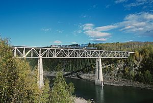
Despite these improvements, more work was needed. From 2010 to 2011, a large project costing $18.5 million rebuilt a section of the highway. Two major bridges over the Pine River were also replaced, bringing the total cost to $40 million.
Heavy rain has caused problems for the highway. In 2011, washouts at 15 different spots closed the highway for almost two weeks. Five years later, more heavy rain closed the highway again for nearly a week.
Fun and Tourism
Parks and Resorts
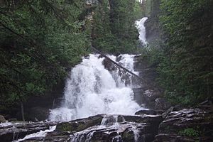
Bijoux Falls Provincial Park was created in 1956 and is located on the southern side of the pass. It's a great spot to see waterfalls!
The Pine Le Moray Provincial Park was established in 2000 on the northern side of the pass.
The Azu Ski Village opened in 1965. It grew to have four ski runs and a T-bar lift. It also had places to stay and eat. In 1979, the ski area was sold and became Powder King Mountain Resort, which is still a popular place for skiing and snowboarding today!
Places to Stay and Eat
In 1955, Katherine and Michael Begallie opened Halfway Lodge near Azouzetta Lake. It was one of the few places to stay in the area. It had a lodge, a café, and later, a gas pump.
Other lodges and motels also opened over the years, like Pine Valley Lodge and Windy Point Lodge. These places offered cabins, cafes, and gas stations for travelers. The Silver Sands Motel also opened and had a liquor license.
The Pine Valley Park Lodge, later renamed Azouzetta Lake Lodge, was also a place to stay and eat. It was bought by Powder King Mountain Resort in 2016.
Pipelines and Power Lines
The Pine Pass is also important for carrying energy. In 1952, survey crews planned a route through the pass for a natural gas pipeline. This pipeline was built to carry natural gas to the lower mainland of British Columbia.
In 1958, pipes were brought by train to build an oil pipeline through the pass. This pipeline connected Taylor, British Columbia, to Kamloops by late 1961.
Huge 500,000-volt power lines from the W. A. C. Bennett Dam were also put in place through the pass by 1967.
In the 1980s, the natural gas pipelines were upgraded to carry more gas. In 2011, heavy rain caused flooding, and a company called Pembina temporarily shut down its oil pipeline to check for damage.
Communications and Services
In the late 1950s, a relay station for the PGE railway's new microwave radio system was built at Azouzetta Lake. This helped with communication.
In the late 1980s, the Ministry of Health installed special stations in the pass to help first responders with their radio reception. BC Hydro also extended power lines to connect Azu to the main electrical grid. A water and sewer system was also installed for the community.
School Bus Service
For many years, families living in the Pine Pass area worked to get school bus service for their children. In the 1970s, parents successfully extended the bus route to the Azu community. However, the service was sometimes cut back due to costs. Parents often had to drive their children to meet the bus further away. By the 1990s, the bus terminus was moved back and forth between Azu village and the Mackenzie turnoff, depending on how many students needed the service.
 | Isaac Myers |
 | D. Hamilton Jackson |
 | A. Philip Randolph |


