
Grande Prairie facts for kids
Quick facts for kids
Grande Prairie
|
||
|---|---|---|
| City of Grande Prairie | ||

Skyline of Grande Prairie viewed from the northeast
|
||
|
||
| Nickname(s):
Swan City
|
||

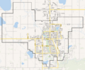
City boundaries
|
||

Grande Prairie
Location in Canada

Grande Prairie
Location in Alberta

Grande Prairie
Location in County of Grande Prairie
|
||
| Country | Canada | |
| Province | Alberta | |
| Region | Northern Alberta | |
| Planning region | Upper Peace | |
| Municipal district | County of Grande Prairie No. 1 | |
| Federal electoral district | Grande Prairie-Mackenzie | |
| Provincial electoral districts | Grande Prairie Grande Prairie-Wapiti |
|
| Incorporated | ||
| • Village | April 30, 1914 | |
| • Town | March 15, 1919 | |
| • City | January 1, 1958 | |
| Area
(2021)
|
||
| • Land | 132.71 km2 (51.24 sq mi) | |
| Elevation | 650 m (2,130 ft) | |
| Population
(2021)
|
||
| • Total | 64,141 | |
| • Density | 483.3/km2 (1,252/sq mi) | |
| • Municipal census (2018) | 69,088 | |
| • Estimate (2020) | 69,355 | |
| Time zone | UTC−07:00 (MST) | |
| • Summer (DST) | UTC−06:00 (MDT) | |
| Forward sortation areas |
T8V - T8X
|
|
| Area code(s) | 780, 587, 825, 368 | |
| Highways | 40, 43, 43X | |
| Waterways | Wapiti River Bear River (Bear Creek) | |

Grande Prairie is a city in northwestern Alberta, Canada. It is located in a region called Peace River Country. The city sits where Highway 43 and Highway 40 meet. This is about 456 kilometers (283 miles) northwest of Edmonton. The County of Grande Prairie No. 1 surrounds the city.
In 2016, Grande Prairie was the seventh-largest city in Alberta. It had a population of 63,166 people. Between 2001 and 2006, it was one of Canada's fastest-growing cities. It is also Canada's northernmost city with over 50,000 residents.
The city's official symbol is the trumpeter swan. This is because the swans migrate and nest nearby in the summer. That's why Grande Prairie is often called the "Swan City." Dinosaurs are also a symbol here. Many dinosaur fossils have been found north and west of the city.
Contents
History of Grande Prairie
The Grande Prairie area was once known as Buffalo Plains. This name came from the buffalo that roamed the large prairie. In the 18th century, the Dane-zaa (Beaver) people lived here. They traded furs with the North West Company at Dunvegan. The first mention of the prairie was in 1824 by a trader named Samuel Black.
In 1880, the Hudson's Bay Company set up a trading post called La Grande Prairie. This post was southwest of what is now the city. In the late 1800s, Cree and Iroquois people also settled here.
Early Settlement and Growth
In 1909, land was surveyed for new settlers. Many people soon arrived using the Edson Trail. By 1912, the Grande Prairie Townsite had a bank, hotel, and post office. This made it an important center. In 1916, a railway from Edmonton reached the town.
The Edson Trail was a difficult path for settlers. It was just a cleared track through the bush. This meant large-scale settlement came later than in other farming areas. Grande Prairie became a village in 1914. When the railway arrived in 1916, more settlers came. This helped farming grow quickly.
The railway and new settlers made Grande Prairie's population grow past 1,000. It became a town on March 27, 1919. A small economic slowdown in the 1920s caused a temporary drop in people. But the population grew back to 1,464 by the 1930s. Even during the Dust Bowl (a time of severe drought), people kept settling here. The Peace Region did not suffer from the drought like other parts of Canada.
Wartime and Modern Development
During the Second World War, Grande Prairie was important for military flights. It was part of the Northwest Staging Route. It also helped with building the Alaska Highway. Even though Dawson Creek was the main starting point, Grande Prairie was a key stop for military planes. This helped the local economy.
Grande Prairie competed with Peace River and Dawson Creek to be the main center of the region. This changed in the late 1950s. Oil and natural gas were discovered in the Peace Region. Also, a large pulp mill was built south of the city in the early 1970s. These events helped Grande Prairie grow faster.
In 1956, Highway 43 was paved. This made travel much faster. It improved Grande Prairie's access and economic importance. The town became a city in 1958, with about 7,600 people.
The opening of the Procter & Gamble pulp mill in 1972 helped the economy boom. The discovery of the Elmworth gas field also added to this growth. Grande Prairie's population jumped from 12,000 in the early 1970s to over 24,000 by 1981.
Between 2001 and 2006, Grande Prairie was one of Canada's fastest-growing cities. Its population grew from 37,000 to 47,000. After 2006, the population dipped slightly. Then it slowly increased to over 69,000 by 2018.
Geography and Climate

Grande Prairie is located just north of the 55th parallel. It is about 465 kilometers (289 miles) northwest of Edmonton. The city sits at an elevation of 669 meters (2,195 feet) above sea level. Farmland surrounds the city to the north, east, and west.
To the south, there is a large boreal forest. This forest has aspen, tamarack, and pine trees. It stretches into the foothills of the Canadian Rockies. The city is on the southern edge of the aspen parkland. This is a special area where boreal forest meets prairie. The Peace River Country has the northernmost aspen parkland in North America.
Bear Creek flows through the city from northwest to southeast. It is a small river that joins the Wapiti River to the south. The Bear Creek Reservoir is a small lake near Northwestern Polytechnic. It is surrounded by marshy wetlands. The land around Grande Prairie is mostly flat or gently rolling. It becomes hilly closer to the mountains in the south. On clear days, you can see some peaks of the Rockies from the city.
Weather in Grande Prairie
Grande Prairie has a northern continental climate. This means cold winters and cool to warm summers. Hot days over 30°C (86°F) are rare, happening only a few days a year. Winter conditions can change a lot from year to year. Sometimes there is little snow until after Christmas.
The average temperature in January is -13.6°C (7.5°F). In July, the average is 16.2°C (61.2°F). The city gets about 445 mm (17.5 inches) of rain and snow each year. Snowfall amounts vary greatly. Grande Prairie can be windy, especially in spring and fall. Warm Chinook winds can bring mild spells in winter.
The city gets sunshine on average 314 days a year. Summers can have thunderstorms, but they are not as strong as those further south. Tornadoes are rare but have happened. A weak tornado hit downtown Grande Prairie on July 8, 2004. It damaged houses and flipped cars, but no one was hurt.
| Climate data for Grande Prairie (Grande Prairie Airport) WMO ID: 71940; coordinates 55°10′47″N 118°53′06″W / 55.17972°N 118.88500°W; elevation: 669 m (2,195 ft); 1981−2010 normals, extremes 1922−present |
|||||||||||||
|---|---|---|---|---|---|---|---|---|---|---|---|---|---|
| Month | Jan | Feb | Mar | Apr | May | Jun | Jul | Aug | Sep | Oct | Nov | Dec | Year |
| Record high humidex | 14.5 | 11.1 | 15.6 | 28.6 | 30.8 | 33.6 | 40.8 | 36.6 | 34.7 | 27.1 | 17.2 | 12.1 | 40.8 |
| Record high °C (°F) | 15.2 (59.4) |
12.8 (55.0) |
16.1 (61.0) |
29.4 (84.9) |
34.4 (93.9) |
41.5 (106.7) |
35.6 (96.1) |
34.5 (94.1) |
31.9 (89.4) |
28.9 (84.0) |
22.2 (72.0) |
13.3 (55.9) |
41.5 (106.7) |
| Mean daily maximum °C (°F) | −8.0 (17.6) |
−4.8 (23.4) |
0.6 (33.1) |
10.1 (50.2) |
16.8 (62.2) |
20.5 (68.9) |
22.6 (72.7) |
21.7 (71.1) |
16.6 (61.9) |
9.4 (48.9) |
−1.8 (28.8) |
−6.0 (21.2) |
8.1 (46.6) |
| Daily mean °C (°F) | −13.6 (7.5) |
−10.6 (12.9) |
−4.9 (23.2) |
4.1 (39.4) |
10.2 (50.4) |
14.3 (57.7) |
16.2 (61.2) |
15.1 (59.2) |
10.2 (50.4) |
3.6 (38.5) |
−6.6 (20.1) |
−11.3 (11.7) |
2.2 (36.0) |
| Mean daily minimum °C (°F) | −19.0 (−2.2) |
−16.4 (2.5) |
−10.3 (13.5) |
−2.0 (28.4) |
3.6 (38.5) |
8.1 (46.6) |
9.8 (49.6) |
8.3 (46.9) |
3.8 (38.8) |
−2.1 (28.2) |
−11.4 (11.5) |
−16.7 (1.9) |
−3.7 (25.3) |
| Record low °C (°F) | −52.2 (−62.0) |
−50.0 (−58.0) |
−42.8 (−45.0) |
−35.6 (−32.1) |
−8.7 (16.3) |
−3.3 (26.1) |
−1.1 (30.0) |
−2.8 (27.0) |
−11.7 (10.9) |
−31.7 (−25.1) |
−40.6 (−41.1) |
−47.2 (−53.0) |
−52.2 (−62.0) |
| Record low wind chill | −63.0 | −55.0 | −53.1 | −46.7 | −16.1 | −4.3 | 0.0 | −3.2 | −15.3 | −33.9 | −56.1 | −56.3 | −63.0 |
| Average precipitation mm (inches) | 29.9 (1.18) |
16.4 (0.65) |
16.9 (0.67) |
19.8 (0.78) |
41.0 (1.61) |
75.9 (2.99) |
76.1 (3.00) |
55.8 (2.20) |
43.0 (1.69) |
26.0 (1.02) |
25.4 (1.00) |
18.9 (0.74) |
445.1 (17.52) |
| Average rainfall mm (inches) | 2.4 (0.09) |
0.8 (0.03) |
1.4 (0.06) |
10.4 (0.41) |
38.1 (1.50) |
75.9 (2.99) |
76.1 (3.00) |
55.7 (2.19) |
41.3 (1.63) |
15.4 (0.61) |
4.2 (0.17) |
0.7 (0.03) |
322.4 (12.69) |
| Average snowfall cm (inches) | 35.0 (13.8) |
20.8 (8.2) |
20.3 (8.0) |
11.0 (4.3) |
3.4 (1.3) |
0.0 (0.0) |
0.0 (0.0) |
0.1 (0.0) |
1.7 (0.7) |
12.0 (4.7) |
26.5 (10.4) |
23.6 (9.3) |
154.3 (60.7) |
| Average precipitation days (≥ 0.2 mm) | 11.7 | 8.5 | 9.0 | 7.6 | 10.5 | 13.2 | 13.3 | 11.8 | 11.7 | 10.7 | 11.3 | 9.1 | 128.4 |
| Average rainy days (≥ 0.2 mm) | 1.9 | 0.81 | 1.6 | 4.8 | 10.0 | 13.2 | 13.4 | 11.8 | 11.5 | 7.7 | 2.8 | 0.81 | 80.4 |
| Average snowy days (≥ 0.2 cm) | 10.8 | 8.4 | 8.0 | 3.8 | 1.1 | 0.0 | 0.0 | 0.04 | 0.63 | 4.0 | 9.3 | 8.5 | 54.5 |
| Mean monthly sunshine hours | 77.8 | 106.2 | 172.1 | 231.0 | 276.0 | 295.2 | 307.7 | 272.4 | 172.5 | 134.5 | 78.9 | 73.5 | 2,197.7 |
| Percent possible sunshine | 32.1 | 39.1 | 47.0 | 54.6 | 55.1 | 56.9 | 59.1 | 58.7 | 45.0 | 41.3 | 31.2 | 32.7 | 46.1 |
| Source: Environment and Climate Change Canada | |||||||||||||
Population and Culture
| Federal census population history |
||
|---|---|---|
| Year | Pop. | ±% |
| 1916 | 337 | — |
| 1921 | 1,061 | +214.8% |
| 1926 | 917 | −13.6% |
| 1931 | 1,464 | +59.7% |
| 1936 | 1,478 | +1.0% |
| 1941 | 1,724 | +16.6% |
| 1946 | 2,267 | +31.5% |
| 1951 | 2,664 | +17.5% |
| 1956 | 6,302 | +136.6% |
| 1961 | 8,352 | +32.5% |
| 1966 | 11,417 | +36.7% |
| 1971 | 13,079 | +14.6% |
| 1976 | 17,626 | +34.8% |
| 1981 | 24,263 | +37.7% |
| 1986 | 26,471 | +9.1% |
| 1991 | 28,271 | +6.8% |
| 1996 | 31,140 | +10.1% |
| 2001 | 36,983 | +18.8% |
| 2006 | 47,076 | +27.3% |
| 2011 | 55,032 | +16.9% |
| 2016 | 63,166 | +14.8% |
| 2021 | 64,141 | +1.5% |
| Source: Statistics Canada |
||
In 2021, Grande Prairie had a population of 64,141 people. This was a small increase from 63,166 in 2016. The city has a land area of 132.71 square kilometers (51.24 sq mi).
In the 2021 census, 15.9% of residents were visible minorities. Also, 11.7% were Indigenous. The largest visible minority groups were Filipino (6.9%), South Asian (2.9%), and Black (2.2%).
Languages Spoken
As of 2021, most residents (83.8%) spoke English as their first language. Other common languages included Tagalog (3.4%), French (2.1%), and Punjabi (0.8%).
Religions in Grande Prairie
In 2021, 45.8% of residents were Christian. This was down from 58.5% in 2011. Many people (49.4%) said they had no religion. Other religions like Islam (1.7%), Hinduism (1.1%), and Sikhism (0.8%) were also present.
Economy of Grande Prairie

Grande Prairie has a diverse economy. Its main industries are oil and gas, agriculture, forestry, and food services.
Agriculture was the first major industry in Grande Prairie. It started when settlers arrived in the early 1900s. Today, farming is still a big part of the local economy. Farmers grow crops like barley, wheat, canola, and oats. They also raise cattle and buffalo. Even though it's far north, the climate is good for large-scale farming. Long summer daylight hours help crops grow. The Peace Country is the northernmost major farming region in North America. New land is still being cleared for farms.
Oil and gas drilling started in the 1950s. But it really grew in the late 1970s. The discovery of the Elmworth gas field caused the city to grow very fast. Today, Grande Prairie sits on the Montney and Duvernay rock formations. This means a lot of focus on natural gas and shale gas. This has kept the region's economy strong.
Forestry is also a major part of Grande Prairie's economy. There are large forests to the south in the foothills. International Paper (formerly Weyerhaeuser Canada) has a large pulp mill here. It opened in 1972 and is one of the city's biggest employers. Canfor also runs a sawmill and lumber yard. A plant that makes oriented strand board (a type of wood panel) opened in 1995.
Grande Prairie is a hub for trade and transportation. It serves a large area with nearly 290,000 people. The city is also on the CANAMEX Corridor. This is a trade route that connects Canada, the United States, and Mexico.
Arts and Culture in Grande Prairie

You can find live music in downtown bars and other places. Summer music festivals are also organized by local groups. Grande Prairie has many types of local music, like country, reggae, metal, folk, and rock.
Cultural places include the Bonnetts Energy Centre. This is a concert hall and hockey rink. The local hockey team, the Grande Prairie Storm, plays there. Other places are the Grande Prairie Museum and the Art Gallery of Grande Prairie. The Second Street Theatre is also a popular spot. Grande Prairie has a professional musical theatre company called "Broadway Live Broadway."
The Reel Shorts Film Festival is a five-day event. It shows short films from around the world. It takes place in early May at the Second Street Theatre.
The Philip J. Currie Dinosaur Museum is about 15 minutes west of Grande Prairie. It is a large building with many exhibits, a theater, and a paleontology lab. The museum is named after Philip J. Currie. He helped us understand the link between dinosaurs and birds.
The Bear Creek Folk Music Festival started in 2016. It is an outdoor music festival held in late August. It takes place on Borstad Hill in Muskoseepi Park.
Sports and Recreation
In 1995, Grande Prairie hosted the Canada Games. This big event was shown on national TV. Many athletes competed, and the city gained recognition. The city also hosted the 2010 Arctic Winter Games in March 2010.
Grande Prairie has many parks. The largest is Muskoseepi Park, which follows Bear Creek through the city. This park has great walking and bike trails. It also has the Ernie Radbourne Pavilion and the outdoor Bear Creek Swimming Pool. In winter, the Muskoseepi Park Pond becomes a skating rink.
Crystal Lake in the northeast also has parkland and wetlands. It's a great place for birdwatching. There are walking and bike paths around the lake.
Evergreen Park is on the southeast side of the city. It is home to the annual Grande Prairie Stompede event. This event attracts about 30,000 people each year. The park has many facilities for agricultural shows, rodeos, and horse racing. It also has a restaurant, lounge, and RV campground.
Grande Prairie has three 18-hole golf courses: The Dunes, Bear Creek, and Grande Prairie Golf and Country Club. There is also a fourth course, Grovedale, southwest of the city. A new nine-hole course, The Bear Paw, opened in 2017. Grande Prairie also has three 18-hole disc golf courses.
Winter Sports and Activities
Downhill skiing is popular at Nitehawk ski hill. It is located south of the city on the Wapiti River. Nitehawk also has a natural luge track. This track is certified for international events. In summer, freestyle ski jumpers practice using a water ramp. Nitehawk hosted the FIL World Luge Natural Track Championships in 2007.
Cross-country skiing is common in winter. The Wapiti Nordic Ski Club is a top facility for cross-country skiing and biathlon. It is just south of the city. It has over 35 kilometers (22 miles) of trails. Some trails are lit at night. There are also snowshoe trails and dog-friendly trails. In summer, these trails are used for hiking and mountain biking.
The foothills south of Grande Prairie are popular year-round. People go hiking in summer and snowmobiling in winter. Kakwa Wildland Park, about 180 kilometers (112 miles) south, is known for Kakwa Falls.
Other Recreation Facilities
The Wapiti Shooters Club is on the south side of the city. It was founded in 1949 and has been upgraded over the years. It offers shotgun, handgun, and rifle ranges. The club is used for training and events.
Grande Prairie has a large, modern fitness center called the Eastlink Centre. It has two indoor pools, including an Olympic-sized pool. It also has a splash park, lazy river, waterslides, and a surf simulator. The facility includes a weight room, courts, and fitness classes. It also has an outdoor skateboard park. The Eastlink Centre is connected to local high schools.
The Outdoor Bear Creek (Aquatera) Swimming Pool reopened in 2019 after major updates. It now has a tots pool, a zero beach, and a waterslide.
The Leisure Centre (formerly Rec-Plex) is in northwest Grande Prairie. Its swimming pool and gym are currently closed. However, the indoor soccer pitch is open for various sports.
Grande Prairie has hosted many sports tournaments, including:
- 2004 Royal Bank Cup
- 2006 Ford World Women's Curling Championship
- 2010 Arctic Winter Games
- 2016 Scotties Tournament of Hearts
The city also has several ice hockey teams:
- Grande Prairie Storm (AJHL)
- Grande Prairie Kings (NWJHL)
- Grande Prairie Athletics (NPHL)
Transportation in Grande Prairie
Air Travel
The Grande Prairie Airport is on the west side of the city. It has daily flights to Calgary and Edmonton. Air Canada and WestJet offer service here. The airport was first built in the 1930s. It was expanded in 1941 to support the war effort and the Alaska Highway. The city took over the airport in 1997.
The airport terminal was built in 1981 and renovated in 2009. One of its runways was extended in 2014. The airport does not have permanent customs facilities.
City Transit
Grande Prairie Transit is the city's public bus system. It has modern buses and routes throughout the city. In September 2023, bus service became free for anyone under 18 years old.
Intercity Bus Service
Greyhound Canada used to offer bus service from Grande Prairie to Edmonton and Dawson Creek. This service ended in 2018. Now, Ebus and Cold Shot Bus Service connect Grande Prairie to Edmonton.
Highways and Roads

Highway 43 is the main east-west highway. It connects Grande Prairie to Edmonton in the southeast and British Columbia in the west. Highway 43 is part of the CANAMEX trade route. It has been widened to a four-lane divided highway.
Highway 40 is the main road into Grande Prairie from the south. It goes south to Grande Cache and Jasper National Park. This highway is part of the shortest paved route to Alaska from the lower 48 states. Many vacationers use Highway 40 to reach Grande Prairie, then Highway 43 to Dawson Creek, BC, which is the start of the Alaska Highway.
Rail Service
The City of Grande Prairie has rail freight service from CN. Tracks run south from Grande Prairie to Grande Cache and Hinton. There, they connect to CN's main transcontinental line. CN also operates local freight service north to Sexsmith and west to Beaverlodge.
Education in Grande Prairie
Schools for Kids
Four school districts operate schools in Grande Prairie:
- The Grande Prairie Public School District (GPPSD) has 18 schools.
- The Grande Prairie Roman Catholic Separate School District No. 28 has ten schools.
- The Peace Wapiti School Division No. 76 (PWSD) has three schools for students from the surrounding county.
- The Northwest Francophone Education Region No. 1 operates École Nouvelle Frontière for students from kindergarten to grade 12.
Grande Prairie has several high schools:
- Grande Prairie Composite High School (GPPSD)
- St. Joseph's Catholic High School (GP&DCS)
- Ecole Nouvelle Frontiere
- Charles Spencer High School (GPPSD)
- Peace Wapiti Academy (PWSD)
College and Polytechnic
Northwestern Polytechnic (NWP) was once known as Grande Prairie Regional College. It started as Grande Prairie Junior College in 1965. Construction of the current campus began in 1973. The first part opened in 1974, and the second in 1991. The college was renamed Northwestern Polytechnic in March 2022.
Notable People from Grande Prairie
- Theodore deWit "Willie deWit", former professional and Olympic boxer
- Tanner Fritz, professional ice hockey player
- Carolyn Dawn Johnson, country music singer-songwriter
- Kelly Sutherland (chuckwagon) retired professional chuckwagon driver
- Tenille Townes, country music singer
- Chris Warkentin, Canadian politician
- William Paul Young, novelist
- Alex Zahara, actor
Images for kids
-
Seal of Grande Prairie
-
City boundaries of Grande Prairie
See also
 In Spanish: Grande Prairie para niños
