Wapiti River facts for kids
Quick facts for kids Wapiti River |
|
|---|---|
|
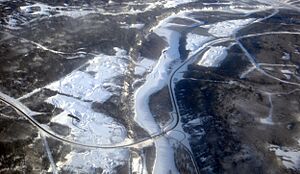
Wapiti River in western Canada
|
|
| Country | Canada |
| Physical characteristics | |
| Main source | Tuck Lake, Wapiti Pass 1,370 m (4,490 ft) 54°26′26″N 120°47′25″W / 54.44069°N 120.79021°W |
| River mouth | Smoky River 485 m (1,591 ft) 55°08′16″N 118°18′05″W / 55.13784°N 118.30152°W |
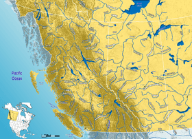
The Wapiti River is a cool river in western Canada. It flows through two provinces: British Columbia and Alberta. This river is a big helper to the Smoky River, which is part of the even larger Peace River Basin. The name "Wapiti" comes from the Cree people and means "elk." So, it's like the "Elk River"!
Where the River Flows
The Wapiti River starts from a lake called Tuck Lake. This lake is found near Wapiti Pass in the Canadian Rockies. The river begins its journey in Wapiti Lake Provincial Park in British Columbia.
From there, the river flows northeast. It then crosses into Alberta. In Alberta, the river starts to meander, which means it winds and curves a lot. It continues through the area known as the County of Grande Prairie No. 1. Finally, the Wapiti River joins the Smoky River about 30 kilometres (19 mi) east of Grande Prairie.
River Environments
As the Wapiti River travels, it passes through different kinds of land. First, it flows through the high, rocky areas of the Rocky Mountains. Then, it moves into rolling hills called foothills. After that, it goes through farmland and areas with aspen parkland in western Alberta.
Several special places are found along the river. These include Wapiti Lake Provincial Park, Bear River Park, O'Brien Provincial Park, and Pipestone Creek Park. These parks help protect the natural beauty and wildlife around the river.
Near where it meets the Smoky River, the Wapiti River moves a lot of water. On average, it carries about 100 cubic metres per second (3,500 cu ft/s) of water. That's like filling 100 bathtubs every second!
Other Streams and Crossings
Many smaller streams flow into the Wapiti River. These are called tributaries. The river also flows under roads and railway bridges. Here are some of the places and streams connected to the Wapiti River:
| Tributary/Crossing | Location | Remarks |
|---|---|---|
| Tuck Lake | 54°26′26″N 120°47′25″W / 54.44069°N 120.79021°W | Where the river begins in Wapiti Pass |
| Wapiti Lake | 54°33′41″N 120°46′42″W / 54.56148°N 120.77831°W | The river flows into this lake |
| Wapiti Lake | 54°35′03″N 120°45′29″W / 54.58420°N 120.75794°W | The river flows out of this lake |
| Wapiti Lake Provincial Park | 54°35′47″N 120°44′20″W / 54.59638°N 120.73880°W | The river leaves this park |
| Fearless Creek | 54°44′11″N 120°30′38″W / 54.73646°N 120.51058°W | A stream joining from the left |
| Calliou Creek | 54°44′29″N 120°27′30″W / 54.74127°N 120.45839°W | A stream joining from the left |
| Red Deer Creek | 54°41′02″N 120°14′59″W / 54.68386°N 120.24966°W | A stream joining from the right |
| Belcourt Creek | 54°41′05″N 120°06′13″W / 54.68479°N 120.10373°W | A stream joining from the right |
| Mistanusk Creek | 54°42′01″N 120°03′37″W / 54.70038°N 120.06016°W | A stream joining from the right |
| Alberta/British Columbia | 54°44′13″N 120°00′04″W / 54.73684°N 120.00109°W | The river crosses into Alberta |
| Chinook Creek | 54°43′38″N 119°56′51″W / 54.72715°N 119.94752°W | A stream joining from the right |
| Narraway River | 54°44′06″N 119°55′23″W / 54.73503°N 119.92292°W | A river joining from the right |
| Lingrell Creek | 54°46′38″N 119°50′36″W / 54.77732°N 119.84333°W | A stream joining from the right |
| Nose Creek | 54°52′06″N 119°38′17″W / 54.86847°N 119.63802°W | A stream joining from the right |
| Calahoo Creek | 54°55′08″N 119°41′04″W / 54.91894°N 119.68454°W | A stream joining from the left |
| Smith Creek | 54°57′27″N 119°36′18″W / 54.95758°N 119.60497°W | A stream joining from the left |
| Pinto Creek | 54°58′32″N 119°27′08″W / 54.97542°N 119.45228°W | A stream joining from the right |
| West Iroquois Creek | 55°00′10″N 119°22′30″W / 55.00271°N 119.37504°W | A stream joining from the right |
| Iroquois Creek | 55°01′16″N 119°19′04″W / 55.02108°N 119.31770°W | A stream joining from the right |
| Redwillow River | 55°01′57″N 119°18′35″W / 55.03241°N 119.30971°W | A river joining from the left |
| Pipestone Creek | 55°02′46″N 119°06′09″W / 55.04614°N 119.10261°W | A stream joining from the left |
| Spring Creek | 55°04′40″N 118°56′24″W / 55.07790°N 118.94005°W | A stream joining from the left |
| Highway 40 | 55°04′19″N 118°48′17″W / 55.07206°N 118.80483°W | A road bridge crosses here |
| Big Mountain Creek | 55°03′34″N 118°39′39″W / 55.05953°N 118.66093°W | A stream joining from the right |
| Canadian National Railway | 55°04′20″N 118°37′21″W / 55.07215°N 118.62247°W | A railway bridge crosses here |
| Bear River | 55°06′26″N 118°29′08″W / 55.10725°N 118.48549°W | A river joining from the left |
| Smoky River | 55°08′16″N 118°18′05″W / 55.13784°N 118.30152°W | The Wapiti River flows into the Smoky River here |
 | Misty Copeland |
 | Raven Wilkinson |
 | Debra Austin |
 | Aesha Ash |


