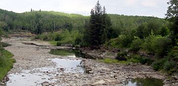
Redwillow River facts for kids
Quick facts for kids Redwillow River |
|
|---|---|
 |
|
| Country | Canada |
| Physical characteristics | |
| Main source | Stony Lake 1,080 meters (3,540 ft) 54°50′07″N 120°33′15″W / 54.83535°N 120.55419°W |
| River mouth | Wapiti River 575 meters (1,886 ft) 55°01′51″N 119°18′34″W / 55.03078°N 119.30938°W |
The Redwillow River is a cool waterway in Canada. It flows through parts of northern Alberta and north-eastern British Columbia. This river is a tributary of the Wapiti River, which means it's a smaller river that flows into a larger one. The Redwillow River also winds its way through an area called the Pouce Coupe Prairie, located in the southern part of the Peace River Country.
Contents
Where Does the Redwillow River Start?
The Redwillow River begins its journey in north-eastern British Columbia. It starts as water flowing out of a place called Stony Lake. This lake is nestled in the Rocky Mountain Foothills, which are the lower hills leading up to the big Rocky Mountains. The river's starting point is about 1,080 meters (3,540 feet) above sea level.
There's even a campground right by Stony Lake, close to where the river begins. You can reach this spot using local roads south of the Heritage Highway.
How the River Flows Through British Columbia
From Stony Lake, the Redwillow River flows towards the east. It travels between two mountains, Lone Mountain and Squaw Mountain. As it moves, it collects water from Rat Lake and other small streams coming down from the mountainsides.
Another important stream, the South Redwillow River, joins in from the right side. This stream brings water from Quicksand Lake. The Redwillow River also drains water from the Little Prairie Lakes. After that, it continues east, picking up more water from Thunder Creek and Hiding Creek.
The Redwillow River's Journey into Alberta
As the Redwillow River keeps flowing east and then north-east, it crosses into the province of Alberta. Here, the river starts to become more "meandered." This means it forms many twists and turns, like a snake wiggling across the land.
The river continues through flat prairie land. It collects water from Lattice Creek and, further east, from Diamond Dick Creek. The river passes near several communities, including Rio Grande, Sylvester, and Elmworth.
South of the town of Beaverlodge, the Redwillow River meets and joins with the Beaverlodge River. Finally, the Redwillow River flows into the Wapiti River. This meeting point is about 575 meters (1,886 feet) above sea level. It's about 83 kilometers (52 miles) east of where the Redwillow River first started.
What Rivers and Creeks Join the Redwillow?
Many smaller rivers and creeks add their water to the Redwillow River along its path. These are called tributaries.
Tributaries in British Columbia
- Rat Lake
- South Redwillow River
- Little Prairie Lakes
- Thunder Creek
- Hiding Creek
Tributaries in Alberta
- Lattice Creek
- Diamond Dick Creek
- Beaverlodge River
Images for kids
 | James Van Der Zee |
 | Alma Thomas |
 | Ellis Wilson |
 | Margaret Taylor-Burroughs |


