Pleasant Lake (Crooked River) facts for kids
Quick facts for kids Pleasant Lake |
|
|---|---|
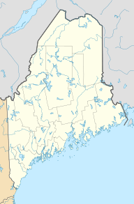
| Location | Maine |
| Coordinates | 44°02′N 70°31′W / 44.033°N 70.517°W |
| Primary outflows | Mill Brook |
| Basin countries | United States |
| Max. length | 3.8 mi (6.1 km) |
| Surface area | 1,332 acres (539 ha) |
| Max. depth | 62 feet (19 m) |
| Water volume | 40,125 acre⋅ft (49,493,000 m3) |
| Surface elevation | 427 ft (130 m) |
Pleasant Lake is a beautiful body of water located in Maine, USA. It stretches through the southern part of Otisfield and into the northern part of Casco, Maine. The lake is a popular spot, with many homes and vacation cabins built along its shores.
Contents
Lake Features and Flow
Pleasant Lake is an important part of the local water system. It has a main outflow, which is where water leaves the lake.
Mill Brook and Crooked River
The water from the southern end of Pleasant Lake flows out as a stream called Mill Brook. This brook travels through the village of Casco. After about 3 miles (4.8 km), Mill Brook joins the Crooked River.
Lake Size and Depth
Pleasant Lake covers a large area of about 1,332 acres (539 ha). It is also quite deep in some spots. The deepest part of the lake reaches about 62 feet (19 m). This makes it a great habitat for various fish species.
Fish and Wildlife
Pleasant Lake is home to many different kinds of fish. It's a good place for fishing and supports a healthy ecosystem.
Common Fish Species
The lake has a strong population of white perch. You can also find smallmouth bass and chain pickerel swimming in its waters.
Stocked Fish
To make fishing even better, the lake has been stocked with other fish. These include brown trout, lake trout, and a special type of Atlantic salmon that lives only in freshwater lakes.
Recreation and Activities
Pleasant Lake offers several opportunities for outdoor fun.
Boat Launch Access
If you want to go boating, there is a special area to launch your boat. This boat launch is located at the southern end of the lake, making it easy to get out on the water.
Seeds of Peace Camp
Pleasant Lake is also the home of Seeds of Peace. This is an international summer camp that brings young people together. They learn how to resolve conflicts and build peace among different groups.
 | Percy Lavon Julian |
 | Katherine Johnson |
 | George Washington Carver |
 | Annie Easley |


