
Pondalowie Bay facts for kids
Quick facts for kids Pondalowie Bay |
|
|---|---|

Pondalowie Bay beach
|
|

Pondalowie Bay
Location in South Australia
|
|
| Location | Spencer Gulf |
| Coordinates | 35°14′10″S 136°50′13″E / 35.23611°S 136.83694°E |
| Type | Bay |
| Basin countries | Australia |
| Max. length | about 4.25 km (2.64 mi) |
| Max. width | about 1.25 km (0.78 mi) |
| Max. depth | 6.4 m (21 ft) |
| Islands | Royston, Middle and South |
Pondalowie Bay is a beautiful bay located in South Australia. You can find it on the west coast of the Yorke Peninsula. This bay is part of the larger Spencer Gulf. It is about 12 kilometers west of Marion Bay. The coastline of Pondalowie Bay is special. It is inside both the area called Inneston and the Innes National Park.
Contents
Exploring Pondalowie Bay
Pondalowie Bay is on the western side of the Yorke Peninsula. It sits within the Spencer Gulf in South Australia. The bay stretches between two points. To the north is Royston Head. To the south is an unnamed point. This southern point is about 1.4 kilometers north-northwest of West Cape.
Islands and Beaches
The western side of the bay has three islands. These islands help protect the bay. From north to south, they are Royston, Middle, and South. The eastern side of the bay features a lovely sandy beach. Behind the beach, you'll find sand hills.
Boating in the Bay
Small boats can enter and leave the bay easily. There is a clear path between Middle Island and South Island. The water here is deep enough for boats. It can be up to 11 meters deep. The gap between the islands is about 1.4 kilometers wide. A special light helps boats find their way. This light is located on South Island. It acts like a lighthouse for safe travel.
Life in Pondalowie Bay
The southern part of Pondalowie Bay is a good place for boats to drop anchor. However, the seabed here is mostly smooth limestone. It has only a thin layer of sand. This means anchors might not hold very well. There are no big docks or piers for boats. But you can launch small boats from the beach. Roads from the national park lead right to the shore.
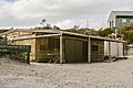
Fishermen's Village
The only place where people live in Pondalowie Bay is a small group of homes. These are known as a "Fishermen's village." Right next to the bay, there is also a camping ground. This camping area is part of the national park. It offers a great spot for visitors to stay.
Protecting the Bay
Pondalowie Bay is a protected area. The coastline and the three islands have been part of Innes National Park since 1977. This means the land is kept safe. The waters of the bay are also protected. Since 2012, they have been part of the Southern Spencer Gulf Marine Park. This helps protect the marine life and environment.
Images for kids
-
Pondalowie Bay fishermen's shacks

