Port Lihou Island facts for kids

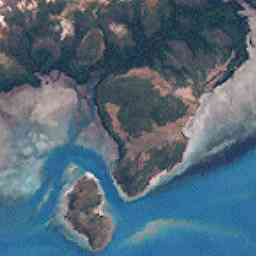
Port Lihou Island is a small island in the Torres Strait. This strait is a waterway located between the country of Australia and Papua New Guinea. The island is also known by its local name, Yeta. The word Yeta means "beard" in the language of the local people.
Yeta is found off the southern coast of Muralag. A narrow channel separates the two islands. This channel is about three kilometres (1.9 miles) long. At its narrowest point, it is only a few metres wide. The island itself is roughly 2.8 by 2.8 km (1.7 by 1.7 miles) in size. Its total area is about 3.97 square kilometres (1.53 square miles).
Island History and Name
The name Yeta was given to the island by the Kaurareg people. They are the traditional owners of this land. Since May 2001, the Kaurareg people have held the native title rights for most of the island. This means they have special rights to the land based on their traditional laws and customs.
The English name, Port Lihou, was given in 1823. It was named after Lieutenant John Lihou of the Royal Navy. He was a skilled sailor and explorer.
John Lihou's Journey
In 1823, John Lihou was the Master of a merchant ship called the Zenobia. He was sailing from Manila to South America. He chose to travel through the Torres Strait. This was a very important journey. It was the first time a ship had sailed through the Torres Strait from west to east.
It was also the first time a ship had sailed through the Coral Sea from the Torres Strait. Lihou navigated his ship southeastward, past New Caledonia.
Discovering Port Lihou
In January 1823, the Zenobia entered Endeavour Strait. During this journey, John Lihou discovered a shallow port. This port was located on the south coast of Prince of Wales Island. He later named this area Port Lihou, after himself.
 | Janet Taylor Pickett |
 | Synthia Saint James |
 | Howardena Pindell |
 | Faith Ringgold |

