
Port William, Ohio facts for kids
Quick facts for kids
Port William, Ohio
|
|
|---|---|
|
Village
|
|

Location of Port William, Ohio
|
|

Location of Port William in Clinton County
|
|
| Country | United States |
| State | Ohio |
| County | Clinton |
| Area | |
| • Total | 0.11 sq mi (0.29 km2) |
| • Land | 0.11 sq mi (0.28 km2) |
| • Water | 0.00 sq mi (0.01 km2) |
| Elevation | 1,030 ft (310 m) |
| Population
(2020)
|
|
| • Total | 229 |
| • Density | 2,100.92/sq mi (812.86/km2) |
| Time zone | UTC-5 (Eastern (EST)) |
| • Summer (DST) | UTC-4 (EDT) |
| ZIP code |
45164
|
| Area code(s) | 937, 326 |
| FIPS code | 39-64360 |
| GNIS feature ID | 2399007 |
Port William is a small village located in Clinton County, Ohio, United States. In 2020, about 229 people lived there.
Contents
History of Port William
Port William was first known as West Liberty. It was officially mapped out and divided into plots of land in 1832. This process is called "platting." A post office, which handles mail, has been operating in Port William since 1834.
Geography of the Village
Port William is a very small place. According to the United States Census Bureau, the village covers an area of about 0.12 square miles (0.31 square kilometers). All of this area is land, meaning there are no large bodies of water within the village limits.
Population and People
The number of people living in Port William has changed over many years. Here is a look at the population counts from different census years:
| Historical population | |||
|---|---|---|---|
| Census | Pop. | %± | |
| 1860 | 212 | — | |
| 1870 | 184 | −13.2% | |
| 1880 | 181 | −1.6% | |
| 1890 | 196 | 8.3% | |
| 1900 | 200 | 2.0% | |
| 1910 | 298 | 49.0% | |
| 1920 | 294 | −1.3% | |
| 1930 | 245 | −16.7% | |
| 1940 | 269 | 9.8% | |
| 1950 | 352 | 30.9% | |
| 1960 | 360 | 2.3% | |
| 1970 | 323 | −10.3% | |
| 1980 | 300 | −7.1% | |
| 1990 | 242 | −19.3% | |
| 2000 | 258 | 6.6% | |
| 2010 | 254 | −1.6% | |
| 2020 | 229 | −9.8% | |
| U.S. Decennial Census | |||
Port William in 2010
In 2010, the census showed that 254 people lived in Port William. There were 97 households, which are groups of people living together in one home. Out of these, 63 were families.
The village had about 2,117 people per square mile. This is called the population density. There were 113 housing units, which are places where people can live.
Most people in the village were White (95.7%). A smaller number were African American (1.2%), Native American (2.0%), or Asian (0.8%). Some people (0.4%) were from two or more racial backgrounds. About 1.2% of the population identified as Hispanic or Latino.
Households and Families
Out of the 97 households:
- 36.1% had children under 18 living there.
- 43.3% were married couples living together.
- 14.4% had a female head of the household with no husband.
- 7.2% had a male head of the household with no wife.
- 35.1% were not families, meaning individuals living alone or with non-relatives.
About 27.8% of all households were made up of just one person. About 7.2% of households had someone living alone who was 65 years old or older. On average, there were 2.62 people per household and 3.17 people per family.
Age of Residents
The average age of people in the village was 35.6 years.
- 29.5% of residents were under 18 years old.
- 7.5% were between 18 and 24 years old.
- 27.2% were between 25 and 44 years old.
- 28% were between 45 and 64 years old.
- 7.9% were 65 years old or older.
The village had a nearly even number of males and females: 49.2% were male and 50.8% were female.
Gallery
-
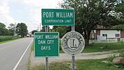
Port William corporation limit sign
-
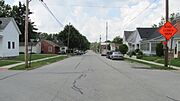
Looking southwest on Main Street in Port William


See also
 In Spanish: Port William (Ohio) para niños
