Portingbury Hills facts for kids
Quick facts for kids Portingbury Hills |
|
|---|---|

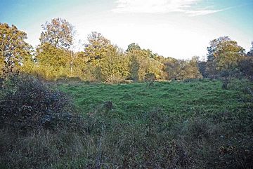
Portingbury Hills (Photo by Glyn Baker)
|
|
| Highest point | |
| Geography | |
| Location | Hatfield Forest, Hatfield Broad Oak, England |
| OS grid | TL5320 |
| Topo map | OS |
Portingbury Hills, also known as Portingbury Rings, is a small hill located in Hatfield Forest, Hatfield Broad Oak, Essex, United Kingdom. This area is known for its ancient earthworks and interesting archaeological finds.
Contents
Discoveries at Portingbury Hills
In 1964 and 1965, archaeologists dug up the area around Portingbury Hills. They found several old items, called artefacts, that tell us about the past. These discoveries included a small flint blade, which is a sharp stone tool about 4 cm long.
They also found animal bones, more flint pieces, and charcoal. These items suggest that people lived or visited this spot a very long time ago. Scientists believe these finds date back to the Iron Age.
Dating the Earthworks
Scientists used a special method called radiocarbon dating on some old organic material found at the site. This helped them figure out when the ditch around the earthworks was dug. They discovered that the ditch was created sometime between 395 and 205 years before Christ (BC).
Understanding the Earthworks
The earthworks at Portingbury Hills are ancient structures made of earth. They are found in the northwest part of Hatfield Forest, in an area called Beggarshall coppice. There are three main parts to these earthworks.
One part is a hill and a mound connected by a zig-zag path. This path is formed by two ditches that run almost parallel to each other. These ditches lead to another rectangular area. This rectangular area measures about 30 by 21 metres (about 98 by 69 feet). It is surrounded by a large ditch, which may have had a bank up to 11 metres (about 36 feet) wide.
Archaeologists think the first ditch around the mound was about 2 metres (6.5 feet) deep. It probably had earth walls, called ramparts, supported by timber. Smaller banks have also been seen crossing Shermore Brook towards Spittlemore coppice.
However, these earthworks are too small to be a hill fort, which was a large defensive settlement. Also, their location is not easy to defend. The ditches are more like those found in medieval moats, which were used to protect castles. It's possible that the earthworks we see today were built up over many years.
In the early 1700s, people could still see traces of a larger, round earthwork near Portingbury Hills.
The Archaeoastronomy Theory
In 1975, a retired geologist named Christian O'Brien suggested an interesting idea about Portingbury Hills. He thought the site might have been used for archaeoastronomy. This is the study of how ancient people understood and used the sky, stars, and planets.
O'Brien believed that Portingbury Hills was built during the Bronze Age. He suggested that the mound was lined up with another hill called Wandlebury Hill. This alignment was supposedly made using a series of specially carved stone markers. These markers formed a unique curved line called a Loxodrome.
Out of the original twenty-six stone markers, eleven can still be seen today. One famous stone is called the Leper Stone. Other distinct stones are also nearby.
O'Brien's theory received different opinions from experts. Some astronomers and archaeologists found it interesting, while others did not agree. For example, a professor from Cambridge University thought the idea was "nonsense." However, a professor from Glasgow University said that "in the absence of a more convincing explanation, this conclusion also has to be taken very seriously.”
 | Chris Smalls |
 | Fred Hampton |
 | Ralph Abernathy |

