Portola Hills, California facts for kids
Quick facts for kids
Portola Hills, California
|
|
|---|---|
|
District of Lake Forest
|
|

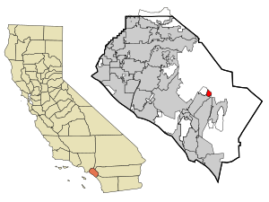
Location of Portola Hills within Orange County, California.
|
|
| Country | United States |
| State | California |
| County | Orange |
| City | Lake Forest |
| Area | |
| • Total | 1.3 sq mi (3 km2) |
| • Land | 1.3 sq mi (3 km2) |
| • Water | 0.0 sq mi (0 km2) |
| Population
(2000)
|
|
| • Total | 6,391 |
| • Density | 5,063.6/sq mi (1,955.1/km2) |
| Time zone | UTC-8 (PST) |
| • Summer (DST) | UTC-7 (PDT) |
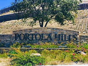
Portola Hills is a lovely district found in the city of Lake Forest, California. It is located in Orange County, which is in the United States. Before the year 2000, Portola Hills was a special area called an "unincorporated community." This means it wasn't officially part of a city. It was also a "census-designated place," which is an area the government counts for population. In 2000, Portola Hills officially joined Lake Forest.
In 2000, about 6,391 people lived here. Portola Hills is close to some cool natural spots. These include Whiting Ranch Wilderness Park and Cleveland National Forest. Other nearby places are Foothill Ranch to the west and Rancho Santa Margarita to the southeast. You can also find Mission Viejo to the south.
Contents
History of Portola Hills
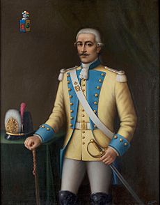
The homes and buildings in Portola Hills were mostly built between the late 1980s and early 1990s. This area was named after a very important person, Gaspar de Portolá. He was the first Spanish explorer to travel by land through California. He passed through this very area in 1769.
A nearby place, Trabuco Canyon, also has an interesting name story. It's named after a type of old gun called a blunderbuss. This gun was lost by members of Portolá's expedition.
Geography and Location
Portola Hills covers an area of about 1.3 square miles. All of this land is dry land, with no large bodies of water. It's a great place to live with lots of space for homes and nature.
Who Lives in Portola Hills?
In 2000, there were 6,391 people living in Portola Hills. There were 2,164 households, which are like homes where people live together. Most of these households, about 1,729, were families.
Many families in Portola Hills have kids. About 52.4% of households had children under 18 living with them. Most families were married couples living together.
The people living in Portola Hills were of different ages. About 32.9% of the population was under 18 years old. This means many kids and teenagers call Portola Hills home! The average age of people living here was 33 years old.
Homes in Portola Hills
Portola Hills has many different types of homes. There are 2,181 housing units in the community. These homes are built on about 348.8 acres of land.
You can find several kinds of homes here:
- Condominiums: These are like apartments that you own. They often share walls with other units. There are two areas with condominiums, offering 1 or 2 bedrooms.
- Townhouses: These homes are usually taller and share walls with neighbors on one or both sides. There are three areas with townhouses, offering 2 or 3 bedrooms.
- Semi-Detached Homes: These homes are connected to another house, often by a garage or a small part of the wall. There are two areas with these homes, offering 2 or 3 bedrooms.
- Detached Homes: These are stand-alone houses that don't share walls with other homes. There are seven areas with detached homes. These are often larger, with 3 to 6 bedrooms.
- Mixed-Use Homes: One area has homes that might combine living spaces with other uses.
Schools in the Area
Children living in Portola Hills usually go to Portola Hills Elementary School. This school was built in the mid-1990s.
For a while, there were some concerns about the school buildings. Some parts of the school needed repairs. Because of this, some students used temporary classrooms for a time. But good news! Money was set aside to fix the school. The plan was to repair two buildings and possibly rebuild a third one. This means the school is being taken care of to make sure it's a safe and great place for kids to learn.
 | Emma Amos |
 | Edward Mitchell Bannister |
 | Larry D. Alexander |
 | Ernie Barnes |


