Potomac, Illinois facts for kids
Quick facts for kids
Potomac
|
|
|---|---|
|
Village (United States)
|
|

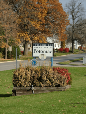
Welcome signs in Potomac
|
|

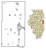
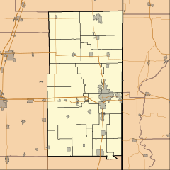
Location of Potomac in Vermilion County, Illinois.
|
|
| Country | |
| State | |
| County | Vermilion |
| Township | Middlefork |
| Area | |
| • Total | 0.49 sq mi (1.26 km2) |
| • Land | 0.49 sq mi (1.26 km2) |
| • Water | 0.00 sq mi (0.00 km2) |
| Elevation | 669 ft (204 m) |
| Population
(2020)
|
|
| • Total | 689 |
| • Density | 1,411.89/sq mi (545.02/km2) |
| ZIP code |
61865
|
| Area code(s) | 217 |
| FIPS code | 17-61366 |
| GNIS ID | 2399011 |
Potomac is a small village located in Vermilion County, Illinois, in the United States. It's part of the larger Danville, Illinois area. In 2010, about 750 people lived here.
Contents
History of Potomac
The village of Potomac was first called Marysville. It was named after the wives of its two founders, John Smith and Isaac Meneley. They started businesses here around 1840.
On May 13, 1871, a post office opened in the town. It was given the name Potomac, probably after the famous Potomac River. Later, the town's name was changed to Potomac to match the post office.
In April 1953, a strong tornado hit Potomac. It caused injuries to about a dozen people.
Growth and Changes in Potomac
Potomac grew quite a bit into the late 1900s. Its population reached its highest point of 909 people in 1970. This was partly because it was located along US Route 136. This route was a main East-West highway through Illinois.
However, when Interstate 74 opened, fewer people traveled through Potomac. This caused many gas stations, restaurants, and small shops in the downtown area to close in the early 1970s. In the early 1990s, a fire destroyed several buildings downtown. This greatly changed how the community looked.
Potomac's Artesian Wells
Potomac is well-known for its Artesian wells. These are special wells where water flows up from the ground naturally. The local high school teams used to be called the "Potomac Artesians." This was before different schools joined together in the mid-1990s.
One of these wells used to shoot an eight-inch stream of water 32 feet into the air! This amazing sight continued until the 1930s. Today, three wells still operate in open areas. One is downtown, another is on the southeast side of town, and the third is in West Side Park. This park, on the west side of town, used to host Fourth of July celebrations called "The Jubilee." These events also included an annual Horse Show.
Hugh M. Luckey (1873–1946), who was a farmer and an Illinois state legislator, was born on a farm near Potomac.
Geography of Potomac
Potomac is located about 18 miles northwest of Danville. Danville is the main city in Vermilion County. U.S. Route 136 runs through the town from east to west. The Middle Fork Vermilion River flows just south of the village.
According to the 2010 census, Potomac covers a total area of about 0.49 square miles (1.26 square kilometers). All of this area is land.
Population of Potomac
The population of Potomac has changed over the years. Here's how many people lived in the village during different census years:
| Historical population | |||
|---|---|---|---|
| Census | Pop. | %± | |
| 1880 | 368 | — | |
| 1890 | 186 | −49.5% | |
| 1900 | 764 | 310.8% | |
| 1910 | 742 | −2.9% | |
| 1920 | 733 | −1.2% | |
| 1930 | 643 | −12.3% | |
| 1940 | 646 | 0.5% | |
| 1950 | 602 | −6.8% | |
| 1960 | 661 | 9.8% | |
| 1970 | 909 | 37.5% | |
| 1980 | 874 | −3.9% | |
| 1990 | 753 | −13.8% | |
| 2000 | 681 | −9.6% | |
| 2010 | 750 | 10.1% | |
| 2020 | 689 | −8.1% | |
| U.S. Decennial Census | |||
In 2000, there were 681 people living in Potomac. The population density was about 1,408.5 people per square mile. The median age in the village was 35 years old.
See also
 In Spanish: Potomac (Illinois) para niños
 | Frances Mary Albrier |
 | Whitney Young |
 | Muhammad Ali |


