Pottsville, Arkansas facts for kids
Quick facts for kids
Pottsville, Arkansas
|
|
|---|---|

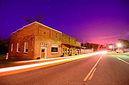
"Downtown" Pottsville
|
|

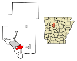
Location of Pottsville in Pope County, Arkansas.
|
|
| Country | United States |
| State | Arkansas |
| County | Pope |
| Area | |
| • Total | 13.56 sq mi (35.11 km2) |
| • Land | 13.53 sq mi (35.05 km2) |
| • Water | 0.02 sq mi (0.06 km2) |
| Elevation | 387 ft (118 m) |
| Population
(2020)
|
|
| • Total | 3,140 |
| • Density | 232.04/sq mi (89.59/km2) |
| Time zone | UTC-6 (Central (CST)) |
| • Summer (DST) | UTC-5 (CDT) |
| ZIP code |
72858
|
| Area code(s) | 479 |
| FIPS code | 05-56990 |
| GNIS feature ID | 2404563 |
Pottsville is a city located in Pope County, Arkansas, in the United States. In 2020, about 3,140 people lived there. Pottsville is part of the Russellville area, which is a group of towns that are close together.
Contents
About Pottsville's Location
Pottsville is found in a central part of Arkansas. To its west, you'll find the city of Russellville. To the east, there's the town of Atkins. North of Pottsville is a place called Crow Mountain.
The city covers a total area of about 35.11 square kilometers (13.56 square miles). Most of this area is land, with a very small part being water.
People Living in Pottsville
Pottsville has grown quite a bit over the years. Here's a look at how its population has changed:
| Historical population | |||
|---|---|---|---|
| Census | Pop. | %± | |
| 1900 | 192 | — | |
| 1910 | 205 | 6.8% | |
| 1920 | 275 | 34.1% | |
| 1930 | 293 | 6.5% | |
| 1940 | 308 | 5.1% | |
| 1950 | 224 | −27.3% | |
| 1960 | 250 | 11.6% | |
| 1970 | 411 | 64.4% | |
| 1980 | 564 | 37.2% | |
| 1990 | 984 | 74.5% | |
| 2000 | 1,271 | 29.2% | |
| 2010 | 2,838 | 123.3% | |
| 2020 | 3,140 | 10.6% | |
| U.S. Decennial Census | |||
Pottsville's Population in 2020
In 2020, the 2020 United States census counted 3,140 people living in Pottsville. These people lived in 1,031 households, and 840 of these were families.
The census also looks at the different backgrounds of the people living in a city. Here's a quick summary for Pottsville in 2020:
| Group | Number of People | Percentage |
|---|---|---|
| White | 2,610 | 83.12% |
| Black or African American | 18 | 0.57% |
| Native American | 26 | 0.83% |
| Asian | 30 | 0.96% |
| Other/Mixed | 149 | 4.75% |
| Hispanic or Latino | 307 | 9.78% |
See also
 In Spanish: Pottsville (Arkansas) para niños
 | Janet Taylor Pickett |
 | Synthia Saint James |
 | Howardena Pindell |
 | Faith Ringgold |

