
Pope County, Arkansas facts for kids
Quick facts for kids
Pope County
|
|
|---|---|

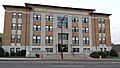
Pope County Courthouse
|
|

Location within the U.S. state of Arkansas
|
|
 Arkansas's location within the U.S. |
|
| Country | |
| State | |
| Founded | November 2, 1829 |
| Named for | John Pope |
| Seat | Russellville |
| Largest city | Russellville |
| Area | |
| • Total | 831 sq mi (2,150 km2) |
| • Land | 813 sq mi (2,110 km2) |
| • Water | 18 sq mi (50 km2) 2.2%% |
| Population
(2020)
|
|
| • Total | 63,381 |
| • Estimate
(2021)
|
63,789 |
| • Density | 76.27/sq mi (29.448/km2) |
| Time zone | UTC−6 (Central) |
| • Summer (DST) | UTC−5 (CDT) |
| Congressional district | 4th |
Pope County is a county located in the state of Arkansas in the United States. In 2020, about 63,381 people lived here. The main city and county seat is Russellville.
Pope County was created on November 2, 1829. It was named after John Pope, who was the third governor of the Arkansas Territory. It was the 19th county formed in Arkansas. The county's boundaries changed many times in the 1800s. The current borders were set in 1877.
The county has different types of land. In the south, you'll find the Arkansas River Valley with farms and towns. To the north, the Ozarks cover almost two-thirds of the county. This includes parts of the Boston Mountains, which are rugged hills. About 40% of Pope County is part of the Ozark National Forest.
Pope County is a "dry county," which means it has laws against selling alcohol.
Pope County is also part of the Russellville, Arkansas, Micropolitan Statistical Area. This area includes all of Pope and Yell County.
Contents
- History of Pope County
- Geography
- Population Facts
- Communities in Pope County
- Townships
- Images for kids
- See also
History of Pope County
Louisiana Purchase and Cherokee Lands
In 1803, Napoleon Bonaparte of France sold a huge area of land, including all of Arkansas, to the United States. This big sale is known as the Louisiana Purchase.
After this, the U.S. government looked at these new lands. They thought about using them as a new home for Native American tribes. These tribes had been living on lands closer to American settlements.
Soon, much of the area that would become Pope County was set aside for the Cherokee and other eastern tribes. Around 1805, some Cherokee people moved to the Arkansas River area. More Cherokee moved there after the big New Madrid earthquakes in 1811-1812.
In 1815, the U.S. government created a reservation for the Cherokee in the Arkansas district. They wanted the Cherokee to move there willingly. This reservation was north of the Arkansas River and south of the White River. The Cherokee who moved here were called the "Old Settlers" or Western Cherokee.
A village on the Illinois Bayou was the main meeting place for the Western Cherokees from 1813 to 1824.
A treaty in 1817 gave land in Arkansas to the Western Cherokees. This land was north of the Arkansas River. Most white settlers moved to new areas south of the river. By 1820, many Cherokee villages stretched for over 70 miles along the Arkansas River. About half of this area was in what would become Pope County.
In 1818, the Cherokee chief Tol-on-tus-ky asked for a mission to be sent to Arkansas. Cephas Washburn and Alfred Finney started the Dwight Mission in 1820. It was on the Illinois Bayou, about four miles from the Arkansas River. The mission was named after Timothy Dwight, a president of Yale College. It had over 25 buildings, including cabins, a dining hall, a library, and a saw mill. The land where Dwight Mission stood is now under Lake Dardanelle. However, the mission's cemetery is still on a nearby hill.
By 1819, when the Arkansas Territory was formed, the Western Cherokees made up at least 20% of the territory's population. Many lived along the Arkansas River, especially in the future Pope County.
Arkansas Territory is Formed
In the 1820s, more settlers came to Arkansas from southern states. This made life difficult for the Native Americans who had moved there. In 1828, a new treaty was signed. It set the western boundary of Arkansas and gave seven million acres to the Cherokees "forever" to the west. The Cherokees agreed to leave Arkansas within 14 months. In 1829, everyone at Dwight Mission moved to the new Indian Territory, which is now Oklahoma.
Pope County was officially created on November 2, 1829. The first temporary county seat was at John Bollinger's home. In 1830, the community of Scotia was chosen as the permanent county seat. But when Johnson County was formed in 1833, Scotia was too close to the new county line. So, the county seat moved to Dwight, and then in 1834, it moved to Norristown. Norristown was a growing town on the Arkansas River.
Early travel into Arkansas was mostly by river. The Arkansas River was useful but also tricky. It could flood or dry up, and it had sandbars. Many early settlers in eastern Arkansas faced illnesses. Because of this, Arkansas got a reputation as a difficult place to live. Most pioneers chose other places to settle.
However, those who went further into central and western Arkansas, including Pope County, found good land. Along the river valley, the soil was fertile. In the mountains, there were healthy forests and good land for farming in the valleys. There was also plenty of food for animals and many wild game animals. By the end of the territorial years, most people in Pope County were farmers, herders, and hunters.
Life in Pope County Before the Civil War

When Yell County was formed in 1840, the county seat was again on the edge of Pope County. So, the county seat moved to Dover in 1841. Dover was a more central location. The first courthouse in Dover was a log building.
In 1850, Pope County had 695 white families. The total population was 4,710 people. About 10% of the people were enslaved (479 individuals). Most people were born in other southern states. Over 80% of the population worked in agriculture, mostly on small family farms. Other jobs included carpentry, blacksmithing, and trading. There were also some lawyers, teachers, and doctors.
Only a small number of people owned enslaved people. Most families did not own land. In 1851, about 76% of households did not own land. By 1860, about 66% still did not.
Dover was the most important town between Little Rock and Fort Smith in 1850. Galla Rock and Norristown were also important trading centers. Goods were moved on the Arkansas River.
In the late 1850s, Edward Payson Washburn created his famous work, The Arkansas Traveler. He was inspired by scenes near his family's home in Norristown. The painting shows a traveler meeting a fiddler. Washburn's father was Cephas Washburn, who founded Dwight Mission.
By 1860, Pope County's population had grown to 7,883 people. The number of enslaved people had also grown to 978. Most families lived in the southern lowlands of the county. A railroad was planned to go through the county, with a stop in Dover.
The Civil War Years
Before the Civil War began, people in Pope County voted against leaving the Union. However, after the Confederate army attacked Fort Sumter, Arkansas decided to leave the Union in May 1861.
During the war, life in Arkansas became very difficult. Travel was dangerous, and farming was risky. County governments often stopped working. In Pope County, important records were moved to a cave to keep them safe. There were small fights in the county, but no major battles. In April 1865, Dover, including the courthouse, was burned.
The war caused many problems for families in Pope County. People were divided by their loyalties. Many people left their homes to find safer places. Most strong men were away fighting. Those left behind, like women, older men, and children, faced dangers from groups of fighters. Some of these groups supported the Confederacy, and others supported the Union. Some groups just attacked everyone, stealing food and belongings.
After the Civil War, Pope County was still not very populated. Many people who had left during the war never came back. The railroad that was planned before the war was finally started in 1869.
Rebuilding After the War
Arkansas was one of the first former Confederate states to rejoin the Union in June 1868. But it took many years for things to become stable again. During this time, called military reconstruction, soldiers were stationed in Pope County at Dover for about a year and a half.
Between 1865 and 1870, several county officials died. This showed how unstable the area was. In March 1870, the new Pope County jail in Dover was burned down.
Pope County Militia War
From 1872 to 1873, there was a period known as the Pope County Militia War. This was not a war with big battles. Instead, an unofficial group of fighters, led by four county officers, took harsh control over the county. They even threatened to burn Dover. By the end of this period, three of the four officers had died.
Late 1800s in Pope County
By June 1873, the Little Rock & Fort Smith Railroad was running through Pope County. This changed where businesses were located. Towns like Norristown and Dover started to decline. Businesses moved to Russellville or Atkins, which were on the new railroad line.
Moving the County Seat from Dover to Russellville
Since the new railroad was eight miles south of Dover, and businesses were moving, it made sense to move the county seat. Russellville was becoming the main business center.
It took 15 years for the county seat to finally move to Russellville. Dover had been chosen in the 1840s because it was central. But 30 years later, most people and businesses were in the southern parts of the county.
In 1873, a law was passed to move the county seat to Russellville. But this was changed back to Dover in 1874. People felt the change should be decided by the citizens, not just the lawmakers.
On March 8, 1878, a storm damaged the courthouse in Dover. It became unsafe to use. The county didn't have money to fix it. Citizens in Russellville offered land and money to build a new courthouse there for free. A church was used as a courtroom while the courthouse was unusable.
In September 1878, an election was held to decide if the county seat should move from Dover. Voters also had to choose between Atkins and Russellville. Most people voted to move the county seat from Dover. However, neither Atkins nor Russellville got enough votes to be chosen. This led to court challenges.
After more elections and court cases, the Arkansas Supreme Court finally approved the move to Russellville in June 1887. Citizens in Russellville had offered land and a large amount of money to build a new courthouse and jail. The county records were moved to Russellville in August 1887. The new courthouse and jail in Russellville were finished in May 1888.
Railroads, Ferries, and Bridges
With the railroad completed and the county seat moved, some smaller towns like Norristown and Dover became less important or disappeared.
On August 15, 1893, the Dardanelle and Russellville Railroad (D&R) started running trains. This short railroad, which still exists today, goes from Russellville to the north bank of the Arkansas River at North Dardanelle. It was built to move farm products, especially cotton, from Dardanelle to the main railroad in Russellville. For the first eight years, people and goods crossed the river by ferry.
In 1891, a Dardanelle pontoon bridge was built across the river at Dardanelle. This bridge was used for almost 40 years, except when high river levels or other problems stopped it.
Twentieth Century in Pope County
On January 16, 1906, a large fire destroyed almost half of the business area in Russellville. Luckily, the county courthouse was saved.
In 1931, the old 1878 county courthouse was taken down. A new building, which is still used today, was built in its place.
Arkansas's first highway rest area was built in Pope County on Highway 7 in the 1930s. Highway 7 became an important road for travelers. The rest stop was called "Rotary Ann" after a ladies' club that helped create it. They saw the need for a place where people could stop, use restrooms, and enjoy the views.
In 1954, the U.S. Army Corps of Engineers dug a new, straight channel for the Arkansas River. This project was part of a plan to control floods and make the river easier to navigate. The new channel is entirely in Pope County. The old bend in the river, called Holla Bend, is now on the south side of the river. It can only be reached by land through Yell County. In 1957, Holla Bend became a national wildlife refuge. Today, it covers over 7,000 acres.
Twenty-First Century in Pope County
In November 2018, voters in Arkansas approved a change to the state's constitution. This change allowed for the first legal casinos in four counties, including Pope County. While casinos in other counties are open, the casino license in Pope County has faced many legal challenges. After several court decisions, the license was awarded to Cherokee Nation Businesses and Legends Resort and Casino in 2021. However, this decision was also challenged and later overturned by the Arkansas Supreme Court in 2023.
Geography
According to the U.S. Census Bureau, Pope County covers a total area of about 831 square miles. Of this, 813 square miles is land, and 18 square miles (2.2%) is water.
Major Highways in Pope County
 Interstate 40
 U.S. Highway 64
 Arkansas Highway 7
 Arkansas Highway 7S
 Arkansas Highway 7T
 Arkansas Highway 16
 Arkansas Highway 27
 Arkansas Highway 105
 Arkansas Highway 123
 Arkansas Highway 124
 Arkansas Highway 164
 Arkansas Highway 247
 Arkansas Highway 324
 Arkansas Highway 326
 Arkansas Highway 331
 Arkansas Highway 333
 Arkansas Highway 363
 Arkansas Highway 980
Counties Next to Pope County
- Newton County (northwest)
- Searcy County (northeast)
- Van Buren County (northeast)
- Conway County (southeast)
- Yell County (south)
- Logan County (southwest)
- Johnson County (west)
Protected Natural Areas
- Holla Bend National Wildlife Refuge (part)
- Ozark National Forest (part)
- East Fork Wilderness
Population Facts
| Historical population | |||
|---|---|---|---|
| Census | Pop. | %± | |
| 1830 | 1,483 | — | |
| 1840 | 2,850 | 92.2% | |
| 1850 | 4,710 | 65.3% | |
| 1860 | 7,883 | 67.4% | |
| 1870 | 8,386 | 6.4% | |
| 1880 | 14,322 | 70.8% | |
| 1890 | 19,458 | 35.9% | |
| 1900 | 21,715 | 11.6% | |
| 1910 | 24,527 | 12.9% | |
| 1920 | 27,153 | 10.7% | |
| 1930 | 26,547 | −2.2% | |
| 1940 | 25,682 | −3.3% | |
| 1950 | 23,291 | −9.3% | |
| 1960 | 21,177 | −9.1% | |
| 1970 | 28,607 | 35.1% | |
| 1980 | 39,021 | 36.4% | |
| 1990 | 45,883 | 17.6% | |
| 2000 | 54,469 | 18.7% | |
| 2010 | 61,754 | 13.4% | |
| 2020 | 63,381 | 2.6% | |
| 2023 (est.) | 64,593 | 4.6% | |
| U.S. Decennial Census 1790–1960 1900–1990 1990–2000 2010–2017 |
|||

2020 Census Information
| Race | Number | Percentage |
|---|---|---|
| White (non-Hispanic) | 50,037 | 78.95% |
| Black or African American (non-Hispanic) | 2,060 | 3.25% |
| Native American | 456 | 0.72% |
| Asian | 664 | 1.05% |
| Pacific Islander | 23 | 0.04% |
| Other/Mixed | 3,726 | 5.88% |
| Hispanic or Latino | 6,415 | 10.12% |
In 2020, there were 63,381 people living in Pope County. There were 22,579 households and 14,881 families.
Communities in Pope County
Cities
- Atkins
- Dover
- London
- Pottsville
- Russellville (county seat)
Towns
Census-Designated Places
Other Small Communities
Townships

Townships in Arkansas are the divisions of a county. Each township includes unincorporated areas; some may have incorporated cities or towns within part of their boundaries. Arkansas townships have limited purposes in modern times. However, the United States Census does list Arkansas population based on townships (sometimes referred to as "county subdivisions" or "minor civil divisions"). Townships are also of value for historical purposes in terms of genealogical research. Each town or city is within one or more townships in an Arkansas county based on census maps and publications. The townships of Pope County are listed below; listed in parentheses are the cities, towns, and/or census-designated places that are fully or partially inside the township.
Pope County used to have more townships. Some were combined or no longer exist, like Allen Township, Hill Township, and Holla Bend Township.
| Township | FIPS code | ANSI code (GNIS ID) |
Population center(s) |
Pop. (2010) |
Pop. density (/mi2) |
Pop. density (/km2) |
Land area (mi2) |
Land area (km2) |
Water area (mi2) |
Water area (km2) |
Geographic coordinates |
|---|---|---|---|---|---|---|---|---|---|---|---|
| Bayliss | 05-90159 | 69697 | 708 | 24.6 | 9.5 | 28.81 | 74.62 | 0.0979 | 0.2536 | 35°24′10″N 93°14′06″W / 35.40278°N 93.23500°W | |
| Burnett | 05-90558 | 69698 | 452 | 20.9 | 8.1 | 21.65 | 56.07 | 0.1051 | 0.2722 | 35°19′10″N 92°52′33″W / 35.31944°N 92.87583°W | |
| Center | 05-90735 | 69699 | 515 | 36.8 | 14.2 | 13.99 | 36.23 | 0.0339 | 0.0878 | 35°24′20″N 92°57′16″W / 35.40556°N 92.95444°W | |
| Clark | 05-90813 | 69700 | London | 2969 | 115.3 | 44.6 | 25.73 | 66.64 | 6.0444 | 15.6549 | 35°19′45″N 93°14′46″W / 35.32917°N 93.24611°W |
| Convenience | 05-90921 | 69701 | 933 | 50.4 | 19.4 | 18.53 | 47.99 | 0.0942 | 0.2440 | 35°20′00″N 92°56′41″W / 35.33333°N 92.94472°W | |
| Dover | 05-91134 | 69702 | Dover | 5277 | 119.1 | 46.0 | 44.29 | 114.7 | 0.3637 | 0.9420 | 35°23′30″N 93°07′01″W / 35.39167°N 93.11694°W |
| Freeman | 05-91377 | 69703 | 98 | 0.8 | 0.3 | 119.78 | 310.2 | 0.0000 | 0.0000 | 35°39′10″N 93°04′06″W / 35.65278°N 93.06833°W | |
| Galla | 05-91407 | 69704 | Pottsville | 3523 | 88.7 | 34.3 | 39.71 | 102.8 | 1.8410 | 4.7682 | 35°13′15″N 93°02′46″W / 35.22083°N 93.04611°W |
| Griffin | 05-91536 | 69705 | 901 | 26.5 | 10.2 | 33.96 | 87.96 | 0.1106 | 0.2865 | 35°25′30″N 92°52′36″W / 35.42500°N 92.87667°W | |
| Gum Log | 05-91560 | 69706 | 1420 | 71.6 | 27.6 | 19.84 | 51.39 | 0.0142 | 0.0368 | 35°16′30″N 92°59′51″W / 35.27500°N 92.99750°W | |
| Illinois | 05-91812 | 69707 | Russellville | 25841 | 540.9 | 208.9 | 47.77 | 123.7 | 6.6022 | 17.0996 | 35°17′00″N 93°07′46″W / 35.28333°N 93.12944°W |
| Jackson | 05-91875 | 69708 | Hector | 1191 | 11.5 | 4.4 | 103.72 | 268.6 | 0.0505 | 0.1308 | 35°29′20″N 92°57′01″W / 35.48889°N 92.95028°W |
| Liberty | 05-92181 | 69709 | 805 | 14.2 | 5.5 | 56.64 | 146.7 | 0.0028 | 0.0073 | 35°29′40″N 93°03′16″W / 35.49444°N 93.05444°W | |
| Martin | 05-92415 | 69710 | 1482 | 23.7 | 9.2 | 62.46 | 161.8 | 0.3931 | 1.0181 | 35°28′25″N 93°10′06″W / 35.47361°N 93.16833°W | |
| Moreland | 05-92553 | 69711 | 700 | 52.2 | 20.2 | 13.40 | 34.71 | 0.0683 | 0.1769 | 35°21′30″N 92°59′46″W / 35.35833°N 92.99611°W | |
| Phoenix | 05-92871 | 69712 | 334 | 26.7 | 10.3 | 12.51 | 32.40 | 0.0000 | 0.0000 | 35°24′30″N 93°00′31″W / 35.40833°N 93.00861°W | |
| Smyrna | 05-93420 | 69713 | 173 | 2.4 | 0.9 | 70.69 | 183.1 | 0.0218 | 0.0565 | 35°38′10″N 92°53′46″W / 35.63611°N 92.89611°W | |
| Valley | 05-93765 | 69714 | 2776 | 125.7 | 48.5 | 22.09 | 57.21 | 0.0144 | 0.0373 | 35°20′05″N 93°02′46″W / 35.33472°N 93.04611°W | |
| Wilson | 05-94089 | 69715 | Atkins | 4371 | 77.6 | 30.0 | 56.32 | 145.9 | 3.0305 | 7.8490 | 35°13′30″N 92°55′01″W / 35.22500°N 92.91694°W |
| Source: | |||||||||||
Images for kids
-
Pope County Courthouse
See also
 In Spanish: Condado de Pope (Arkansas) para niños
