Conway County, Arkansas facts for kids
Quick facts for kids
Conway County
|
|
|---|---|
|
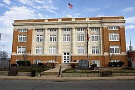
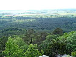
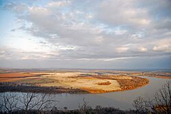
Clockwise from top: Conway County Courthouse, the Arkansas River, Cedar Falls, a panoramic view of the Arkansas River Valley from Petit Jean State Park, the Morrilton Train Station, and downtown Morrilton
|
|
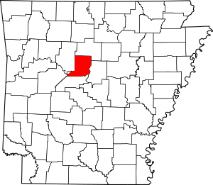
Location within the U.S. state of Arkansas
|
|
 Arkansas's location within the U.S. |
|
| Country | |
| State | |
| Founded | October 20, 1825 |
| Named for | Henry Wharton Conway |
| Seat | Morrilton |
| Largest city | Morrilton |
| Area | |
| • Total | 566.66 sq mi (1,467.6 km2) |
| • Land | 556.15 sq mi (1,440.4 km2) |
| • Water | 10.51 sq mi (27.2 km2) 1.8%% |
| Population
(2020)
|
|
| • Total | 20,715 |
| • Density | 36.5563/sq mi (14.1145/km2) |
| Time zone | UTC−6 (Central) |
| • Summer (DST) | UTC−5 (CDT) |
| Congressional district | 2nd |
Conway County is a county in the state of Arkansas. It was created on October 20, 1825, making it Arkansas's 11th county. Conway County has four main towns, including Morrilton, which is the county seat (the main town where the county government is located) and also the biggest town.
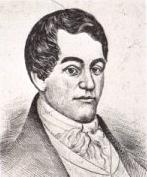
The county is named after Henry Wharton Conway. He was a politician who represented the Arkansas Territory in the U.S. Congress from 1823 to 1827.
In 2020, about 20,715 people lived in Conway County. The county seat is Morrilton. In 2010, the very center of Arkansas's population was found in Conway County, near the town of Plumerville.
Contents
History of Conway County
Conway County was officially formed on October 20, 1825. It was created from a part of Pulaski County. As mentioned, it was named after Henry Wharton Conway, who was a delegate to the U.S. Congress for the Arkansas Territory.
For many years, from 1831 to 1883, the county seat was a town called Lewisburg. But in 1871, a railroad company planned to build train tracks about 1 mile (1.6 km) north of Lewisburg. The new train station was going to be named Morrilton, after a farmer named E. J. Morrill, who sold the land for the railroad.
Because of the new railroad, people started moving from Lewisburg to Morrilton in 1880. By 1883, the county government also moved to Morrilton. The train station itself was built in 1910.
When Conway County was first created, it was much larger than it is today. Over time, parts of Conway County were used to create other counties:
- Van Buren County was formed in 1833.
- Perry County was formed in 1840.
- Faulkner County was formed in 1873.
Geography and Nature
Conway County is located in the Arkansas River Valley region. This is a rich, flat valley that follows the Arkansas River. It sits between the Ozark Mountains to the north and the Ouachita Mountains to the south.
The county covers about 567 square miles (1,469 square kilometers). Most of this area, about 552 square miles (1,429 square kilometers), is land. The rest, about 14 square miles (36 square kilometers), is water. Conway County is the fifth smallest county in Arkansas by area.
Conway County is about 52 miles (84 km) northwest of Little Rock. It's also about 109 miles (175 km) east of Fort Smith.
Conway County shares its borders with several other counties:
- Faulkner County is to the east.
- Perry County is to the south.
- Van Buren County is to the north.
- Yell County is to the southwest.
- Pope County is to the west.
Protected Natural Areas
A small part of northern Conway County, about 16 square kilometers (4,000 acres), is protected within the Ozark National Forest. This is a large forest that spreads across many counties in Arkansas.
Petit Jean State Park is Arkansas's oldest state park. It is located in southern Conway County, on top of Petit Jean Mountain.
Conway County also has five Wildlife Management Areas (WMAs). These are special places managed by the Arkansas Game and Fish Commission for wildlife and outdoor activities:
- Ed Gordon Point Remove WMA is a wetland area known for hunting ducks, deer, and doves.
- Lake Overcup WMA is a popular lake for crappie fishing.
- Cypress Creek WMA is around Brewer Lake, which provides water for Conway.
- Parts of the Cherokee WMA and Piney Creeks WMA are also in the county.
- The county is also home to the Cove Creek Natural Area.
Population Information
| Historical population | |||
|---|---|---|---|
| Census | Pop. | %± | |
| 1830 | 982 | — | |
| 1840 | 2,892 | 194.5% | |
| 1850 | 3,583 | 23.9% | |
| 1860 | 6,697 | 86.9% | |
| 1870 | 8,112 | 21.1% | |
| 1880 | 12,755 | 57.2% | |
| 1890 | 19,459 | 52.6% | |
| 1900 | 19,772 | 1.6% | |
| 1910 | 22,729 | 15.0% | |
| 1920 | 22,578 | −0.7% | |
| 1930 | 21,949 | −2.8% | |
| 1940 | 21,536 | −1.9% | |
| 1950 | 18,137 | −15.8% | |
| 1960 | 15,430 | −14.9% | |
| 1970 | 16,805 | 8.9% | |
| 1980 | 19,505 | 16.1% | |
| 1990 | 19,151 | −1.8% | |
| 2000 | 20,336 | 6.2% | |
| 2010 | 21,273 | 4.6% | |
| 2020 | 20,715 | −2.6% | |
| 2023 (est.) | 21,077 | −0.9% | |
| U.S. Decennial Census 1790–1960 1900–1990 1990–2000 2010 |
|||
According to the 2020 United States census, there were 20,715 people living in Conway County. Most people in the county are White (about 78%), followed by Black or African American (about 10.5%).
In 2010, there were 21,273 people in the county. About 24% of the population was under 18 years old. The average age was about 40.5 years old.
Towns and Communities
Conway County has several towns and smaller communities.
Cities
- Morrilton (This is the county seat)
- Oppelo
- Plumerville
Town
Census-designated places
These are areas that are like towns but are not officially incorporated as cities or towns.
Other Unincorporated Communities
These are smaller communities that are not officially part of a city or town.
- Blackwell
- Cleveland
- Formosa
- Jerusalem
- Lanty
- Mount Olive
- Pleasant Hill
- Pontoon
- Solgohachia
- Winrock
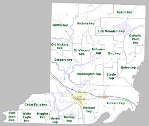
Townships
Counties in Arkansas are divided into smaller areas called townships. Townships in Arkansas are the divisions of a county. Each township includes unincorporated areas; some may have incorporated cities or towns within part of their boundaries. Arkansas townships have limited purposes in modern times. However, the United States Census does list Arkansas population based on townships (sometimes referred to as "county subdivisions" or "minor civil divisions"). Townships are also of value for historical purposes in terms of genealogical research. Each town or city is within one or more townships in an Arkansas county based on census maps and publications. The townships of Conway County are listed below; listed in parentheses are the cities, towns, and/or census-designated places that are fully or partially inside the township.
- Austin
- Bentley (Oppelo)
- Bird
- Catholic Point
- Cedar Falls
- Gregory
- Griffin
- Higgins
- Howard (Menifee, Plumerville)
- Lick Mountain (CDP Center Ridge)
- Martin
- McLaren
- Nichols
- Old Hickory
- Petit Jean
- St. Vincent
- Steele
- Union
- Washington
- Welborn (Morrilton)
- White Eagle
Roads and Highways
These are the main roads that go through Conway County:
- I-40
- US Highway 64
 AR 9
AR 9 AR 92
AR 92 AR 95
AR 95 AR 113
 AR 124
 AR 132
 AR 154
 AR 155
 AR 213
 AR 247
 AR 287
 AR 980
See also
 In Spanish: Condado de Conway para niños
 | Frances Mary Albrier |
 | Whitney Young |
 | Muhammad Ali |


