
Powlett River facts for kids
Quick facts for kids Powlett |
|
|---|---|

|
|
| Native name | Kugerungmome |
| Country | Australia |
| State | Victoria |
| Region | South East Coastal Plain (IBRA), West Gippsland |
| Local government area | Bass Coast |
| Physical characteristics | |
| Main source | Strzelecki Ranges near Ellerside, north of Inverloch 42 m (138 ft) 38°32′38″S 145°44′35″E / 38.54389°S 145.74306°E |
| River mouth | Bass Strait west of Wonthaggi 0 m (0 ft) 38°35′0″S 145°30′39″E / 38.58333°S 145.51083°E |
| Length | 27 km (17 mi) |
| Basin features | |
| River system | Western Port catchment |
| Tributaries |
|
The Powlett River is a river in Victoria, Australia. It flows all year round and is part of the Western Port area. You can find it in the West Gippsland region.
Contents
Where the Powlett River Flows
The Powlett River starts on the southern side of the Strzelecki Ranges. This is near a place called Ellerside, which is north of Inverloch. The river then flows towards the west.
It is joined by a smaller stream, which is called a tributary. Finally, the river reaches its mouth in Bass Strait. This mouth is located west of Wonthaggi. The entire river flows within the Shire of Bass Coast.
River's Journey and Length
The Powlett River drops about 40 meters (131 feet) from where it starts to where it meets the sea. The total length of the river is about 27 kilometers (17 miles).
The Bass Highway crosses over the river. This happens between the towns of Daylston and Wonthaggi.
Why the River is Called Powlett
The original name for this river in the Australian Aboriginal Boonwurrung language is Kugerungmome. The exact meaning of this name is not fully known.
The river was given its current name in 1840. It was named after Frederick Powlett. He was an important person known as the Commissioner of the Western Port District at that time.
Images for kids
-
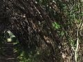
Dalyston's Powlett River Walking tracks

