Pozer River facts for kids
Quick facts for kids Pozer River |
|
|---|---|

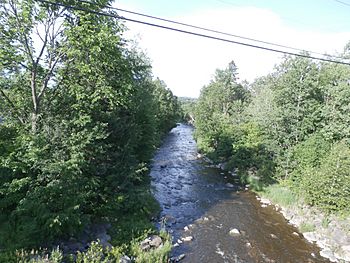
Pozer River seen from the Highway 271 bridge downstream.
|
|
| Native name | Rivière Pozer |
| Country | Canada |
| Province | Quebec |
| Region | Chaudière-Appalaches |
| MRC | Beauce-Sartigan Regional County Municipality, |
| Physical characteristics | |
| Main source | Agricultural and forest streams Saint-Honoré-de-Shenley 308 metres (1,010 ft) 46°00′34″N 70°51′41″W / 46.009366°N 70.861461°W |
| River mouth | Chaudière River Saint-Georges 160 metres (520 ft) 46°03′28″N 70°41′57″W / 46.05783°N 70.69928°W |
| Length | 26.9 kilometres (16.7 mi) |
| Basin features | |
| River system | St. Lawrence River |
| Tributaries |
|
The Pozer River (which is rivière Pozer in French) is a river in Quebec, Canada. It starts in Shenley Township and flows into the Chaudière River near Saint-Georges. The Chaudière River then flows north to join the St. Lawrence River.
The Pozer River passes through a few towns. These include Saint-Honoré-de-Shenley, Saint-Benoit-Labre, and a part of Saint-Georges. These towns are all located in the Beauce-Sartigan Regional County Municipality, which is in the Chaudière-Appalaches region of Quebec.
Contents
Where Does the Pozer River Flow?
The Pozer River is part of a larger system of rivers and streams. These are called watersheds. A watershed is an area of land where all the water drains into a single river or lake.
Nearby River Systems
The Pozer River has several important neighbors in terms of water flow:
- To the north: Fabrique stream and the Chaudière River.
- To the east: The Chaudière River.
- To the south: Roy brook, Toinon River, and rivière de la Grande Coudée.
- To the west: Bras Saint-Victor and rivière des Hamel.
The River's Starting Point
The Pozer River gets its water from many smaller streams. These streams drain water from lakes like Saint-Charles, Poulin, and Raquette. They also collect water from the northern part of Shenley Township.
The very beginning of the river is about 7.7 kilometres (4.8 mi) northeast of La Guadeloupe. It's also about 5.6 kilometres (3.5 mi) north of Saint-Honoré-de-Shenley and 8.7 kilometres (5.4 mi) southeast of Saint-Éphrem-de-Tring.
How Long is the Pozer River?
The Pozer River flows for about 26.9 kilometres (16.7 mi) (or 16.7 miles). Its path is divided into several sections as it makes its way to the Chaudière River.
Here's how the river flows:
- It starts by flowing 5.9 kilometres (3.7 mi) northeast. For about 0.5 kilometres (0.31 mi), it crosses the southeast part of Saint-Éphrem-de-Beauce.
- Next, it goes 3.8 kilometres (2.4 mi) northeast, picking up water from the Tomiche stream.
- Then, it flows 1.7 kilometres (1.1 mi) northeast.
- After that, it travels 6.3 kilometres (3.9 mi) northeast, reaching the border between Saint-Benoit-Labre and Saint-Georges.
- It continues 1.1 kilometres (0.68 mi) northeast.
- The river then flows 3.9 kilometres (2.4 mi) northeast, making some zigzags and a loop to the north.
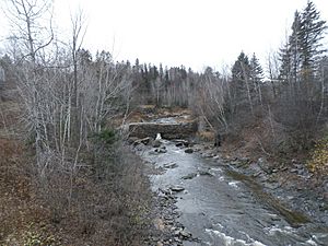
- Finally, it travels 3.1 kilometres (1.9 mi) northeast, passing through "Les Sept Chutes" (The Seven Falls) and "Parc des Sept Chutes" (Seven Falls Park). This is on the south side of Domaine Pozer, near Route 271.
- The last 1.1 kilometres (0.68 mi) of the river flows northward through the western part of Domaine Pozer. It then reaches its end point, where it joins the Chaudière River in Saint-Georges.
The river's path is quite winding, stretching for about 25 kilometres (16 mi) in a northeast direction. It goes through Saint-Benoît-Labre and the area once known as Aubert-Gallion. It also flows through Parc des Sept-Chutes before meeting the Chaudière River.
What's in a Name? The History of Pozer River
The Pozer River has had a few names over time. Long ago, it was called the "Jean-Gagnon river." This name appeared on a document from 1818. It was still on a map in 1864, sometimes as "Rivière Gagnon." This name likely came from an early settler or family in the area.
The spelling of "Gagnon" might also be linked to "Gallion," which was part of the name for the lordship Aubert-Gallion. Different spellings like Gayon, Galion, and Gagnon were used to describe this area at various times.
How the Pozer Name Came to Be
The river's current name, Pozer, comes from the family of John George Pfo(t)zer. The spelling of their name later became Pozer. This family bought the Aubert-Gallion area in 1808. John George Pozer was even called "the Millionaire Pozer." In 1817, he brought 189 German people to Canada and helped them settle in his new land.
The name Pozer became common for the river towards the end of the 1800s. It might specifically honor Christian Henry Pozer (1835-1884). He was a lawyer who was born and died in the Aubert-Gallion manor. He was elected as a representative in 1867 and became a senator in 1876. During his career, he worked hard to create new townships, explore for minerals, and build railways in the Beauce region.
The name "Pozer River" was officially recognized on December 5, 1968, by the Commission de toponymie du Québec.
 | Bayard Rustin |
 | Jeannette Carter |
 | Jeremiah A. Brown |


