
Prairie County facts for kids
Prairie County is a name used for two different areas in the United States. When you see "Prairie County," it could be talking about a county in Arkansas or a county in Montana. Both are named "Prairie" because they are in areas that used to have large, flat grasslands called prairies.
Contents
What is a County?
A county is like a smaller division within a state. Think of it as a local government area, similar to a district or a borough in other places. Counties help manage things like local laws, schools, and roads for the people living there. Each county usually has a main town called a "county seat," where the government offices are located.
Prairie County, Arkansas

Prairie County, Arkansas, is located in the central part of the state. It was created on November 25, 1846. The county got its name because it has many flat, open prairie lands.
Geography and Nature
This county is known for its flat to gently rolling land. It's part of the Arkansas Delta region, which is very fertile. The White River flows through the eastern part of the county. This river is important for both nature and farming. The area has a lot of farmland, especially for rice and soybeans.
Towns and People
Prairie County has two county seats: Des Arc and Lonoke. This is a bit unusual, as most counties only have one. The population of Prairie County is around 8,000 people. Many people in the county work in agriculture or related businesses.
History of Prairie County, Arkansas
The land where Prairie County is now was once home to Native American tribes. Later, European settlers arrived, and the area became known for its rich soil, perfect for farming. During the American Civil War, the county saw some small battles. After the war, farming continued to be the main way of life.
Prairie County, Montana

Prairie County, Montana, is located in the eastern part of the state. It was formed on February 5, 1915, making it much newer than Prairie County, Arkansas. It was named for the vast prairies that cover much of eastern Montana.
Geography and Nature
This county is part of the Great Plains. It has wide-open spaces with rolling hills and grasslands. The Yellowstone River forms part of its southern border. This river is a major waterway in Montana and is important for wildlife and irrigation. The landscape is mostly dry, but the river provides water for farming.
Towns and People
The county seat of Prairie County, Montana, is Terry. It's the largest town in the county. Prairie County, Montana, has a much smaller population than its Arkansas namesake, with only about 1,000 people living there. Ranching and farming are the main activities for the people in this area.
History of Prairie County, Montana
Before it became a county, this area was used by Native American tribes, especially for hunting bison. In the 1800s, explorers and settlers began to arrive. The arrival of the railroad in the late 1800s helped towns like Terry grow. Ranching became very important, and it still is today. The county was created to help local communities manage their affairs as more people settled in the region.
Images for kids
-
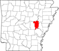
Prairie County, Arkansas, is in the central part of the state.
-
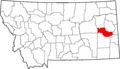
Prairie County, Montana, is in the eastern part of the state.
