Prudenville, Michigan facts for kids
Quick facts for kids
Prudenville, Michigan
|
|
|---|---|
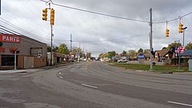
Houghton Lake Drive (M-55) at Gladwin Road (M-18)
|
|
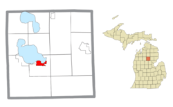
Location within Roscommon County
|
|
| Country | United States |
| State | Michigan |
| County | Roscommon |
| Township | Denton |
| Established | 1875 |
| Area | |
| • Total | 3.72 sq mi (9.63 km2) |
| • Land | 2.85 sq mi (7.39 km2) |
| • Water | 0.87 sq mi (2.24 km2) |
| Elevation | 1,145 ft (349 m) |
| Population
(2020)
|
|
| • Total | 1,643 |
| • Density | 576.49/sq mi (222.58/km2) |
| Time zone | UTC-5 (Eastern (EST)) |
| • Summer (DST) | UTC-4 (EDT) |
| ZIP code(s) |
48629 (Houghton Lake)
48651 |
| Area code(s) | 989 |
| FIPS code | 26-66400 |
| GNIS feature ID | 0635500 |
Prudenville is a small community in Roscommon County, Michigan, in the United States. It's known as an unincorporated community and a census-designated place (CDP). This means it's a recognized area for counting people, but it doesn't have its own local government like a city or town. In 2020, about 1,643 people lived there. Prudenville is part of Denton Township.
Contents
History of Prudenville
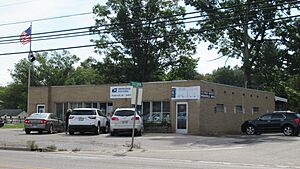
Prudenville got its first post office on September 6, 1875. For a short time, it was called Edna, but then its name was changed back to Prudenville. The post office closed for a while but reopened in 1921. Today, it's still open at 899 West Houghton Lake Drive.
In the 1870s, people started moving to the Prudenville area. This was because of the Homestead Acts, which gave free land to settlers. The area had lots of trees, making it perfect for logging. The community was named after Peter Pruden, an early developer.
By 1882, Prudenville had grown to include hotels, businesses, and a school. The Roscommon Lumber Company built a special trestle railroad. This railroad helped move logs into the east bay of Houghton Lake. From there, the logs floated across the lake and down the Muskegon River to sawmills.
The lumber company was very busy from 1882 to 1887. It employed 700 workers and harvested huge amounts of pine trees.
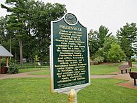
In 2004, Prudenville and the Roscommon Lumber Company were recognized as a Michigan State Historic Site. A special marker was placed in Trestle Park in 2014 to remember their history.
Geography and Location
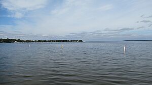
Prudenville covers about 3.72 square miles (9.63 square kilometers). Most of this area is land, but about 0.87 square miles (2.24 square kilometers) is water.
The community has its own post office with the ZIP Code 48651. This post office serves most of Denton Township and parts of other nearby townships. Prudenville is a "census-designated place," which means it's a specific area defined for counting people. It doesn't have its own city government.
Prudenville is in the Northern Michigan region. It sits on the southeast side of Houghton Lake. This lake is the largest inland lake in Michigan. Nearby, you can find parts of the Au Sable State Forest and the Backus Creek State Game Area.
Main Roads in Prudenville
 M-18: This road is known as S. Gladwin Road. It briefly joins M-55 before heading north as E. Houghton Lake Drive.
 M-55: This road is called W. Houghton Lake Drive. It then becomes W. West Branch Road as it leaves the area.
- M-157: This highway is located just east of Prudenville.
Population and People
| Historical population | |||
|---|---|---|---|
| Census | Pop. | %± | |
| 1990 | 1,513 | — | |
| 2000 | 1,737 | 14.8% | |
| 2010 | 1,682 | −3.2% | |
| 2020 | 1,643 | −2.3% | |
| U.S. Decennial Census | |||
According to the 2000 census, there were 1,737 people living in Prudenville. There were 818 households, with 542 of them being families.
About 18.2% of households had children under 18. Many households (55.3%) were married couples. About 30.1% of households were individuals living alone. Around 16.9% of households had someone aged 65 or older living by themselves.
The population's age was spread out. About 17.6% were under 18 years old. About 28.8% were 65 years or older. The average age in Prudenville was 52 years. For every 100 females, there were about 89.6 males.
See also
 In Spanish: Prudenville (Míchigan) para niños
 | Isaac Myers |
 | D. Hamilton Jackson |
 | A. Philip Randolph |


