Pueblo, Rincón, Puerto Rico facts for kids
Quick facts for kids
Pueblo
|
|
|---|---|
|
Barrio
|
|

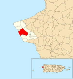
Location of Pueblo within the municipality of Rincón shown in red
|
|
| Commonwealth | |
| Municipality | |
| Area | |
| • Total | 2.80 sq mi (7.3 km2) |
| • Land | 2.56 sq mi (6.6 km2) |
| • Water | 0.24 sq mi (0.6 km2) |
| Elevation | 164 ft (50 m) |
| Population
(2010)
|
|
| • Total | 3,796 |
| • Density | 1,482.8/sq mi (572.5/km2) |
| Source: 2010 Census | |
| Time zone | UTC−4 (AST) |
Pueblo barrio is a special area, or barrio, located in the town of Rincón, Puerto Rico. In 2010, about 3,796 people lived there. Rincón also has an administrative center called Rincón barrio-pueblo, which is a bit smaller.
A Glimpse into Pueblo's Past
After the Spanish–American War, Spain gave Puerto Rico to the United States. This happened under a special agreement called the Treaty of Paris of 1898. Puerto Rico then became an unincorporated territory of the U.S. This means it's part of the U.S. but doesn't have all the same rights as a state.
In 1899, the United States Department of War counted everyone living in Puerto Rico. They found that Pueblo barrio had 1,074 residents back then. The population has grown quite a bit since then.
| Historical population | |||
|---|---|---|---|
| Census | Pop. | %± | |
| 1900 | 1,074 | — | |
| 1980 | 2,574 | — | |
| 1990 | 2,992 | 16.2% | |
| 2000 | 3,393 | 13.4% | |
| 2010 | 3,796 | 11.9% | |
| U.S. Decennial Census 1899 (shown as 1900) 1910-1930 1930-1950 1980-2000 2010 |
|||
Exploring Pueblo's Areas: Sectors
Barrios in Puerto Rico are like big neighborhoods. They are often divided into even smaller local areas. These smaller areas are called sectores (which means sectors in English).
The types of sectors can be different. Some are simply called sector. Others might be named urbanización (a planned housing development), reparto (a subdivision), barriada (a neighborhood), or residencial (a residential complex).
Here are some of the sectors you can find in Pueblo barrio:
Avenida Albizu Campos, Avenida Canal, Avenida Vistamar, Barrio Pueblo Rural, Calle Borinquen Sea Beach Drive, Calle Encanto, Calle Fisherman Walk, Calle Francisco Colón Guerra, Calle Germán Chaparro Villanueva, Calle Los Robles, Calle Muñoz Rivera, Calle Muñoz Rivera, Calle Pelican Walk, Calle Vistamar, Camino Vistamar, Carretera 115, Carretera 412, Carretera 414 (Camino Mortero), Cofresí Tower, Comunidad Stella, Condominio Coconut Court, Condominio Puerta del Sol, Condominio Puesta del Sol, Condominio Sea Beamorrench Village, Condominio Stella del Mar, Extensión Los Robles, Reparto Matías, Sector El Coquí, Sector La Jalda o Camino Anselmo, Sector Los Caobos, Sector Maní, Sector Muñoz, Sector Soto, Sector Vargas, Sector Villa Rincón, Sectores Korea, Urbanización Colinas Monte y Mar, Urbanización Sea Beach Colony, Urbanización Villa Rincón, Vertedero, Villa Angélica, Villa Cofresí, and Villas de la Pradera.
See also
 In Spanish: Pueblo (Rincón) para niños
- List of communities in Puerto Rico
- List of barrios and sectors of Rincón, Puerto Rico
 | Bessie Coleman |
 | Spann Watson |
 | Jill E. Brown |
 | Sherman W. White |


