
Purchase line facts for kids
The Purchase Line was an important boundary line in Pennsylvania during the 1700s. It was created in 1768 by a special agreement called the Treaty of Fort Stanwix. This line helped separate lands that belonged to Native American tribes from lands that the British colonists wanted to settle. In New York State, this same boundary was known as the Line of Property.
What Was the Purchase Line?
The Purchase Line was a boundary that started near a place called Kittanning. From there, it was supposed to go in a straight line to the closest fork of the western branch of the Susquehanna River. This line was very important because it decided where people could and could not settle.
Finding the Exact Spot
Even though the treaty described the line, its exact location wasn't clear at first. So, in 1773, Native American leaders and representatives from Pennsylvania met again. They met at a place known as "Canoe Place," which was the farthest point canoes could travel up the Susquehanna River. This spot was where the Susquehanna River met Cush Cushion Creek, which is now Cherry Tree, Pennsylvania.
At this meeting, everyone agreed that "Canoe Place" was the exact "nearest point" mentioned in the treaty. This spot became a special meeting point for three modern-day counties: Clearfield, Cambria, and Indiana. Later, the town of Cherry Tree, Pennsylvania was fully included in Indiana County to make things simpler.
The Line Today
Today, the Purchase Line still acts as a boundary for much of its original path. For example, in Armstrong County, it runs southeast from Kittanning. It separates some townships like Rayburn and Valley (to the north) from Manor and Kittanning (to the south).
There's a small break in the line around the town of Cowanshannock. But the line starts again where Armstrong County meets Indiana County. In Indiana County, it continues to separate townships like South Mahoning, East Mahoning, Grant, and Montgomery (to the north) from Washington, Rayne, and Green (to the south). There's even a small community called Purchase Line on PA 286, just south of where the actual line runs.
Maps
-

Fragment of Guy Johnson's map of the Line of Property 1768; showing the portion in Pennsylvania; Purchase Line between the Allegheny and Susquehanna rivers on the west side of map
-
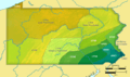
Map showing Pennsylvania and the territory involved in the purchase of 1768.


