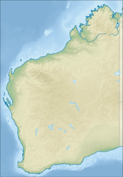
Queerearrup Lake facts for kids
Quick facts for kids Queerearrup Lake |
|
|---|---|
| Location | Wheatbelt, Western Australia |
| Coordinates | 33°30′34″S 117°13′58″E / 33.50944°S 117.23278°E |
| Type | saline |
| Primary inflows | surface flow, groundwater |
| Primary outflows | evaporation |
| Catchment area | 23,000 ha (57,000 acres) |
| Basin countries | Australia |
| Max. length | 2.6 km (1.6 mi) |
| Max. width | 1.9 km (1.2 mi) |
| Surface area | 430 ha (1,100 acres) |
| Max. depth | 3.1 m (10 ft) |
| Shore length1 | 8.3 km (5.2 mi) |
| Islands | 0 |
| Settlements | none |
| 1 Shore length is not a well-defined measure. | |
Queerearrup Lake is a large, salty lake found in Western Australia. It is located in the Great Southern region. The lake is about 230 km (140 mi) southeast of Perth. It is also near the towns of Woodanilling and Wagin. Queerearrup Lake is the biggest lake in the Shire of Woodanilling.
Contents
About Queerearrup Lake
Queerearrup Lake has a long, stretched-out shape. Its surface covers about 430 ha (1,100 acres), which is like 1,000 football fields! It's very close to another lake called Lake Charling on its western side. To the east, the closest lake is Lake Flagstaff.
This lake is part of a series of lakes. Water can flow from these lakes into the Beaufort River. Queerearrup Lake is a popular spot for fun activities. Part of the area around the lake is set aside for public recreation. Most of the lake is in the Shire of Woodanilling. However, the northern part is in the Shire of Wagin.
The Lake's Water Area
The land that drains water into Queerearrup Lake is called its catchment area. This area is huge, covering about 23,000 ha (57,000 acres). A lot of this land has been cleared for farming. The landscape around the lake has many smaller lakes and swampy areas. It also has small sand dunes and flat plains.
The lake sits along an old natural water path. The area gets about 462 mm (18.2 in) of rain each year. But it also loses a lot of water to evaporation, about 1,826 mm (71.9 in) annually. This means more water evaporates than falls as rain.
History of Queerearrup Lake
The Noongar people are the traditional owners of this land. They have lived in this region for thousands of years. The name "Queerearrup" comes from Noongar words. "Queer" means 'brush wallaby', and "up" means 'place of'. So, it means 'place of the brush wallaby'.
European settlers came to this area in the late 1800s. A homestead called Queerearrup Station was built by Thomas Cornwall. It was on the northwest side of the lake. Other farmers also settled nearby.
Plants and Animals
The lake is home to many different plants and animals. On the western side, there is a high bank. Here you can find plants like Melaleuca and Casuarina obesa. You can also see Acacia acuminata and swamp yate trees.
The lake is a great place for birds. Many different bird species live here. This includes beautiful black swans.
Fun at Queerearrup Lake
Queerearrup Lake is a popular spot for outdoor activities. When the weather is warm, people come here to ski, swim, and have picnics. There are good facilities available for visitors. You can find parking and public toilets. There are also barbecues and a boat ramp.
A special swimming area is on the southern shore. You can enter the water from a rock that sticks out into the lake. The water depth here is usually between 1 to 2 m (3 ft 3 in to 6 ft 7 in).


