
Río Arriba Saliente facts for kids
Quick facts for kids
Río Arriba Saliente
|
|
|---|---|
|
Barrio
|
|

Río Arriba Saliente barrio from bridge on PR-642, near junction with Puerto Rico Highway 6685
|
|

Location of Río Arriba Saliente within the municipality of Manatí shown in red
|
|

Río Arriba Saliente
Location in Caribbean
|
|
| Commonwealth | |
| Municipality | |
| Area | |
| • Total | 6.62 sq mi (17.1 km2) |
| • Land | 6.55 sq mi (17.0 km2) |
| • Water | 0.07 sq mi (0.2 km2) |
| Elevation | 614 ft (187 m) |
| Population
(2010)
|
|
| • Total | 3,592 |
| • Density | 549.2/sq mi (212.0/km2) |
| Source: 2010 Census | |
| Time zone | UTC−4 (AST) |
Río Arriba Saliente is a rural area, also called a barrio, located in the town of Manatí, Puerto Rico. In 2010, about 3,592 people lived there. It's a place where you can find beautiful natural landscapes and a quiet way of life.
| Historical population | |||
|---|---|---|---|
| Census | Pop. | %± | |
| 1900 | 1,593 | — | |
| 1910 | 2,041 | 28.1% | |
| 1920 | 2,467 | 20.9% | |
| 1930 | 2,619 | 6.2% | |
| 1940 | 3,096 | 18.2% | |
| 1950 | 3,087 | −0.3% | |
| 1980 | 2,298 | — | |
| 1990 | 2,445 | 6.4% | |
| 2000 | 3,119 | 27.6% | |
| 2010 | 3,592 | 15.2% | |
| U.S. Decennial Census 1899 (shown as 1900) 1910-1930 1930-1950 1980-2000 2010 |
|||
History
Puerto Rico became a part of the United States after the Spanish–American War. This happened because of a peace agreement called the Treaty of Paris of 1898. After the war, Puerto Rico became an unincorporated territory of the United States. This means it's a territory that belongs to the U.S. but is not fully a part of it, like a state.
In 1899, the United States government did a count of all the people in Puerto Rico. This count, called a census, showed that 1,593 people lived in the Río Arriba Saliente barrio at that time. Over the years, the population has grown, as you can see in the chart above.
Gallery
-
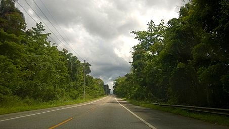
Puerto Rico Highway 149 in Río Arriba Saliente barrio
.jpg)
See Also
 In Spanish: Río Arriba Saliente para niños
- List of communities in Puerto Rico
